Dzerzhinsky (masculine), Dzerzhinskaya (feminine), or Dzerzhinskoye (neuter) may refer to:

Lubyanskaya Square, or simply Lubyanka in Moscow lies about 900 metres (980 yd) north-east of Red Square. History first records its name in 1480, when Grand Prince Ivan III of Moscow, who had conquered Novgorod in 1471, settled many Novgorodians in the area. They built the church of St Sophia, modelled after St Sophia Cathedral in Novgorod, and called the area Lubyanka after the Lubyanitsa street of their native city.

Khamovniki District is a district of Central Administrative Okrug of the federal city of Moscow, Russia. Population: 102,730 (2010 Census); 97,110 (2002 Census).

The Garden Ring, also known as the "B" Ring, is a circular ring road avenue around central Moscow, its course corresponding to what used to be the city ramparts surrounding Zemlyanoy Gorod in the 17th century.

Kuznetsky Most is a street in central Moscow, that runs from Bolshaya Dmitrovka Street to Lubyanka Street. The name, literally Blacksmith's Bridge, refers to the 18th-century bridge over the Neglinnaya River, and a nearby foundry and the settlement of its workers. The street is administered by Tverskoy District (west) and Meshchansky District (east).
Zamoskvorechye District is a district of the Central Administrative Okrug of the federal city of Moscow, Russia. It has a population of 55,612 (2010 Census); 50,590 (2002 Census).
The Third Ring Road, or The Third Ring, is a beltway around central Moscow, Russia, located between the Garden Ring in the city centre and the Moscow Ring Road (MKAD).
Rozhdestvensky Boulevard is a major boulevard in Meshchansky District of Moscow, Russia. It begins at Trubnaya Square (west) and ends at Sretenka Gates in the same district (completing the Boulevard Ring link from Petrovsky Boulevard to Sretensky Boulevard.

Bolshaya Nikitskaya Street is a radial street that runs west from Mokhovaya Street to Garden Ring in Moscow, between Vozdvizhenka Street (south) and Tverskaya Street (north). Central, eastern part of the street is notable for its educational institutions and theaters, western part beyond the Boulevard Ring has many Neoclassical mansions and competes with nearby Povarskaya Street for the title of Moscow's Embassy Row.

Sretensky Monastery is an Orthodox monastery in Moscow, founded by Grand Prince Vasili I in 1397. It used to be located close to the present-day Red Square, but in the early 16th century it was moved northeast to what is now Bolshaya Lubyanka Street. The Sretensky Monastery gave its name to adjacent streets and byways, namely Sretenka Street, Sretensky Boulevard, Sretensky Lane, Sretensky Deadend, and Sretensky Gates Square. Sretensky Theological Academy is subordinated to the monastery.

Yakimanka District is a district of Central Administrative Okrug of the federal city of Moscow, Russia. Population: 26,578 (2010 Census); 22,822 (2002 Census).

Fyodor Osipovich Schechtel was a Russian architect, graphic artist and stage designer, the most influential and prolific master of Russian Art Nouveau and late Russian Revival architecture.

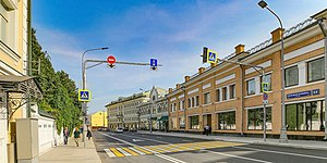
Krasnoselsky District (Russian: Красносе́льский райо́н is a district of Central Administrative Okrug of the federal city of Moscow, Russia. The district recorded a population of 47,256 ; and 45,229 .

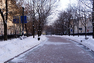
Meshchansky District is a district of Central Administrative Okrug of the federal city of Moscow, Russia. Population: 58,002 (2010 Census); 56,077 (2002 Census).

The Russian route M8 "Kholmogory" or Yaroslavl highway, is a major trunk road that links Moscow to the Russian North in general and the sea harbour of Arkhangelsk in particular. The road runs north of Moscow across a distance of 1271 kilometres through Mytishchi, Pushkino, Sergiyev Posad, Pereslavl-Zalessky, Rostov the Great, Yaroslavl, Danilov, Gryazovets, Vologda, Kadnikov, Velsk, Kholmogory, and Arkhangelsk, ending up in the city of Severodvinsk. It passes Moscow, Vladimir, Yaroslavl, Vologda, and Arkhangelsk Oblasts.

Leninsky Avenue is a major avenue in Moscow, Russia, that runs in the south-western direction between Kaluzhskaya Square in the central part of the city through Gagarin Square to the Moscow Ring Road. It is a part of the M3 highway which continues from Moscow to Kaluga and Bryansk to the border with Ukraine, and used to provide connections with Kyiv and Odesa. It is also a part of the European route E101 connecting Moscow and Kyiv.

Prospect Mira is a major arterial avenue in the north-east of Moscow. Until 1957, different sections of the avenue were named 1st Meschanskaya Street, Trinity Highway, Great Alekseevskaya Street, Great Rostokinskiy Street and Yaroslavl Highway. Today, it is one of the longest Moscow arteries, measuring 8.9 kilometres in length. It is located in the Sukharev area and is a continuation of Sretenka and Yenisei Streets, linking the Garden Ring near Sklifosovsky Hospital to the Moscow MKAD ring road extension of the M8 expressway.

Sretenka Street is a street in Meshchansky district of the Central Administrative Okrug, Moscow. Sretenka Street goes from Sretenskie Vorota Square to Bolshaya Sukharevskaya and Malaya Sukharevskaya Squares.

Bolshaya Pokrovskaya Street is the high street in the historical centre of Nizhny Novgorod and one of its oldest streets. Until 1917 it was considered a street for noblemen. Formed the main street of the city by the end of the 18th century. It is considered an analog of the Arbat in Moscow or 6-7 Lines of Vasilyevsky Island in St. Petersburg.