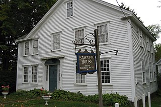
Bolton is a town in Worcester County, Massachusetts, United States. Bolton is in central Massachusetts, located 25 miles west-northwest of downtown Boston along Interstate 495. It is within Greater Boston and MetroWest regions. The population was 5,665 at the 2020 census.
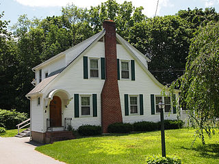
A mansard or mansard roof is a multi-sided gambrel-style hip roof characterised by two slopes on each of its sides, with the lower slope at a steeper angle than the upper, and often punctured by dormer windows. The steep roofline and windows allow for additional floors of habitable space, and reduce the overall height of the roof for a given number of habitable storeys. The upper slope of the roof may not be visible from street level when viewed from close proximity to the building.
Merritt Island National Wildlife Refuge is a 140,000 acres (57,000 ha) U.S. National Wildlife Refuge (NWR) on the Atlantic coast of Florida's largest barrier island. NASA's Kennedy Space Center and visitor complex are also situated on the island and NASA can restrict access to the refuge based on its operational needs.
The Nashua River, 37.5 miles (60.4 km) long, is a tributary of the Merrimack River in Massachusetts and New Hampshire in the United States. It is formed in eastern Worcester County, Massachusetts, at the confluence of the North Nashua River and South Nashua River, and flows generally north-northeast past Groton to join the Merrimack at Nashua, New Hampshire. The Nashua River watershed occupies a major portion of north-central Massachusetts and a much smaller portion of southern New Hampshire.

The Deep Fork National Wildlife Refuge (DFNWR) is part of the United States system of National Wildlife Refuges, and is a critical resource for wildfowl that migrate along the Central Flyway in Spring and Fall. It is located in Eastern Oklahoma, near the city of Okmulgee. The preserve runs along both banks of the Deep Fork River for about 20 miles (32 km). According to TravelOK, DFNWR receives about 45,000 visitors every year.
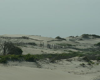
The Hockomock Swamp is a vast wetland encompassing much of the northern part of southeastern Massachusetts. This 16,950-acre (6,859 ha) land is considered the largest freshwater swamp in the state. It acts as a natural flood control mechanism for the region.

Route 110 is a 69.24-mile-long (111.43 km) southwest–northeast state route in the U.S. state of Massachusetts. Route 110’s western terminus is at a concurrency of Route 12 and Route 140 in West Boylston, and its eastern terminus is at the junction of U.S. 1 and Route 1A in Sailsbury, a few miles from the Atlantic Ocean. Route 110 provides an alternate route for the northern part of I-495.

National Chambal Sanctuary, also called the National Chambal Gharial Wildlife Sanctuary, is a 5,400 km2 (2,100 sq mi) tri-state protected area in northern India for the protection of the Critically Endangered gharial, the red-crowned roof turtle and the Endangered Ganges river dolphin. Located on the Chambal River near the tripoint of Rajasthan, Madhya Pradesh and Uttar Pradesh, it was first declared in Madhya Pradesh in 1978, and now constitutes a long narrow eco-reserve co-administered by the three states. Within the sanctuary, the pristine Chambal River cuts through mazes of ravines and hills with many sandy beaches.
Pea Island National Wildlife Refuge is a national wildlife refuge located on North Carolina's Pea Island, a coastal barrier island and part of a chain of islands known as the Outer Banks, adjacent to Cape Hatteras National Seashore. The sanctuary is located 10 miles (16 km) south of Nags Head, North Carolina on NC 12.

Tosohatchee Wildlife Management Area is located along the St. Johns River east of Orlando in Christmas on Taylor Creek Road, off SR 50.

Route 117 is a 31.0718-mile-long (50.0052 km) east–west state highway in Massachusetts, running from Route 12 in Leominster in northeast Worcester County to U.S. Route 20 in Waltham in central Middlesex County.
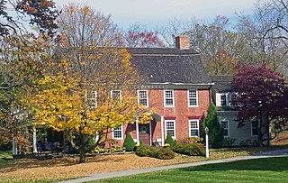
Dutch Colonial is a style of domestic architecture, primarily characterized by gambrel roofs having curved eaves along the length of the house. Modern versions built in the early 20th century are more accurately referred to as "Dutch Colonial Revival", a subtype of the Colonial Revival style.
The Nashaway were a tribe of Algonquian Indians inhabiting the upstream portions of the Nashua River valley in what is now the northern half of Worcester County, Massachusetts, mainly in the vicinity of Sterling, Lancaster and other towns near Mount Wachusett, as well as southern New Hampshire. The meaning of Nashaway is "river with a pebbled bottom".

The Assabet River National Wildlife Refuge is a 2,230-acre (9.0 km2) protected National Wildlife Refuge located approximately 25 miles (40 km) west of Boston and 4 miles (6.4 km) west of the Eastern Massachusetts National Wildlife Refuge Complex Headquarters, along the Assabet River. It is located in portions of the towns of Hudson, Maynard, Stow and Sudbury. The Assabet River National Wildlife Refuge consists of two separate pieces of land. The larger northern section is just north of Hudson Road, extending north to the Assabet River. The southern section is located to the south of Hudson Road. There is a visitor center located in the northern section on Winterberry Way.

Oxbow National Wildlife Refuge is a property of the United States National Wildlife Refuge (NWR) system located in Middlesex and Worcester counties in Massachusetts. It was founded in 1974.
The Newcomb–Brown Estate is located at the junction of the US 44 highway and Brown Road in Pleasant Valley, New York, United States. It is a brick structure built in the 18th century just before the Revolution and modified slightly by later owners but generally intact. Its basic Georgian style shows some influences of the early Dutch settlers of the region.
The Milnerton Racecourse Nature Reserve is a lowland conservation area located in the City of Cape Town, South Africa.

Frances A. Crane Wildlife Management Area is a wildlife management area (WMA) in Falmouth, Massachusetts, operated by the state Department of Fish and Game.

The Houghton Lake Flats Flooding State Wildlife Management Area is a protected wildlife area located in rural Lake Township within Roscommon County in the U.S. state of Michigan. The wildlife management area incorporates 1,830 acres (7.41 km2) of artificially restored marsh and wetlands just west of Houghton Lake.

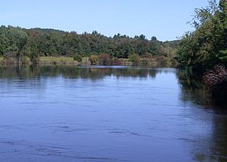
The Still River is a 5-mile-long (8.0 km) tributary of the Nashua River in Bolton, Massachusetts and Harvard, Massachusetts. The river is located near Lancaster, Massachusetts in eastern Worcester County, Massachusetts. The village of Still River, Massachusetts is located in Harvard, Massachusetts, where the river merges with the Nashua in the Bolton Flats.


