
Hodal is a city and a municipal council in Palwal district in the Haryana state of India. It is located at 27°53′39″N77°22′09″E and has an average elevation of 190 meters.
Tanjung Pengelih is a small town in Pengerang, Kota Tinggi District, Johor, Malaysia. The Tanjung Pengelih historical British Military Operation Centre fortress during World War II is located here. The Royal Malaysian Naval Academy is also in Tanjung Pengelih.

Otyrar is a district of Turkistan Region in southern Kazakhstan. The administrative center of the district is the selo of Shauildir. Population: 56,246 ; 53,131 ; 54,017.

Kamień is a village in the administrative district of Gmina Jabłonowo Pomorskie, within Brodnica County, Kuyavian-Pomeranian Voivodeship, in north-central Poland. It lies 4 kilometres (2 mi) south-east of Jabłonowo Pomorskie, 20 km (12 mi) north-west of Brodnica, and 54 km (34 mi) north-east of Toruń.
Borek is a village in the administrative district of Gmina Kowalewo Pomorskie, within Golub-Dobrzyń County, Kuyavian-Pomeranian Voivodeship, in north-central Poland. It lies 4 kilometres (2 mi) south-east of Kowalewo Pomorskie, 9 km (6 mi) north-west of Golub-Dobrzyń, and 26 km (16 mi) north-east of Toruń.
Bielawy is a village in the administrative district of Gmina Nakło nad Notecią, within Nakło County, Kuyavian-Pomeranian Voivodeship, in north-central Poland. It lies approximately 3 kilometres (2 mi) west of Nakło nad Notecią and 30 km (19 mi) west of Bydgoszcz.
Borek is a village in the administrative district of Gmina Zławieś Wielka, within Toruń County, Kuyavian-Pomeranian Voivodeship, in north-central Poland. It lies approximately 21 km (13 mi) north-west of Toruń and 24 km (15 mi) east of Bydgoszcz.
Mały Borek is a settlement in the administrative district of Gmina Płaska, within Augustów County, Podlaskie Voivodeship, in north-eastern Poland, close to the border with Belarus. It lies approximately 7 kilometres (4 mi) south-east of Płaska, 24 km (15 mi) east of Augustów, and 84 km (52 mi) north of the regional capital Białystok.
Kosmaty Borek is a village in the administrative district of Gmina Czarna Białostocka, within Białystok County, Podlaskie Voivodeship, in north-eastern Poland. It lies approximately 6 kilometres (4 mi) west of Czarna Białostocka and 23 km (14 mi) north of the regional capital Białystok.
Brzozowy Borek is a village in the administrative district of Gmina Dąbrowa Białostocka, within Sokółka County, Podlaskie Voivodeship, in north-eastern Poland.
Kossaki-Falki is a village in the administrative district of Gmina Rutki, within Zambrów County, Podlaskie Voivodeship, in north-eastern Poland. It lies approximately 5 kilometres (3 mi) north-west of Rutki-Kossaki, 16 km (10 mi) north-east of Zambrów, and 54 km (34 mi) west of the regional capital Białystok.
Nowy Borek is a village in the administrative district of Gmina Zambrów, within Zambrów County, Podlaskie Voivodeship, in north-eastern Poland.
Rogowe Kopce is a village in the administrative district of Gmina Tomaszów Lubelski, within Tomaszów Lubelski County, Lublin Voivodeship, in eastern Poland.
Papierny Borek is a village in the administrative district of Gmina Krasnosielc, within Maków County, Masovian Voivodeship, in east-central Poland. It lies approximately 10 kilometres (6 mi) north of Krasnosielc, 27 km (17 mi) north of Maków Mazowiecki, and 99 km (62 mi) north of Warsaw.
Perzanki-Borek is a village in the administrative district of Gmina Krasnosielc, within Maków County, Masovian Voivodeship, in east-central Poland.
Borek is a village in the administrative district of Gmina Iława, within Iława County, Warmian-Masurian Voivodeship, in northern Poland. It lies approximately 13 kilometres (8 mi) east of Iława and 53 km (33 mi) west of the regional capital Olsztyn.
Borek is a settlement in the administrative district of Gmina Ruciane-Nida, within Pisz County, Warmian-Masurian Voivodeship, in northern Poland. It lies approximately 12 kilometres (7 mi) south-west of Ruciane-Nida, 24 km (15 mi) west of Pisz, and 70 km (43 mi) east of the regional capital Olsztyn.
Prusowy Borek is a village in the administrative district of Gmina Szczytno, within Szczytno County, Warmian-Masurian Voivodeship, in northern Poland. It lies approximately 8 kilometres (5 mi) south-east of Szczytno and 48 km (30 mi) south-east of the regional capital Olsztyn.
Arona parish is an administrative unit of the Madona Municipality, Latvia.
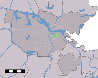
Oostelijke Eilanden is a neighborhood in the centre of Amsterdam, Netherlands, consisting of Kattenburg, Wittenburg, and Oostenburg. Notable buildings include the Oosterkerk and 's Lands Zeemagazijn.


