
Birao is the capital of Vakaga, one of the 14 prefectures of the Central African Republic and was an administrative post in the colony of Ubangui-Shari. In March 2007, the town was almost completely burnt down in the fighting between rebels and government troops in the area.
Ouanda Djallé is a sub-prefecture and town in the prefecture of Vakaga in the Central African Republic. It is located 130 km south of Birao. By population it is one of the smallest sub-prefectures in the country.
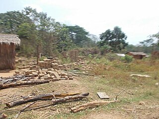
Tiri is a village in the Bamingui-Bangoran prefecture in the northern Central African Republic.
Gordil is a town in the Vakaga Prefecture of the northern Central African Republic.
Am Dafok, also spelt Am Dafock, is a village in the Vakaga prefecture of Central African Republic (CAR). The town sits on the CAR side of the border with Sudan; on the Sudanese side of the border lies Um Dafuq in the state of South Darfur.
Sam Ouandja is a town located in the Central African Republic prefecture of Haute-Kotto near the border with Sudan. It has historically served as important arms trafficking hub for armed groups in Central African Republic. Artisanal diamond mining is also active in the commune.
In March 2022 Russian mercenaries from Wagner Group supported by armed forces launched an offensive against armed groups in the northeastern parts of the Central African Republic (CAR) during which they killed dozens of rebels and possibly hundreds of civilians including citizens of Chad, Niger, Sudan and CAR who were working there as artisanal miners, herders and camel drivers while displacing thousands. The events have been described by multiple sources including domestic in the Central African Republic as well as in Sudan based on survivor testimony.

Tiringoulou, also spelled Tirigoulou or Tiroungoulou, is a village in the Vakaga Prefecture in the northern Central African Republic.

Sikkikede , also spelled Sikikédé and Sikikede, is a town in Vakaga Prefecture, Central African Republic. It is the largest settlement in Vakaga, with a population of around 20.000 people. CPJP established the headquarter in Sikkikede.
Ndiffa is a town in Vakaga Prefecture, Central African Republic.
Sergobo , also spelled Seregobo, is a village in Vakaga Prefecture, Central African Republic and inhabited by Gula.
Takamala is a village in Vakaga Prefecture, Central African Republic.
Mélé is a village located in Vakaga Prefecture, Central African Republic.
Délembé is a village in Vakaga, Central African Republic.
Tissi, also known as Tissi-Fongoro, is a village situated across the Central African Republic-Chad border in Vakaga Prefecture, Central African Republic. Tissi is the northernmost settlement in the Central African Republic.
Mouka is a village situated in Haute-Kotto Prefecture, Central African Republic.

Arnaud Djoubaye Abazène is a Central African politician from Vakaga who is currently serving as the minister of justice and the founder of RPRC.
Pavica, also spelled Pavika, is a village situated in Basse-Kotto Prefecture, Central African Republic.
Manou is a mining village situated 5 km from Gordil in Vakaga Prefecture, Central African Republic.
Délé is a village situated 12 km from Ouanda Djallé town in Vakaga Prefecture, Central African Republic.
