| Bospoort Dam | |
|---|---|
 | |
 Location of Bospoort Dam in South Africa 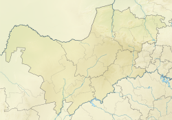 Bospoort Dam (North West (South African province)) | |
| Official name | Bospoort Dam |
| Country | South Africa |
| Location | North West |
| Coordinates | 25°33′45″S27°21′14″E / 25.56250°S 27.35389°E |
| Purpose | Irrigation |
| Opening date | 1933 |
| Owner(s) | Department of Water Affairs |
| Dam and spillways | |
| Type of dam | Combination gravity and earth fill dam |
| Impounds | Hex River |
| Height | 23 m |
| Length | 468 m |
| Reservoir | |
| Creates | Bospoort Dam Reservoir |
| Total capacity | 18.2×10⁶ m3 (640×106 cu ft) |
| Surface area | 378.8 ha (936 acres) |
Bospoort Dam is a gravity/earth-fill type dam on the Hex River, a tributary of the Elands River, part of the Crocodile River (Limpopo) basin. [1] It is located near Rustenburg, North West, South Africa. Its primary purpose is for irrigation.