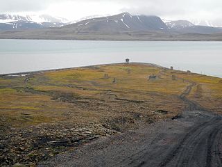
Sjuøyane is the northernmost part of the Svalbard archipelago north of Norway, and some 20 km north of the major island Nordaustlandet.

Sørkapp Land is the land area south of Hornsund, at the southern part of Spitsbergen, Svalbard. Two glaciers, Hornbreen and Hambergbreen, divide Sørkapp Land from Torell Land.

Torell Land is a land area at the southeast part of Spitsbergen, Svalbard. It is named after Otto Martin Torell. Two glaciers, Hornbreen and Hambergbreen, divide Torell Land from Sørkapp Land.

Orvin Land is the land area of the northeastern part of Nordaustlandet, Svalbard, east of Duvefjorden, including the lower part of Austfonna. The area is named after geologist Anders Kristian Orvin. Orvin Land is bordered by Prins Oscars Land to the east and Austfonna to the south.

Nordkappsundet is a 10-15 km wide strait between Chermsideøya off the north of Nordaustlandet in the south and Sjuøyane in the north, Svalbard in Arctic Norway. Named after Nordkapp on Chermsideøya, the northern extreme of mainland Svalbard.

Finneset is a peninsula located on the east side of Grønfjorden on Spitsbergen in Svalbard, Norway. It is located 2 kilometers (1.2 mi) south of Barentsburg. A whaling station was located there until 1905. From 1911 it became the site of the first wireless station in the Arctic, named Svalbard Radio from 19 September 1925. It was also a meteorological station operated by the Norwegian Meteorological Institute. Both services moved to Longyearbyen on 1 September 1930. It is named for being a fine place to land a ship.
Glenhalvøya is a peninsula in Orvin Land at Nordaustlandet, Svalbard, between Finn Malmgren Fjord and Duvefjorden. It is named after Arctic explorer Alexander Richard Glen. The island of Søre Repøya is separated from the peninsula by the strait of Gilessundet.

Brennevinsfjorden is a fjord in Gustav V Land at Nordaustlandet, Svalbard. The fjord has a length of about eleven nautical miles, and runs in between Depotodden and Kapp Hansteen.
Platenhalvøya is a peninsula at Nordaustlandet, Svalbard, between Zorgdragerfjorden and Duvefjorden. The peninsula constitutes the northeastern part of Prins Oscars Land. The mountains Binneyfjellet and Goodenoughfjellet are among the highest peaks of Nordaustlandet.
Ekstremfjorden is a fjord at the northern coast of Nordaustlandet, Svalbard, east of Laponiahalvøya. It mouths into the western part of Nordenskiöldbukta.
Storøya is an island in the Svalbard archipelago. It is located east of Nordaustlandet, separated from Nordaustlandet by the strait of Storøysundet. The southern part of the island is covered by the glacier Storøyjøkulen.
Sørodden is a headland and the most southern point of the island Storøya in the Svalbard archipelago, east of Nordaustlandet. The headland is also the southern part of the glacier Storøyjøkulen.
Franklinfjellet is a mountain in Gustav V Land, on the peninsula Botniahalvøya of Nordaustlandet, Svalbard, Norway. It has a height of 430 m.a.s.l. The mountain is named after British naval officer John Franklin.
Kapp Hansteen is a headland at the northwestern side of Nordaustlandet, Svalbard. The headland is named after astronomer Christopher Hansteen. It is located at the northern part of the peninsula Botniahalvøya, between Brennevinsfjorden and Lady Franklinfjorden.
Depotodden is a headland in Gustav V Land at Nordaustlandet, Svalbard. It is located south of the mountain of Basisfjellet on the peninsula Laponiahalvøya, at the northeastern side of Brennevinsfjorden.
Verlegenhuken is the northernmost point of Ny-Friesland at Spitsbergen, Svalbard. It is located north of the coastal plain Verlegenhukflya at the peninsula Mosselhalvøya. Verlegenhuken is the most northern point of Spitsbergen.
Sabinebukta is a bay at the northern side of Nordaustlandet, Svalbard. The bay is split into Vestre Sabinevågen and Austre Sabinevågen. The Sabine Islands are located in the outer part of the bay. The bay is named after Arctic explorer Edward Sabine.
Storsteinhalvøya is a peninsula at the northwestern side of Nordaustlandet, Svalbard. It is surrounded by Murchisonfjorden to the south, Franklinsundet to the north, and Lady Franklinfjorden to the northeast. The peninsula is almost free of glaciated areas, and contains some lakes. The nearly closed bay Claravågen is located at the western side, and Pentavika and Westmanbukta at the northern side.
Søre Repøya is the largest and southern island of the two Repøyane, off Orvin Land at Nordaustlandet, Svalbard. The island rises to a plateau of up to 240 m.a.s.l. It is separated from Glenhalvøya by the sound Gilessundet, and from Nordre Repøya by the sound Poortsundet. The island is named after Dutch whaler Outger Rep van Ootzaan.
Snøtoppen is a mountain in Gustav V Land at Nordaustlandet, Svalbard. It has a height of 620 m.a.s.l. and is the highest mountain of the peninsula of Laponiahalvøya.


