
The Northwest Passage (NWP) is the sea lane between the Atlantic and Pacific oceans through the Arctic Ocean, along the northern coast of North America via waterways through the Arctic Archipelago of Canada. The eastern route along the Arctic coasts of Norway and Siberia is accordingly called the Northeast Passage (NEP). The various islands of the archipelago are separated from one another and from Mainland Canada by a series of Arctic waterways collectively known as the Northwest Passages, Northwestern Passages or the Canadian Internal Waters.

A strait is a landform connecting two seas or two water basins. While the landform generally constricts the flow, the surface water still flows, for the most part, at the same elevation on both sides and through the strait in both directions. In some straits there may be a dominant directional current through the strait. Most commonly, it is a narrowing channel that lies between two land masses. Some straits are not navigable, for example because they are either too narrow or too shallow, or because of an unnavigable reef or archipelago. Straits are also known to be loci for sediment accumulation. Usually, sand-size deposits occur on both the two opposite strait exits, forming subaqueous fans or deltas.

The Strait of Malacca is a narrow stretch of water, 800 kilometres (500 mi) long and from 65 to 250 km wide, between the Malay Peninsula to the northeast and the Indonesian island of Sumatra to the southwest, connecting the Andaman Sea and the South China Sea. As the main shipping channel between the Indian and Pacific oceans, it is one of the most important shipping lanes in the world. It is named after the Malacca Sultanate that ruled over the strait between 1400 and 1511, the center of administration of which was located in the modern-day state of Malacca, Malaysia.

The Luzon Strait is the strait between Luzon and Taiwan. The strait thereby connects the Philippine Sea to the South China Sea in the western Pacific Ocean.

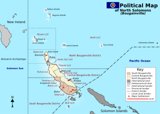
Bougainville, officially the Autonomous Region of Bougainville, is an autonomous region in Papua New Guinea. The largest island is Bougainville Island, while the region also includes Buka Island and a number of outlying islands and atolls. The current capital is Buka, situated on Buka Island.

The Northeast Passage is the shipping route between the Atlantic and Pacific Oceans, along the Arctic coasts of Norway and Russia. The western route through the islands of Canada is accordingly called the Northwest Passage (NWP).

The Torres Strait, also known as Zenadh Kes, is a strait between Australia and the Melanesian island of New Guinea. It is 150 km (93 mi) wide at its narrowest extent. To the south is Cape York Peninsula, the northernmost extremity of the Australian mainland. To the north is the Western Province of Papua New Guinea. It is named after the Spanish navigator Luís Vaz de Torres, who sailed through the strait in 1606.

New Georgia Sound is the sound in the New Georgia Islands region that runs approximately southeast–northwest through the middle of the Solomon Islands archipelago in the Southern Pacific Ocean and Melanesia.
Bougainville, an autonomous region of Papua New Guinea (PNG), has been inhabited by humans for at least 29,000 years, according to artefacts found in Kilu Cave on Buka Island. The region is named after Bougainville Island, the largest island of the Solomon Islands archipelago, but also contains a number of smaller islands.

USS Conway (DD/DDE-507), a Fletcher-class destroyer, was the second ship of the United States Navy to be named for William Conway, who distinguished himself during the Civil War.
Francis Ona was a Bougainville secessionist leader who led an uprising against the Government of Papua New Guinea as part of the Bougainville Civil War. He and his followers were concerned about the environmental and social effects of the operation of the Panguna mine by Bougainville Copper, a subsidiary of Rio Tinto Group. On 17 May 1990, Ona declared the independence of the Republic of Me'ekamui. It was not recognised internationally. In May 2004 Ona proclaimed himself "King of Me'ekamui." While resisting the peace process and 2005 elections, Ona mostly stayed in a safe haven, where his BRA forces controlled territory. He died of malaria in his village.
Bougainville – Our Island Our Fight is a 1998 Australian documentary film. It was produced and directed by Wayne Coles-Janess.

Indispensable Strait is a waterway in the Solomon Islands, running about 200 kilometres northwest-southeast from Santa Isabel to Makira, between the Florida Islands and Guadalcanal to the southwest, and Malaita to the northeast.
Bougainville may refer to:
Wayne Coles-Janess is an Australian producer, writer and director of drama and documentary film and TV programs. Based in Melbourne, Australia, he has produced documentaries about frontier places in the country. He has also made some documentaries in several international locations, including during times of war.
The Andaman and Nicobar Command (ANC) is a integrated tri-services command of the Indian Armed Forces, based at Port Blair in the Andaman and Nicobar Islands, a Union Territory of India. It was created in 2001 to safeguard India's strategic interests in Southeast Asia and the Strait of Malacca by increasing rapid deployment of military assets in the region. It provides logistical and administrative support to naval ships which are sent on deployment to East Asia and the Pacific Ocean.
The Solomon Islands (archipelago) is an island group in the western South Pacific Ocean, north-east of Australia. The archipelago is in the Melanesian subregion and bioregion of Oceania and forms the eastern boundary of the Solomon Sea. The many islands of the archipelago are distributed across the sovereign states of Papua New Guinea and Solomon Islands. The largest island in the archipelago is Bougainville Island, which is a part of the Autonomous Region of Bougainville along with Buka Island, the Nukumanu Islands, and a number of smaller nearby islands. Much of the remainder falls within the territory of Solomon Islands and include the atolls of Ontong Java, Sikaiana, the raised coral atolls of Bellona and Rennell, and the volcanic islands of Choiseul, Guadalcanal, Makira, Malaita, New Georgia, the Nggelas, Santa Isabel, and the Shortlands. The Santa Cruz Islands are not a part of the archipelago.
Abraham Bristow (c1771-1846) was a British mariner, sealer and whaler. In August 1806 he discovered the Auckland Islands.
Early Polynesian explorers reached nearly all Pacific islands by 1200 CE, followed by Asian navigation in Southeast Asia and the West Pacific. During the Middle Ages, Muslim traders linked the Middle East and East Africa to the Asian Pacific coasts, reaching southern China and much of the Malay Archipelago. Direct European contact with the Pacific began in 1512, with the Portuguese encountering its western edges, soon followed by the Spanish arriving from the American coast.
The Bougainville conflict, also known as the Bougainville Civil War, was a multi-layered armed conflict fought from 1988 to 1998 in the North Solomons Province of Papua New Guinea (PNG) between PNG and the secessionist forces of the Bougainville Revolutionary Army (BRA), and between the BRA and other armed groups on Bougainville. The conflict was described by Bougainvillean President John Momis as the largest conflict in Oceania since the end of World War II in 1945, with an estimated 15,000–20,000 Bougainvilleans dead, although lower estimates place the toll at around 1,000–2,000.
