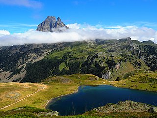
Pyrénées National Park is a French national park located within the departments of Hautes-Pyrénées and Pyrénées-Atlantiques. The park is located along the border of France and Spain along the Pyrenees Mountains, with a scenic landscape offering a variety of outdoor activities including hiking, skiing, mountain climbing and observing wildlife.
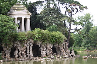
The Bois de Vincennes, located on the eastern edge of Paris, France, is the largest public park in the city. It was created between 1855 and 1866 by Emperor Napoleon III.
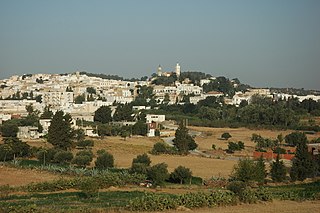
Zaghouan is a town in the northern half of Tunisia.
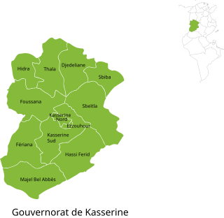
Kasserine Governorate, sometimes spelt Casrein, is one of the twenty-four governorates (provinces) of Tunisia. It is in west-central Tunisia on the frontier with Algeria, wholly north of the true centre line but the area is south or west of the bulk of the population of the country, based on Tunisia's greater northern rainfall. It covers an area of 8,260 km2 and has a population of 468,925 (2023).The capital is Kasserine which is at the foot of Jebel ech Chambi, Tunisia's highest mountain, in turn part of the Dorsal Atlas mountains. The mountain and its associated escarpment form its own national park in the province.

Hammam-Lif is a coastal town about 20 km south-east of Tunis, the capital of Tunisia. It has been known since antiquity for its thermal springs originating in Mount Bou Kornine.

Jebel ech Chambi is a mountain peak in Tunisia. At an elevation of 1,544 m (5,066 ft), it is the highest mountain in the country. It stands above the city of Kasserine in western central Tunisia. The summit is covered by a pine forest and is part of Chambi National Park.

Vanoise National Park is a French national park between the Tarentaise and Maurienne valleys in the French Alps, containing the Vanoise massif. It was created in 1963 as the first national park in France.

The Rocky Mountains Park Act was enacted on June 23, 1887, by the Parliament of Canada, establishing Banff National Park which was then known as "Rocky Mountains Park". The act was modelled on the Yellowstone Park Act passed by the United States Congress in 1881. The Rocky Mountains Park Act outlined the national park concept, balancing conservation and development interests.

Gaspésie National Park is a provincial park located south of the town of Sainte-Anne-des-Monts, Quebec, Canada in the inland of the Gaspé peninsula. The park contains the highest peak of the Appalachian Mountains in Canada, Mont Jacques-Cartier, 1,270 metres (4,170 ft) above sea level. In addition, the park contains the only population of Caribou found south of the Saint Lawrence River in Canada.

Xonrupt-Longemer is a commune in the Vosges department in Grand Est in northeastern France.

Toubkal National Park is a national park in the High Atlas mountain range, 70 kilometres from Marrakesh in central-western Morocco. Established in 1942, it covers an area of 380 km2. Jbel Toubkal is the highest peak of the park at 4,167 metres.
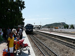
Borj Cédria is a railway town in Tunisia located at 36°41′34″N10°25′39″E on the Oued Gattana river. The population in 2004 was 8974.

El Watania 1, also known as Télévision Tunisienne 1, is the first Tunisian public national television channel. It is owned and operated by Télévision Tunisienne. Formerly named RTT (1966–1983), RTT 1 (1983–1992), TV7 (1992–1997), Tunis 7 (1997–2008), Tunisie 7 (2008–2011), it has been known as El Watania 1 since 2011.

Mont-Orford National Park is a national park in Orford, Quebec, Canada that is maintained and protected by the Sépaq. a provincial body.

Jebel Boukornine, also spelled Djebel Bou Kornine or Mount Bou Kornine, is a 576 metres (1,890 ft) mountain in northern Tunisia overlooking the Gulf of Tunis and the city of Hammam Lif. It consists of folded and faulted outcrops of Jurassic limestone.
Micropterix carthaginiensis is a species of moth belonging to the family Micropterigidae, native to Tunisia. It was described by John Heath in 1986. It is found in the marshland on the southern shore of Lake Ichkeul and at Jebel Boukornine, its type locality.
Chambi National Park is a national park in Tunisia's Kasserine Governorate. Located in the country's west-central part, the park is close to the border with Algeria. It protects the flora and fauna surrounding Mount Chambi, the highest mountain peak in Tunisia.
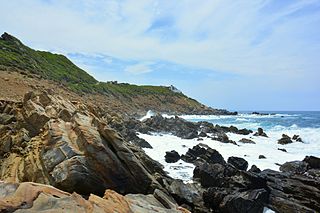
Jebel Chitana-Cap Negro national Park is a national park situated on the north coast of Tunisia, between the cap Serrat and the Sidi el Barrak Dam. It consists of the forest chain of Jebel Chitana, within the forest district of Bizerte, and that of Bellif, dependent on the forest district of Béja.

The Djebel Serj is a limestone mountain located in the center of Tunisia, within the Tunisian ridge. It rises to 1,357 meters above sea level. The mountain is located at 35° 56′ 12″n, 9° 32′ 59″e

North East Tunisia is one of the six geographic and economic regions of Tunisia. It consists of seven governorates: Bizerte, Tunis, Aryanah, Menouba, Ben Arous, Zaghouan and Nabeul. At the 2014 Census, the region had a population of 4,176,779. That makes it the most populated region of the country and it has the highest density with 347 people per square kilometer.


