
Crafton is a hamlet in the civil parish of Mentmore, in Buckinghamshire, England.

Nash Lee is a hamlet in the parish of Wendover, in Buckinghamshire, England. It is located to the north of the village, about two miles west of Wendover.

Westlington is a hamlet near the village of Dinton in the civil parish of Dinton-with-Ford and Upton, Buckinghamshire, England.

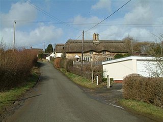
Upton is a hamlet in the civil parish of Dinton-with-Ford and Upton, in Buckinghamshire, England. It is located to the north of the main village of Dinton, on the junction between the new road from Aylesbury to Thame, and the old road before it was rerouted.

Cornriggs is a hamlet in the civil parish of Stanhope, in County Durham, England. It is situated on the north side of Weardale in the North Pennines, which is designated as both an Area of Outstanding Natural Beauty and a UNESCO Global Geopark.

Ayot Green is a hamlet in Hertfordshire, England and is near the A1(M) Motorway, close to Welwyn Garden City. It is a typical traditional English village, centred on a village green. There are several other Ayots in the area, including Ayot St Lawrence and Ayot St Peter, and it also gives name to the rail trail called Ayot Greenway which stretches from Ayot Green to Wheathampstead.

Coombe Hill is a hamlet in the civil parish of Leigh in Gloucestershire, England. It lies on the A38 road between Gloucester and Tewkesbury, at the junction with the A4019 road to Cheltenham.
Bridgeyate is a hamlet in South Gloucestershire, England. Bridgeyate is situated between the cities of Bristol and Bath. The increase in housebuilding in the area has seen Bridgeyate become attached to the nearby villages of Warmley and North Common, but it still retains its own identity with a large common and three public houses, The Griffin, The White Hart and The Hollybush. The Hollybush reopened in March 2014 after an extensive refit.

Gaunt's Earthcott, sometimes spelt Gaunts Earthcott, is a hamlet in the civil parish of Almondsbury in South Gloucestershire, England.

The River Dever is a chalk stream in Hampshire in the south of England. It rises at West Stratton near Micheldever and flows westwards for 11 mi (18 km) to meet the River Test at Wherwell.

The Vale of Berkeley is an area in Gloucestershire, England. It lies between the River Severn and the Cotswold Edge, north of Bristol and south of Gloucester. It includes the towns of Berkeley, Thornbury, Cam, Dursley, Wotton-under-Edge and surrounding villages.

Brabourne Lees is a village in the civil parish of Brabourne, within the Ashford borough of Kent, England. The village (centre) is just under 5 miles (8 km) east of Ashford town centre itself geographically. By road this is a journey of about 6 miles (10 km). In 2021 it had a population of 1480.

Lye Green is a hamlet in the civil parish of Chesham in Buckinghamshire, England. It is located north east of Chesham. Lycrome Road runs through the centre of the hamlet, from the A416 in the east to the B4505 in the west.

Whelpley Hill is a hamlet in the parish of Ashley Green in Buckinghamshire, England. It is located to the east of Chesham, near the border with Hertfordshire and is the site of an Iron Age hillfort.

The hamlet of Beacon Hill, is situated off the B474 near Penn and on the outskirts of High Wycombe Buckinghamshire. Nearby is the Golf Course at Wycombe Heights.
Lower Wick is a small hamlet located in the county of Gloucestershire, England. It is situated about five miles south west of Dursley, eighteen miles southwest of Gloucester and fifteen miles northeast of Bristol. Lower Wick is within the civil parish of Alkington.

Darby Green is a village in the parish of Yateley, North East Hampshire, England. The electoral ward of Frogmore and Darby Green is separated from the rest of the parish by a small gap around Clarks Farm, until recently a composting farm in the mushroom producing industry. The ward has a boundary shared with Blackwater, which is one part of the Civil Parish of Hawley.
Ratford is a hamlet near Calne in the county of Wiltshire, England, with a population of approximately 50.
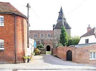
Wethersfield is a village and civil parish on the B1053 road in the Braintree district of Essex, England. It is near the River Pant. Wethersfield has a school, a social club, a fire station and one place of worship. Nearby settlements include the town of Braintree and the village of Finchingfield. The village probably gets its name from a Viking invader named Wuthha or Wotha, who controlled that particular "field" or clearing. Reverend Patrick Brontë, father of the Brontë sisters, was a young curate here in 1807, as was the Rev. John West, missionary to Canada, who married Harriet Atkinson here in 1807.

Egypt is a hamlet near Thornton, in the City of Bradford, West Yorkshire, England.
