Tyndale Monument

Last updated

Tyndale Monument
Tyndale Monument.jpg
Tyndale Monument
Location Nibley Knoll
Designer Samuel Sanders Teulon [1]
Typecenotaph
Materialstone
Width26 feet 6 inches (8 m) at the base [1]
Height111 feet (34 m)
Completion date1866
Opening date6 November 1866 [1]
Dedicated to William Tyndale

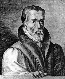
The Tyndale Monument is a tower built on a hill at North Nibley, Gloucestershire, England. It was built in honour of William Tyndale, an early translator of the New Testament into English, who was born nearby. It is a Grade II* listed building. [2]

The tower was constructed in 1866 [2] and is 111 ft (34 m) tall. [3] [4] It is possible to enter and climb up a spiral staircase composed of 121 steps to the top of the tower. The hill it is on allows a wide range of views, especially looking down to the River Severn. A nearby topograph points to some other landmarks visible. The hill on which the monument stands is quite steep. The path follows a rough fairly steep bridleway which is part of the Cotswold Way. The tower itself is surrounded by fencing and has floodlights that light up the tower at night. The stairway has automatic lighting. The Cotswold Way long-distance footpath passes the foot of the monument, and then descends the hill into North Nibley.

The door to the tower is open most of the time for free access to a staircase which takes you to the top. Locally, it is commonly called Nibley Monument rather than its official name. The hill is called Nibley Knoll or Nibley Knob.

There is a commemorative plaque on the front of the tower. The text engraved on it reads: [2] [1]

William Tyndale. William Tyndale.jpg
William Tyndale.
ERECTED A.D. 1866
IN GRATEFUL REMEMBRANCE OF
WILLIAM TYNDALE
TRANSLATOR OF THE ENGLISH BIBLE
WHO FIRST CAUSED THE NEW TESTAMENT
TO BE PRINTED IN THE MOTHER TONGUE
OF HIS COUNTRYMEN
BORN NEAR THIS SPOT HE SUFFERED
MARTYRDOM AT VILVORDEN IN
FLANDERS ON OCT 6 1536

The monument is a landmark that can be seen even in places as far as Bristol, which is over 20 miles away. In the town of Thornbury there is a street called Tyndale View where the tower can be seen from approximately 10 miles away.

Further down the Cotswold Edge, at Hawkesbury, is the Somerset Monument, erected in 1846, and the design of the Tyndale tower has features in common with this.

In October 2019 protesters from Extinction Rebellion used the monument to display a protest banner. [5]

Related Research Articles

<span class="mw-page-title-main">William Tyndale</span> English biblical scholar, translator, and reformer (1494–1536)

William Tyndale was an English biblical scholar and linguist who became a leading figure in the Protestant Reformation in the years leading up to his execution. He is well known as a translator of most of the Bible into English, and was influenced by the works of prominent Protestant Reformers such as Martin Luther.

<span class="mw-page-title-main">Gloucestershire</span> County of England

Gloucestershire is a ceremonial county in South West England. It is bordered by Herefordshire to the north-west, Worcestershire to the north, Warwickshire to the north-east, Oxfordshire to the east, Wiltshire to the south, Bristol and Somerset to the south-west, and the Welsh county of Monmouthshire to the west. The city of Gloucester is the largest settlement and the county town.

<span class="mw-page-title-main">Dursley</span> Market town in Gloucestershire, England

Dursley is a market town and civil parish in the Stroud District of Gloucestershire, England. It lies between the cities of Bristol and Gloucester. It is under the northeast flank of Stinchcombe Hill, and about 4 miles (6.4 km) southeast of the River Severn. The town is adjacent to the village of Cam. The population of Dursley was 7,463 at the 2021 Census.

<span class="mw-page-title-main">Stroud</span> Town in Gloucestershire, England

Stroud is a market town and civil parish in Gloucestershire, England. It is the main town in Stroud District. The town's population was 13,500 in 2021.

<span class="mw-page-title-main">Cotswold Way</span> Long-distance footpath in the southwest of England

The Cotswold Way is a 102-mile (164 km) long-distance footpath, running along the Cotswold Edge escarpment of the Cotswold Hills in England. It was officially inaugurated as a National Trail on 24 May 2007 and several new rights of way have been created.

<span class="mw-page-title-main">Wotton-under-Edge</span> Market town in Gloucestershire, England

Wotton-under-Edge is a market town and civil parish in the Stroud district of Gloucestershire, England. Near the southern fringe of the Cotswolds, the Cotswold Way long-distance footpath passes through the town.

<span class="mw-page-title-main">North Nibley</span> Human settlement in England

North Nibley is a village in Gloucestershire, England about 1.9 miles (3 km) northwest of Wotton-under-Edge.

<span class="mw-page-title-main">Broadway Tower, Worcestershire</span> Folly in Worcestershire, England, United Kingdom

Broadway Tower is an 18th-century folly near the village of Broadway, in the English county of Worcestershire. It is a Grade II listed building.

<span class="mw-page-title-main">Fairford</span> Human settlement in England

Fairford is a market town in Gloucestershire, England. The town lies in the Cotswold hills on the River Coln, 6 miles (9.7 km) east of Cirencester, 4 miles (6.4 km) west of Lechlade and 9 miles (14 km) north of Swindon. Nearby are RAF Fairford and the Cotswold Water Park.

<span class="mw-page-title-main">Coalpit Heath</span> Village in South Gloucestershire, England

Coalpit Heath is a small village in the civil parish of Westerleigh and Coalpit Heath, in the South Gloucestershire district, in the ceremonial county of Gloucestershire, England, south of Yate and east of Frampton Cotterell.

<span class="mw-page-title-main">Peel Monument, Ramsbottom</span> Commemorative monument

The Peel Monument at Ramsbottom, Lancashire, England, is one of two monuments in the area erected in memory of Prime Minister and founder of the police force Robert Peel, who was born in Bury. It is on Harcles Hill near Ramsbottom, 1100 feet above sea level. Because of its proximity to the village of Holcombe, Harcles Hill is more commonly known as Holcombe Hill and the monument as Holcombe or Peel Tower.

<span class="mw-page-title-main">Uley Bury</span>

Uley Bury is the long, flat-topped hill just outside Uley, Gloucestershire, England. It is an impressive multi-vallate, scarp-edge Iron Age hill fort dating from around 300 B.C. Standing some 750 feet above sea level it has views over the Severn Vale.

<span class="mw-page-title-main">Stanton, Gloucestershire</span> Human settlement in England

Stanton is a village and civil parish in Tewkesbury Borough, Gloucestershire, England. The village is a spring line settlement at the foot of the Cotswold escarpment, about 2+12 miles (4 km) southwest of Broadway in neighbouring Worcestershire. Broadway is Stanton's postal town. The 2011 Census recorded the parish's population as 198.

<span class="mw-page-title-main">Stinchcombe</span> Village and civil parish in Gloucestershire, England

Stinchcombe is a small village and civil parish in Gloucestershire, England on the B4060 road between Dursley and North Nibley. The church is called St Cyr's and its churchyard contains 40–60 gravestones. The population taken at the 2011 census was 480.

<span class="mw-page-title-main">Lord Hill's Column</span> Doric column monument in Shrewsbury, United Kingdom

Lord Hill's Column is a monument located outside of Shropshire Council's headquarters, Shirehall, in the town of Shrewsbury, Shropshire. It is a column of the Doric order and measures 133 ft 6 in (40.7 m) in height. It commemorates General Rowland Hill, 1st Viscount Hill, with a 17 ft (5.2 m) tall statue standing on the top of the column. The column is shorter than the 44.5m 'Monument to British Liberty' at Gibside, but the combined height of the column and statue is higher in total. The column was built between 1814 and 1816; its diameter is 2 ft (0.6 m) wider than Nelson's Column, and, not including the pedestal, is 15 ft (4.6 m) higher.

<span class="mw-page-title-main">Church of St. John the Baptist, Cirencester</span> Church

The Church of St. John Baptist, Cirencester is a parish church in the Church of England in Cirencester, Gloucestershire, England. It is a Grade I listed building.

<span class="mw-page-title-main">Dover's Hill</span>

Dover's Hill is a 754 feet hill in the Cotswolds area of central England. The hill is 1 mile (1.6 km) north-west of Chipping Campden in Gloucestershire. Dover's Hill and the surrounding land is the property of The National Trust.

<span class="mw-page-title-main">Bradley, Gloucestershire</span>

Bradley is a small village in the Stroud District, in the county of Gloucestershire, England.

<span class="mw-page-title-main">The Air Balloon, Birdlip</span> Pub in Birdlip, Gloucestershire, England

The Air Balloon is a road junction and former pub in Birdlip, Gloucestershire, England. The junction is on the A417 at a significant congestion point. The pub was open from the late 18th century to 2022, when it closed as part of road improvements, and was subsequently demolished.

References

  1. 1 2 3 4 "Tyndale Monument North Nibley". North Nibley. Retrieved 27 October 2019.
  2. 1 2 3 "Tyndale Monument with railed surround". National Heritage List for England. Historic England. Retrieved 27 October 2019.
  3. "Tyndale Monument". Visit the Cotswolds. Retrieved 27 October 2019.
  4. Appleton, Joanne. "The Tyndale Monument". Time Travel Britain. Retrieved 27 October 2019.
  5. "Extinction Rebellion target Tyndale Monument in Gloucestershire with protest visible from M5". Gloucestershire Live. Retrieved 27 October 2019.

51°39′31.9″N2°22′21.4″W / 51.658861°N 2.372611°W / 51.658861; -2.372611