
Willenhall is a historic market town and civil parish in the Metropolitan Borough of Walsall, and partly in Wolverhampton, in the West Midlands, England, with a population taken at the 2011 census of 28,480. It is situated between Wolverhampton and Walsall, historically in the county of Staffordshire. It lies upon the River Tame, and is part of the Black Country.
Compton is a suburb of Wolverhampton, West Midlands, England. It is located to the west of Wolverhampton city centre on the A454, within the Tettenhall Wightwick ward.
Wednesfield is a town and historic village in the City of Wolverhampton, West Midlands, England, It is 2 miles (3.2 km) east-northeast of Wolverhampton city centre and about 10 miles (16 km) from Birmingham and is part of the West Midlands conurbation. It was historically within the county of Staffordshire.
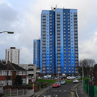
Holt Park is a medium-sized low-rise 1970s housing estate in the northwest suburbs of Leeds, West Yorkshire, England. It is approximately 6 miles (10 km) from Leeds city centre situated between Tinshill, Cookridge and Adel, and is at the edge of the Leeds urban fringe, bordering the green belt which makes up two thirds of the metropolitan borough of the City of Leeds. The nearby Tinshill BT Tower dominates the skyline.

Penn is an area which is divided between the City of Wolverhampton and South Staffordshire district. The population of the Wolverhampton Ward taken at the 2011 census was 12,718. Originally, it was a village in the historic county of Staffordshire. There is considerable confusion about exactly which areas fall within Penn. In 19th century censuses, Merry Hill, Bradmore are understood to form part of Penn, although these areas are generally understood to be separate today. However, there has never been any doubt that the two historic settlements of Upper and Lower Penn form the core of the area.

Bushbury is a suburban village and ward in the City of Wolverhampton in the West Midlands, England. It lies two miles north-east of Wolverhampton city centre, divided between the Bushbury North and Bushbury South and Low Hill wards. Bushbury also lies near to the villages of Coven, Featherstone and Four Ashes which are in South Staffordshire.
Whitmore Reans is in Wolverhampton, West Midlands, England. It is situated to the north-west of the city centre, in the city council's Park and St Peter's wards.

Merry Hill is a suburb of Wolverhampton, West Midlands and a ward of Wolverhampton City Council. It is situated in the south-west of the city, bordering South Staffordshire and the Tettenhall Wightwick, Park, Graiseley and Penn wards. It forms part of the Wolverhampton South West constituency.
Park, or Park Ward, is a ward of Wolverhampton City Council, West Midlands. It is located to the west of the city centre, and covers parts of the suburbs Bradmore, Compton, Finchfield, Merridale, Newbridge and Whitmore Reans. It borders the St Peter's, Graiseley, Merry Hill, Tettenhall Wightwick and Tettenhall Regis wards. It forms part of the Wolverhampton South West constituency.
Graiseley is both an inner-city area of Wolverhampton, situated immediately to the south-west of the city centre, and the name of a ward of Wolverhampton City Council.
Goldthorn Park is a suburb of Wolverhampton, West Midlands. It is situated 1½ miles south of the city centre within the Blakenhall ward. It mostly consists of private houses built from the 1930s onwards.

Ettingshall is an area of Wolverhampton, West Midlands, England, and is a ward of Wolverhampton City Council. The population of this ward taken at the 2011 census was 13,482.
Merridale is an area of Wolverhampton, West Midlands, England. It is situated to the south-west of the city centre, on the border of the city council's Graiseley and Park wards.
Fallings Park is a suburb of Wolverhampton, West Midlands, and a ward of Wolverhampton City Council. It is situated in the northeast of the city, bordering South Staffordshire and the Wednesfield North, Heath Town, Bushbury South and Low Hill and Bushbury North wards. It forms part of the Wolverhampton North East constituency. Fallings Park ward covers over 5,000 properties in the following areas: Longknowle, Newbolds, Scotlands, Underhill, Willows. The population of the Wolverhampton Ward taken at the 2011 census was 12,410.

Moulsecoomb is a suburb of Brighton, Sussex, England, on the northeast side around the A270 Lewes Road, between Coldean and Bevendean, 2+1⁄4 miles (3.6 km) north of the seafront. The eastern edge adjoins Falmer Hill on the South Downs. It is often divided into smaller sections on maps: North Moulsecoomb, East Moulsecoomb and South Moulsecoomb.

Tinshill is a district of Leeds, 4 miles (7 km) north of Leeds city centre, West Yorkshire, England. It was the Danes in the 9th century who named the hill "Tyndr's Hyll".
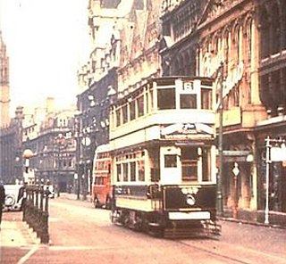
Birmingham Corporation Tramways operated a network of tramways in Birmingham from 1904 until 1953. It was the largest narrow-gauge tramway network in the UK, and was built to a gauge of 3 ft 6 in. It was the fourth largest tramway network in the UK behind London, Glasgow and Manchester.

Bantock House Museum and Park is a museum of Edwardian life and local history, with 48 acres (190,000 m2) of surrounding parkland in Wolverhampton, England. It is named after Alderman Baldwin and Kitty Bantock who once lived there. It is run by Wolverhampton City Council's Arts and Museums service.

Wolverhampton is a city and metropolitan borough in the West Midlands, England. Located 12 miles (19 km) northwest of Birmingham, the population in 2021 was 263,700.
Chapel Ash is a small area in Wolverhampton surrounded by the City Centre, Whitmore Reans & Merridale.
