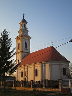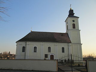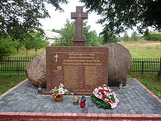
Bosut is a village located in the Sremska Mitrovica municipality, in the Syrmia District of Serbia. It is situated near the Bosut River, in the autonomous province of Vojvodina. The village has a Serb ethnic majority and its population numbers 1,139 people.

Donji Tovarnik is a village in Serbia. It is situated in the Pećinci municipality, in the Srem District, Vojvodina province. The village has a Serb ethnic majority and its population numbering 1,016 people.

Ogar is a village in Serbia. It is situated in the Pećinci municipality, in the Srem District, Vojvodina province. The village has a Serb ethnic majority and its population numbering 1,143 people.

Sibač is a village in Serbia. It is situated in the Pećinci municipality, in the Srem District, Vojvodina province. The village has a Serb ethnic majority and its population numbering 544 people.

Subotište is a village in Serbia. It is situated in the Pećinci municipality, in the Srem District, Vojvodina province. The village has a Serb ethnic majority and its population numbering 942 people.

Vitojevci is a village in Serbia. It is situated in the Ruma municipality, in the Srem District, Vojvodina province. The village has a Serb ethnic majority and its population numbering 913 people.

Grabovci is a village in Serbia. It is situated in the Ruma municipality, in the Srem District, Vojvodina province. The village has a Serb ethnic majority and its population numbering 1,480 people.

Kraljevci is a village in Serbia. It is situated in the Ruma municipality, in the Srem District, Vojvodina province. The village has a Serb ethnic majority and its population numbering 1,232 people.

The A658 is a road in the UK running from Bradford, West Yorkshire (53.7949°N 1.7487°W), to Knaresborough, North Yorkshire (54.0065°N 1.4327°W), passing along the way Leeds Bradford International Airport, where it runs through a tunnel directly under the main runway. The road originally terminated south of the village of Pannal at the junction with the A61 but was extended when the south Harrogate and Knaresborough bypass was built and the road now ends east of Knaresborough where it meets the A59.
Jabłoń-Zambrowizna is a village in the administrative district of Gmina Nowe Piekuty, within Wysokie Mazowieckie County, Podlaskie Voivodeship, in north-eastern Poland.

Czarnowo-Undy is a village in the administrative district of Gmina Kołaki Kościelne, within Zambrów County, Podlaskie Voivodeship, in north-eastern Poland.
Grabina is a village in the administrative district of Gmina Olszówka, within Koło County, Greater Poland Voivodeship, in west-central Poland.
Żerniki is a village in the administrative district of Gmina Oborniki, within Oborniki County, Greater Poland Voivodeship, in west-central Poland.
Klenak is a village in Serbia. It is situated in the Ruma municipality, in the Srem District, Vojvodina province. The village has a Serb ethnic majority and its population numbering 3,246 people.

Obrež is a village in Serbia. It is situated in the Pećinci municipality, in the Srem District, Vojvodina province. The village has a Serb ethnic majority and its population numbering 1,400 people. In 2006, construction began on a new village center building in which a main administrative office, and a small night club/bar were built. The two venues frequently host Serbian folk singers.
Selišta is a village in the municipality of Bileća, Republika Srpska, Bosnia and Herzegovina.
Vrbanja is a village in the municipality of Bugojno, Bosnia and Herzegovina.

Hamhŭng Station is a railway station in Yŏkchŏn 1-dong, Sŏngch'ŏngang-guyŏk, Hamhŭng city, South Hamgyŏng province, North Korea, located on the P'yŏngra Line of the Korean State Railway; it is also the starting point of the Sinhŭng Line and the Sŏho Line. A locomotive depot is located here, and there are spurs to the Hamhŭng Knitwear Factory and the Paekkŭmsan Combined Foodstuffs Factory in Haebit-tong, Sŏngch'ŏngang-guyŏk.
Düdenköy, Elmalı is a village in the District of Elmalı, Antalya Province, Turkey.
Seh Darreh is a village in Jolgah Rural District, in the Central District of Jahrom County, Fars Province, Iran. At the 2006 census, its population was 54, in 12 families.


