
Hristo Botev Stadium is a multi-purpose stadium in Gabrovo, Bulgaria. This 14,000 seat stadium is currently used for football matches and is the home ground of FC Yantra.
The Stade Perruc is a multi-use stadium in Hyères, France. It is currently used mostly for football matches and is the home stadium of Hyères FC. The stadium had a capacity of 1,410 when it was built in 1951.

Rudunki is a village in the administrative district of Gmina Aleksandrów Kujawski, within Aleksandrów County, Kuyavian-Pomeranian Voivodeship, in north-central Poland. It lies 4 kilometres (2 mi) west of Aleksandrów Kujawski and 20 km (12 mi) south of Toruń.
Słomkowo is a village in the administrative district of Gmina Aleksandrów Kujawski, within Aleksandrów County, Kuyavian-Pomeranian Voivodeship, in north-central Poland. It lies 4 kilometres (2 mi) west of Aleksandrów Kujawski and 20 km (12 mi) south of Toruń.
Cibory Gałeckie is a village in the administrative district of Gmina Zawady, within Białystok County, Podlaskie Voivodeship, in north-eastern Poland. It lies approximately 8 kilometres (5 mi) south-west of Zawady and 41 km (25 mi) west of the regional capital Białystok.
Smolnik is a village in the administrative district of Gmina Komańcza, within Sanok County, Subcarpathian Voivodeship, in south-eastern Poland, close to the border with Slovakia. It lies approximately 10 kilometres (6 mi) south-east of Komańcza, 32 km (20 mi) south of Sanok, and 85 km (53 mi) south of the regional capital Rzeszów.
Bieniew is a village in the administrative district of Gmina Iłów, within Sochaczew County, Masovian Voivodeship, in east-central Poland.
Ruda is a village in the administrative district of Gmina Lubowidz, within Żuromin County, Masovian Voivodeship, in east-central Poland.
Swornegacie is a village in the administrative district of Gmina Chojnice, within Chojnice County, Pomeranian Voivodeship, in northern Poland. It lies approximately 19 kilometres (12 mi) north of Chojnice and 93 km (58 mi) south-west of the regional capital Gdańsk.
Plękity is a village in the administrative district of Gmina Małdyty, within Ostróda County, Warmian-Masurian Voivodeship, in northern Poland. which is in Europe.
Wicimiczki is a village in the administrative district of Gmina Płoty, within Gryfice County, West Pomeranian Voivodeship, in north-western Poland. It lies approximately 10 kilometres (6 mi) north-east of Płoty, 14 km (9 mi) south-east of Gryfice, and 73 km (45 mi) north-east of the regional capital Szczecin.
Pogorzelica is a village in the administrative district of Gmina Rewal, within Gryfice County, West Pomeranian Voivodeship, in north-western Poland. It lies approximately 7 kilometres (4 mi) east of Rewal, 22 km (14 mi) north of Gryfice, and 84 km (52 mi) north-east of the regional capital Szczecin.
Trzcinno is a village in the administrative district of Gmina Człopa, within Wałcz County, West Pomeranian Voivodeship, in north-western Poland.

Jardinópolis, Santa Catarina is a municipality in the state of Santa Catarina in the South region of Brazil.

Negosavlje is a village in the municipality of Medveđa, Serbia. According to the 2002 census, the village has a population of 426 people.
Ilmaste is a village in Lüganuse Parish, Ida-Viru County in northeastern Estonia.
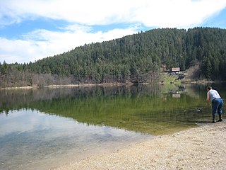
Vassacher See is a small lake north of the Carinthian city of Villach, Austria. Its surface covers an area of 4.43 ha, its maximum depth is 10.2 m.

Gunja(Urdu: گنجه ) is a town and a union council of Kharian Tehsil and Gujrat District, in the Punjab province of Pakistan. It is part of Kharian Tehsil. Other villages in the union council are Chak Ikhlas, Mughli, Dhalla, Chak Rajjadi, Jataria Khurd, Jataria Kalan, Chatta and Shahsar mast.

Lakhmir Wala is a village in the Mansa district of Indian Punjab.

Ősagárd is a village and commune in Nógrád County, Hungary with 296 inhabitants (2015).


