North Uist is an island and community in the Outer Hebrides of Scotland.

South Uist is the second-largest island of the Outer Hebrides in Scotland. At the 2011 census, it had a usually resident population of 1,754: a decrease of 64 since 2001. The island, in common with the rest of the Hebrides, is one of the last remaining strongholds of the Gaelic language in Scotland. South Uist's inhabitants are known in Gaelic as Deasaich (Southerners). The population is about 90% Roman Catholic.

Benbecula is an island of the Outer Hebrides in the Atlantic Ocean off the west coast of Scotland. In the 2011 census, it had a resident population of 1,283 with a sizable percentage of Roman Catholics. It is in a zone administered by Comhairle nan Eilean Siar or the Western Isles Council. The island is about 12 kilometres from west to east and a similar distance from north to south. It lies between the islands of North Uist and South Uist and is connected to both by road causeways. Benbecula's main settlement and administrative centre is Balivanich.

The Inner Hebrides is an archipelago off the west coast of mainland Scotland, to the south east of the Outer Hebrides. Together these two island chains form the Hebrides, which experience a mild oceanic climate. The Inner Hebrides comprise 35 inhabited islands as well as 44 uninhabited islands with an area greater than 30 hectares. Skye, Mull, and Islay are the three largest, and also have the highest populations. The main commercial activities are tourism, crofting, fishing and whisky distilling. In modern times the Inner Hebrides have formed part of two separate local government jurisdictions, one to the north and the other to the south. Together, the islands have an area of about 4,130 km2 (1,594 sq mi), and had a population of 18,948 in 2011. The population density is therefore about 4.6 inhabitants per square kilometre.
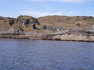
Lismore is an island of some 2,351 hectares in the Inner Hebrides of Scotland. The climate is damp and mild, with over 166 centimetres (65 in) of rain recorded annually. This fertile, low-lying island was once a major centre of Celtic Christianity, with a 6th-century monastery associated with Saint Moluag, and later became the seat of the medieval Bishop of Argyll. There are numerous ruined structures, including a broch and two 13th-century castles.

The Garvellachs or Isles of the Sea form a small archipelago in the Inner Hebrides of Scotland. The islands include Garbh Eileach, Dùn Chonnuill and Eileach an Naoimh. Part of the Argyll and Bute council area, they lie in Firth of Lorne west of Lunga and northwest of Scarba and have been uninhabited since the 19th century.
The Treshnish Isles are an archipelago of small islands and skerries, lying west of the Isle of Mull, in Scotland. They are part of the Inner Hebrides. Trips to the Treshnish Isles operate from Ulva Ferry, Tobermory, Ardnamurchan and Tiree.

Glenlivet is a glen in the Highlands of Scotland through which the River Livet flows.
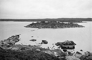
Garbh Eileach is an uninhabited island in the Inner Hebrides of the west coast of Scotland that lies in the Firth of Lorn between Mull and Argyll. With an area of 142 ha it is the largest of the Garvellachs and reaches a maximum elevation of 110 m (361 ft) above sea level.
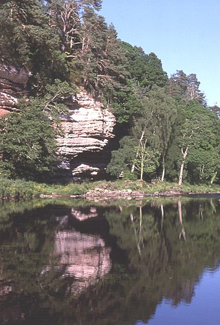
The River Findhorn is one of the longest rivers in Scotland. Located in the north east, it flows into the Moray Firth on the north coast. It has one of the largest non-firth estuaries in Scotland.
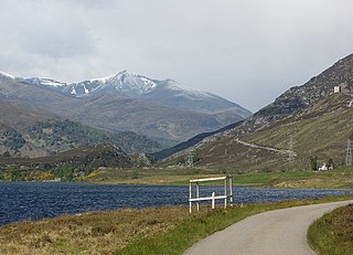
Glen Strathfarrar is a glen in the Highland region of Scotland, near Loch Ness.
Hermetray is an uninhabited island off North Uist, in the Outer Hebrides of Scotland.
Dùn Anlaimh, also known as Dùn Amhlaidh, and Eilean nan Cinneachan, is a crannog, located within Loch nan Cinneachan on the Inner Hebridean island of Coll. Upon the crannog there are the remains of walls and several buildings. These remains are not unlike those of other fortified islands found throughout the Outer Hebrides, and it is likely that Dùn Anlaimh dates from the late Middle Ages. According to local tradition on Coll, the fort was once the home of a Norse chieftain who was defeated in battle somewhere nearby. The early 20th century antiquary Erskine Beveridge considered it as one of the four most interesting fortifications, on Coll. The site of Dùn Anlaimh is located at grid reference NM18845684. The RCAHMS classifies the site as a 'crannog' and an 'island dwelling'.

Dùn an Achaidh, sometimes Anglicised as Dun Acha, is a dun located near the village of Acha on the Inner Hebridean island of Coll. It is considered the best preserved dun on the island. The site of Dùn an Achaidh is located at grid reference NM18335456. According to local tradition, the dun was the stronghold of, and named after, the son of a Norse king. The early 20th century antiquary Erskine Beveridge considered it as one of the four most interesting fortifications on Coll.

Dùn Dubh is a hillfort, located on the Inner Hebridean island of Coll. The fort is one of three associated with a local tradition which states that they were once the fortresses of Norsemen before being defeated by a Maclean chieftain. The early 20th century antiquary Erskine Beveridge considered it as one of the four most interesting fortifications, on Coll. The site is located at grid reference NM18365942.

Dùn Beic is a dun located on the Inner Hebridean island of Coll. It is located at grid reference NM15495644 and is thought to date to between 1000 BCE to 1000 CE. The etymology of the dun's name is uncertain; one possibility is that it could be made up of a personal name. The dun appears in local legend as being one of several fortresses held by Norsemen, who were defeated in battle against the ancestor of the Macleans of Coll. There have been several archaeological finds at Dùn Beic; these include pieces of flint, burnt bone, and fragments of incised pottery.
Dunira is an estate of about 350 hectares in Perthshire, Scotland, 3 miles northwest of Comrie and 25 mi (40 km) northwest of Stirling. The estate is set against a backdrop of mountains, hills and rich lush lowland. Dunira was the home of Henry Dundas, 1st Viscount Melville, although the house he built was replaced in the 19th century. The replacement house burned down in 1948, although the estate is still active.
William Ross was a Scottish writer of Romantic poetry in Scottish Gaelic from the Isle of Skye and a Church of Scotland parish schoolmaster, who is often referred to as, "The Bard of Gairloch." Although Ross, similarly to Alasdair Mac Mhaighstir Alasdair, has been referred to as, "the Robbie Burns of the Highlands", he also bears close parallels to his near contemporary John Keats. Similarly to Keats, more than two hundred years after dying of tuberculosis while still in his twenties, Ross remains a highly important and admired figure in Scottish Gaelic literature and is considered one of the greatest poets and writers in the history of the language.

Dunearn is a hill fort located 15 kilometres (9.3 mi) south south east of Nairn in Highland, Scotland. It is situated on a steep-sided hill called Doune rising to approximately 266 metres (873 ft) above ordnance datum just south of Dulsie Bridge in the parish of Ardclach.

Moniack Burn is a small river in the Highland council area of Scotland. The stream flows from the hills of the Aird, its source near the hamlet of Foxhole, passing the settlements of South Clunes, Easter, and Kirkhill before draining into the Beauly Firth.