Related Research Articles

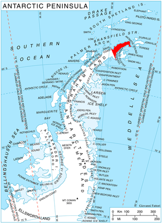
James Ross Island is a large island off the southeast side and near the northeastern extremity of the Antarctic Peninsula, from which it is separated by Prince Gustav Channel. Rising to 1,630 metres (5,350 ft), it is irregularly shaped and extends 64 km in a north–south direction. It was charted in October 1903 by the Swedish Antarctic Expedition under Otto Nordenskiöld, who named it for Sir James Clark Ross, the leader of a British expedition to this area in 1842 that discovered and roughly charted a number of points along the eastern side of the island. The style, "James" Ross Island is used to avoid confusion with the more widely known Ross Island in McMurdo Sound.
Quarles Range is a high and rugged range of the Queen Maud Mountains, extending from the polar plateau between Cooper Glacier and Bowman Glacier and terminating near the edge of Ross Ice Shelf.
The Mariner Glacier is a major glacier over 60 nautical miles long, descending southeast from the plateau of Victoria Land, Antarctica, between Mountaineer Range and Malta Plateau, and terminating at Lady Newnes Bay, Ross Sea, where it forms the floating Mariner Glacier Tongue.
Irving Island is a small island at the northeastern end of the Barcroft Islands, in the Biscoe Islands, Antarctica. It is situated 1.18 km east of St. Brigid Island and 1.9 km north of St. Isidore Island. The island was mapped from air photos taken by the Falkland Islands and Dependencies Aerial Survey Expedition (1956–57), and was named by the UK Antarctic Place-Names Committee for Laurence Irving, an American physiologist who has specialized in the effects of a polar environment.
Andreaea Plateau is a small plateau with an average elevation of 180 metres (590 ft), located southwest of Robin Peak, Signy Island, in the South Orkney Islands. The feature is notable for the largest known stand in the Antarctic of the black-brown moss Andreaea.
The Bender Mountains are a small group of mountains 4 nautical miles southwest of the Berry Peaks, between the southeast edge of the Ross Ice Shelf and the Watson Escarpment.
The Gothic Mountains is a group of mountains, 20 nautical miles long, in the Queen Maud Mountains of Antarctica, located west of Watson Escarpment and bounded by Scott Glacier, Albanus Glacier, and Griffith Glacier.

Boydell Glacier is a glacier on Trinity Peninsula in northern Graham Land. It is about 9 miles (14 km) long, flowing southeastward from Detroit Plateau to enter Sjögren Inlet in Prince Gustav Channel north of the terminus of Sjögren Glacier and 6 miles (10 km) west of Mount Wild. It was mapped by the Falkland Islands Dependencies Survey from surveys (1960–61), and named by the UK Antarctic Place-Names Committee for James Boydell, English inventor of a steam traction engine, the first practical track-laying vehicle.
Cauldron Pool is a hot, brackish steaming pond located east of Tow Bay and below the west slopes of volcanically active Lucifer Hill, in northwest Candlemas Island, South Sandwich Islands. The descriptive name, suggestive of a cauldron, was applied by the UK Antarctic Place-Names Committee in 1971.
Cook Rock is an arched rock, 45 metres (150 ft) high, lying close east of Trousers Rock and 0.3 nautical miles (0.6 km) northeast of Vindication Island in the South Sandwich Islands. It was charted in 1930 by Discovery Investigations personnel on the Discovery II and named for Captain James Cook.

Noble Glacier is a small glacier lying just north of Flagstaff Glacier on the east side of Keller Peninsula, King George Island, in the South Shetland Islands. Named by the United Kingdom Antarctic Place-Names Committee (UK-APC) in 1960 for Hugh M. Noble of Falkland Islands Dependencies Survey (FIDS), glaciologist at Admiralty Bay in 1957, who made detailed studies of the regime of Flagstaff and Stenhouse Glacier.
Mount Perseus is the lower and more northerly of twin ice domes in the east part of Candlemas Island, South Sandwich Islands. Named by United Kingdom Antarctic Place-Names Committee (UK-APC) in 1971 in association with nearby Mount Andromeda. In Greek mythology, Perseus married Andromeda after rescuing her from a sea monster.
Gorgon Pool is a lake, or perhaps lagoon, between the Chimaera Flats and Kraken Cove in Candlemas Island, South Sandwich Islands. It was named by the UK Antarctic Place-Names Committee in association with nearby Medusa Pool. The Gorgon is a mythical creature of Homer's Iliad, linked in other mythology with Medusa.
Lucifer Hill is a reddish, cindery, sulphur-streaked hill forming the summit of the northern section of Candlemas Island in the South Sandwich Islands. It was one of the most active volcanic vents in this island chain at the time of HMS Protector's survey in 1964. The name applied by the UK Antarctic Place-Names Committee after Lucifer refers to the diabolical and infernal mythical association of active volcanoes. Clinker Gulch extends from Lucifer Hill to the northern shore of Candlemas.
Medusa Pool is a tidal lagoon that occupies the west side of the central lowlands of Candlemas Island in the South Sandwich Islands. The name, given by the UK Antarctic Place-Names Committee in 1971, is associated in classical mythology with the geomorphologically similar Gorgon Pool, nearby, Medusa being one of the gorgons.
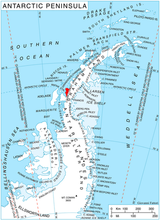
Mount Machatschek is a prominent, mainly snow-covered mountain in northern Adelaide Island, Antarctica, about 14 nautical miles (26 km) southwest of Mount Velain. It was mapped from air photos taken by the Ronne Antarctic Research Expedition (1947–48) and the Falkland Islands and Dependencies Aerial Survey Expedition (1956–57), and was named by the UK Antarctic Place-Names Committee after Austrian geomorphologist Fritz Machatschek (1876–1957), who was the joint author with Erich von Drygalski of Gletscherkunde, 1942.

Sölch Glacier is a glacier on the Pernik Peninsula of the Loubet Coast in Graham Land, flowing west to Salmon Cove just north of Kanchov Peak on the east side of Lallemand Fjord. It was mapped from air photos taken by the Falkland Islands and Dependencies Aerial Survey Expedition, 1956–57, and named by United Kingdom Antarctic Place-Names Committee for Johann Sölch (1883–1951), an Austrian glacial geologist and glaciologist.
References
 This article incorporates public domain material from "Breakbones Plateau". Geographic Names Information System . United States Geological Survey.
57°4′S26°41′W / 57.067°S 26.683°W