
Carrick-on-Shannon is the county town of County Leitrim in Ireland. It is the largest town in the county of Leitrim and the smallest county town in the entire country. A smaller part of the town lies in County Roscommon. The population of the town was 4,062 in 2016. It is situated on a strategic crossing point of the River Shannon. The Leitrim part of the town is in the civil parish of Kiltoghert which is in the ancient barony of Leitrim.

Mohill is a town in County Leitrim, Ireland. The town of Carrick-on-Shannon is approximately 16 km (10 miles) away.

Roosky, Ruskey, or Rooskey is a village on the River Shannon in the northern midlands of Ireland, near the point where counties Leitrim, Longford, and Roscommon meet. The N4 road from Dublin to Sligo passes by the Leitrim side of the village.

Dowra is a village in northwest County Cavan, Ireland. Located in a valley on Lough Allen, it is the first village on, and marks the most uppermost navigable point of, the River Shannon. On one side of its bridge is County Cavan; on the other is County Leitrim. The nucleus of the village is situated on the Cavan side. It is located on the junction of the R200 and R207 regional roads.
Gorvagh is a townland in County Leitrim, Ireland. It is located at 53°58′49.01″N07°51′25.99″W, about 4 miles (6.4 km) from Mohill and 6 miles (9.7 km) from Ballinamore. It belongs to the barony and parish of Mohill with St. Josephs church situated on a hill overlooking the main Mohill Ballinamore road (R202) which traverses the area.
Oldthort or Oultort is a townland near Portumna, County Galway, Ireland, mainly along the Tynagh Road. Oultort townland has an area of 1.86 square kilometres (0.72 sq mi), and had a population of 70 people as of the 2011 census.

Dristernan is a small townland in County Leitrim, Ireland. It has an area of approximately 0.5 square kilometres (0.2 sq mi), and had a population of 15 people as of the 2011 census.

Eslinbridge, also written Eslin Bridge, is a settlement in Mohill parish in County Leitrim at the crossroads of L3444 and L3447. Here, the L3444 road crosses Eslin River on a bridge.

Cogaula is a townland in the civil parish of Islandeady, County Mayo, Ireland. The townland has an area of approximately 1.5 square kilometres (0.6 sq mi), and had a population of 74 people as of the 2011 census.
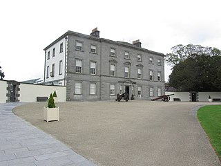
Oldbridge is a townland near Drogheda in County Meath, Ireland. The area is home to the Boyne Navigation, the Battle of the Boyne Interpretive Centre and the southern half of the Mary McAleese Boyne Valley Bridge.
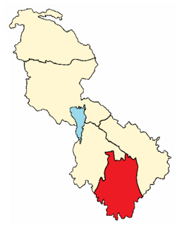
The barony of Mohill is an ancient barony in County Leitrim, Republic of Ireland.
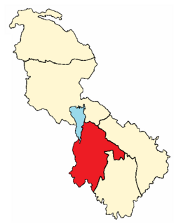
The baronly of Leitrim is a barony in County Leitrim, Republic of Ireland.
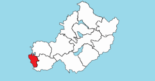
Brawny is a barony in south–west County Westmeath, Ireland. It was formed by 1672. It is bordered by County Roscommon to the west. It also borders two other Westmeath baronies: Kilkenny West and Clonlonan. The largest centre of population in the barony is the town of Athlone.

Lough Marrave is a small freshwater lake in county Leitrim in the northwest of Ireland.
TullyOran is a townland nearby Mohill town, county Leitrim, in Ireland. Tullyoran Court Tomb is an ancient megalithic tomb located here.

Lough Conway is a very small freshwater lake in northwest Ireland.
Leitrim is a barony in Ireland that lies partly in County Galway and partly in County Clare. It is located in the extreme south-east of County Galway and the north-East of County Clare. Under the Local Government (Ireland) Act 1898, part of the barony was transferred from Galway to the administrative county of Clare. Leitrim is bounded, clockwise from the southwest, by the Clare baronies of Tulla Upper and Tulla Lower; the Galway baronies of Loughrea to the west, Kilconnell to the north, and Longford to the east; and by Lough Derg to the south and southeast. It measures 20 miles (32 km) from north to south and 9.5 miles (15.3 km) from east to west.

Carlanstown is a village and townland in County Meath, Ireland. It is located approximately 4 km northeast of the larger town of Kells, County Meath on the N52 road. As of the 2016 census, there were 664 people living in the village.
Farthingstown is a townland in County Westmeath, Ireland. The townland is located on the border with County Offaly and is in the civil parish of Castlelost. The M6 Motorway runs through the middle, with a junction linking up with the R400 regional road. The Monagh River flows through the south of the area. The town of Rochfortbridge is to the north.
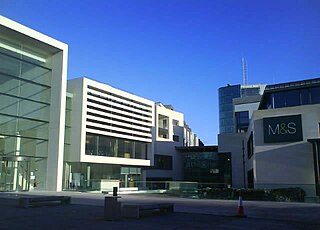
Athlone is the name given to two bordering townlands in County Westmeath, Ireland. The townlands are in the civil parish of St. Mary's.


