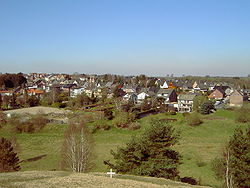
Overview
The L12 country road passes through the centre of Breinigerberg and links it to Breinig to the west and the crossing of Nachtigaellchen to the east, which in turn is west of Mausbach.
To the east of Breinigerberg is the forest of Stolberg (part of the North Eifel Nature Park) and the Schlangenberg Nature Reserve which is famous for its calamine flora. The hill of Schlangenberg is 276 metres above sea level and originates in the former ore mine of Breinigerberg. Names like Bleiweg, which means "Way of lead", even today, give hints to the history of the village. The calamine from the ore mine Breinigerberg was used exclusively in Stolberg for the production of brass.
The history of Breinigerberg can be traced back to the Romans. Twenty five coins dated between 100 BC and the year 92/93 AD as well as remains of a Roman craftsmen settlement had been found in the village. The buildings show that the ancient Romans worked between 100 and 400 AD in this Breinigerberg region.
In the former primary school which was closed in 1988 an information centre on the Schlangenberg nature reserve has been opened by the Eifel- und Heimatverein Breinig. It is open to the public and presents detailed information on the special flora and fauna of the Schlangenberg region. Historical tools used in the ore mines of Breinigerberg are exhibited as well.
To the north and south of Breinigerberg there are further nature reserves like the Brockenberg or Baerenstein. Most of them are former chalk pits.
Breinigerberg has two sports grounds used by the local football team FC. Breinigerberg. The former primary school is also used as a youth centre (Remember).
One of the major events at Breinigerberg is the funfair one week after Pentecost.

Calamine is a historic name for an ore of zinc. The name calamine was derived from lapis calaminaris, a Latin corruption of Greek cadmia (καδμία), the old name for zinc ores in general. The name of the Belgian town of Kelmis, La Calamine in French, which was home to a zinc mine, comes from this. In the 18th and 19th centuries large ore mines could be found near the German village of Breinigerberg.
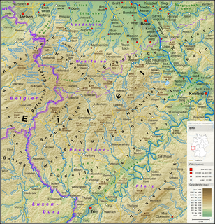
The Eifel is a low mountain range in western Germany and eastern Belgium. It occupies parts of southwestern North Rhine-Westphalia, northwestern Rhineland-Palatinate and the southern area of the German-speaking Community of Belgium.

The Ore Mountains or Ore Mountain Range in Central Europe have formed a natural border between Bohemia and Saxony for around 800 years, from the 12th to the 20th centuries. Today, the Czech Republic–Germany border runs just north of the main crest of the mountain range. The highest peaks are the Klínovec in the Czech Republic, which rises to 1,244 metres (4,081 ft) above sea level and the Fichtelberg in Germany.
The Hunsrück is a long, triangular, pronounced upland in Rhineland-Palatinate, Germany. It is bounded by the valleys of the Moselle-Saar (north-to-west), the Nahe (south), and the Rhine (east). It is continued by the Taunus mountains, past the Rhine and by the Eifel past the Moselle. To the south of the Nahe is a lower, hilly country forming the near bulk of the Palatinate region and all of the, smaller, Saarland. Below its north-east corner is Koblenz.

Ahr is a river in Germany, a left tributary of the Rhine. Its source is at an elevation of approximately 470 metres (1,540 ft) above sea level in Blankenheim in the Eifel, in the cellar of a timber-frame house near the castle of Blankenheim. After 18 kilometres (11 mi) it crosses from North Rhine-Westphalia into Rhineland-Palatinate.
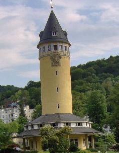
Bad Ems is a town in Rheinland Pfalz, Germany. It is the administrative seat of the Rhein-Lahn rural district and is well known as a spa on the river Lahn. Bad Ems is the seat of the Verbandsgemeinde Bad Ems-Nassau. The town has around 9,000 inhabitants.

Stolberg is a town in North Rhine-Westphalia, Germany. It has a long history as an industrial town and belongs to the district Aachen and the lower district court of Eschweiler.
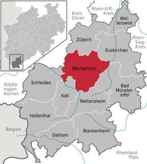
Mechernich is a town in the district of Euskirchen in the south of the state of North Rhine-Westphalia, Germany. It is located in the "Naturpark Nordeifel" in the Eifel hills, approx. 15 km south-west of Euskirchen and 55 km from Cologne. Mechernich is a former mining town and had, in 2009, its 700-years celebration of foundation. Its local football club is called TUS Mechernich.
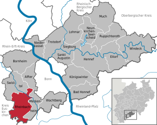
Rheinbach is a town in the Rhein-Sieg-Kreis district (Landkreis), in North Rhine-Westphalia, Germany. It belongs to the administrative district (Regierungsbezirk) of Cologne.
Fichtelberg is a municipality in the district of Bayreuth in Bavaria in Germany. It is a state-recognised climatic spa.

Veldenz is an Ortsgemeinde – a municipality belonging to a Verbandsgemeinde, a kind of collective municipality – in the Bernkastel-Wittlich district in Rhineland-Palatinate, Germany. It is the former main seat of the County of Veldenz, once a prominent principality to which belonged 120 villages and towns now in Rhineland-Palatinate and northern Alsace and Lorraine.
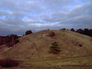
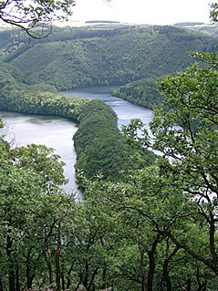
The nature reserve of Schlangenberg which means snake-mountain is located in the west of Germany close to the Dutch and Belgian border. The reserve is near the village Breinigerberg, 15 kilometres from Aachen or 7 kilometres distant from the city of Stolberg (Rhineland). Schlangenberg itself is a small hill peaking 276 m above sea level.

Kupferhof Bauschenberg was one of many brass producing factories built in the 17th century in the German city of Stolberg. Bauschenberg, the name of a small hill, gave the factory its name.

Büsbach is the largest of 17 districts and villages belonging to the German town of Stolberg (Rhineland).
The Eifel National Park is the 14th national park in Germany and the first in North Rhine-Westphalia. The park was founded in 2004, and is classified as a "national park in development".

The Volcano Park in Mayen-Koblenz is a geopark in the rural district of Mayen-Koblenz in the eastern Vulkan Eifel, Germany. It was founded in 1996 and wraps around the Laacher See. Together with the Volcano Park, Brohltal/Laacher See and the Vulkan Eifel Nature and Geo-Park, it forms part of the national Eifel Volcano Land Geo-Park. The three parks are connected by the 280-kilometre-long German Volcano Route.
Kornelimünster is a town in the rural Münsterländchen area of Kornelimünster/Walheim, a district of Aachen, Germany.

Madan-e Nakhlak is a village in Chupanan Rural District, Anarak District, Nain County, Isfahan Province, Iran. At the 2006 census, its population was 55, in 52 families.
Stolberg Zinc joint-stock company for mining and smelter operations in Aachen, or Stolberg Zinc Mines GmbH, is a metal mining concern in the Aachen region and specifically in the area of Eschweiler-Stolberg, with headquarters in Stolberg.

The Calmont, also called the Calmond, between Bremm and Ediger-Eller in the county of Cochem-Zell in the German state of Rhineland-Palatinate, is a steep hill on the heights above the Moselle river to a height of 380.6 m above sea level (NHN). It lies within the Moselle wine region and is home to the vineyards of Bremmer Calmont and Ellerer Calmont which, with gradients of up to over 65º, are among the steepest vineyards in the world.