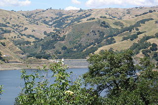
Calaveras Reservoir is located primarily in Santa Clara County, California, with a small portion and its dam in Alameda County, California. In Spanish, Calaveras means "skulls".

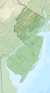
The Manasquan River is a 26.5-mile-long (42.6 km) waterway in central New Jersey.

The Mokelumne River is a 95-mile (153 km)-long river in northern California in the United States. The river flows west from a rugged portion of the central Sierra Nevada into the Central Valley and ultimately the Sacramento–San Joaquin River Delta, where it empties into the San Joaquin River-Stockton Deepwater Shipping Channel. Together with its main tributary, the Cosumnes River, the Mokelumne drains 2,143 square miles (5,550 km2) in parts of five California counties. Measured to its farthest source at the head of the North Fork, the river stretches for 157 miles (253 km).

Prettyboy Reservoir is a 1,500-acre (610 ha) reservoir in the Hereford Zone of northern Baltimore County, Maryland. While the reservoir is in Baltimore County, the independent city of Baltimore owns the reservoir and the surrounding land. The reservoir is one of three reservoirs created to supply the municipal water system for Baltimore City, Baltimore County, and northern Anne Arundel County constructed by the Baltimore City Department of Public Works. Prettyboy Reservoir, along with Loch Raven Reservoir further down the Big Gunpowder Falls, provide about 61% of the drinking water for the Baltimore metropolitan area system; for this reason, the Prettyboy is considered a "source water" or drinking water watershed. The reservoir contains about 19 billion US gallons (72,000,000 m3) of water on average.

A combination of aqueducts, reservoirs, and tunnels supplies fresh water to New York City. With three major water systems stretching up to 125 miles (201 km) away from the city, its water supply system is one of the most extensive municipal water systems in the world.
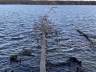
The Manasquan Reservoir is a source of water for municipalities and utilities, as well as a 1,204-acre (4.87 km2) park, located in Howell Township, in Monmouth County, New Jersey, United States. The reservoir doubles as a park that is part of the Monmouth County Park System. The park has trails, a visitor's center, a nature/environmental center, a boat launching area and several dikes for fishing, among its facilities. The reservoir itself, which is dammed from the Manasquan River, is operated by the New Jersey Water Supply Authority, which is a part of the much larger Raritan Basin Watershed. The nature trails circling around the reservoir are what makes this county park as one of the most popular hiking destinations in Central New Jersey, as the park receives over one million visitors a year. It is reachable by car and there are five parking lots, including one for vehicles hauling trailers. The park's trails are open to walkers, runners, hikers, bicyclists and equestrians.
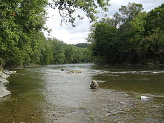
Fishing Creek is a 29.98-mile (48.25 km) long tributary of the Susquehanna River in Columbia County, Pennsylvania, in the United States. It joins the Susquehanna River near the census-designated place of Rupert and the town of Bloomsburg. The watershed has an area of 385 square miles (1,000 km2).
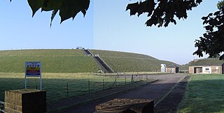
The Queen Elizabeth II Reservoir lies to the south of the River Thames and to the west of the Island Barn Reservoir. To the north are the Bessborough and Knight reservoirs. The A3050 runs to the north of the reservoir and it is situated in Walton on Thames. It is managed by Thames Water.
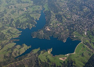
Briones Reservoir is an open cut terminal water storage reservoir located in western Contra Costa County, in the East Bay region of the San Francisco Bay Area, California.

The Los Vaqueros Reservoir and watershed is located in the northern Diablo Range, within northeastern Contra Costa County, northern California. It was completed by the Contra Costa Water District (CCWD) in 1998 to improve the quality of drinking water for its 550,000 customers in Central and Eastern Contra Costa County. The reservoir is accessible via Vasco Road, a road which connects Brentwood and Livermore.

The Hackensack Water Company Complex is a set of historic buildings in Weehawken, New Jersey, registered in the U.S. National Register of Historic Places. The Hackensack Water Company, a predecessor of Suez North America, developed water supply and storage in northeastern New Jersey from the 1870s to the 1970s, initially to provide service to the city of Hackensack and the towns of North Hudson. Originally its headquarters and major facilities were located at Hackensack, in Bergen County. Under Robert W. de Forest, who ran the Hackensack Water Company for 46 years beginning in 1881, the company constructed new facilities and moved its headquarters to Weehawken in Hudson County, setting up offices in a brick water tower, part of the present complex.

California's interconnected water system serves almost 40 million people and irrigates over 5,680,000 acres (2,300,000 ha) of farmland. As the world's largest, most productive, and potentially most controversial water system, it manages over 40 million acre-feet (49 km3) of water per year. Use of available water averages 50% environmental, 40% agricultural and 10% urban, though this varies considerably by region and between wet and dry years. In wet years, "environmental" water averages 61%, while in dry years it averages 41%, and can be even lower in critically dry years.
The Lipari Landill is an inactive landfill on a 6-acre (2.4 ha) former gravel pit in Mantua Township, New Jersey. It was used from 1958 to 1971 as a dump site for household and industrial wastes. Toxic organic compounds and heavy metals dumped at the site have percolated into the ground water and leached into lakes and streams in the surrounding area. The site has been identified as the worst toxic dump in the United States and was ranked at the top of the United States Environmental Protection Agency's Superfund eligibility list.

Lake Chesdin is a lake in south-central Virginia, on the border of Chesterfield County and Dinwiddie County and going upstream into Amelia County. It provides water and power to the region. It is also a popular fishing area and is known to have great opportunities for largemouth bass. It is also known to have populations of crappie, bluegill, walleye, striped bass, channel catfish, gizzard shad and white perch.
Beaver Run Reservoir is a reservoir in Westmoreland County in the U.S. state of Pennsylvania, 23 miles (37 km) east of Pittsburgh. The elevation of Beaver Run Reservoir is 1,053 feet (321 m) above sea level.
The Marin Municipal Water District (MMWD) is the government agency that provides drinking water to southern and central Marin County, California. Chartered in 1912, it became California's first municipal water district. It serves 191,000 customers in a 147-square-mile (380 km2) area that includes ten towns and cities.

The British Engineerium is an engineering and steam power museum in Hove, East Sussex. It is housed in the Goldstone Pumping Station, a set of High Victorian Gothic buildings started in 1866. The Goldstone Pumping Station supplied water to the local area for more than a century before it was converted to its present use. The site has been closed to the public since 2006, and in March 2018 the entire complex was put up for sale.
Slab Creek Dam is a dam in the American River watershed of the central Sierra Nevada, within El Dorado County, California.

Griffy Reservoir, commonly known as Lake Griffy, is a reservoir in the city of Bloomington, Indiana. Created by a dam on Griffy Creek in the 1920s, the reservoir used to serve as the main source of drinking water for Bloomington for several decades, until that role was taken over by the larger Lake Lemon and Lake Monroe in the 1950s.

