
100 Mile House is a district municipality located in the South Cariboo region of central British Columbia, Canada.
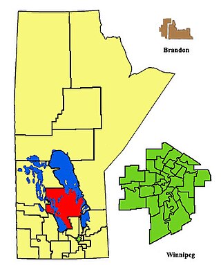
Interlake was a provincial electoral division in the Canadian province of Manitoba. It was created by redistribution in 1979, and has formally existed since the 1981 provincial election. Previously, much of the Interlake region was included in the constituency of St. George. As its name implies, Interlake was located between Lake Winnipeg and Lake Manitoba, in the mid-northern section of the province.

Gimli was a provincial electoral division in the Canadian province of Manitoba. It was created by redistribution in 1899, and existed continuously until the 2019 election. Following this, it was redistributed into the Interlake-Gimli electoral district.

Selkirk—Interlake—Eastman is a federal electoral district in Manitoba, Canada, that has been represented in the House of Commons of Canada from 1976 to 1987, and since 1997.
The Rural Municipality of Bifrost is a former rural municipality (RM) in the Canadian province of Manitoba.

The Interlake Region is an informal geographic region of the Canadian province of Manitoba that lies roughly between Lake Winnipeg and Lake Manitoba in the Canadian province of Manitoba.
Bridge Lake Provincial Park is a provincial park in British Columbia, Canada. It is located at the eastern end of the lake of the same name, adjacent to the community of the same name, which is the largest community on the Interlakes Highway. It was established in 1956, and a merge with the nearby Bridge Lake Centennial Park in 2004 and another expansion in 2013 brought the park to its current size.

Stonewall is a town in the Canadian province of Manitoba with a population of 5,046 as of the 2021 census. The town is situated approximately 25 kilometres (16 mi) north of Winnipeg on PTH 67. It is known for its limestone quarries. The local festival is the Quarry Days which is usually held over three days in August on Main Street. The town is surrounded by the R.M. of Rockwood.

Teulon is a town located approximately 59 kilometres north of Winnipeg, Manitoba, Canada, on Provincial Trunk Highway 7. Located between Stonewall and Gimli, Teulon is commonly referred to as "The Gateway to the Interlake". Teulon is surrounded by the Rural Municipality of Rockwood.

The Village of Dunnottar is a village in the Canadian province of Manitoba. As part of the Interlake and Metro regions, the municipality is located on the shores of Lake Winnipeg, just off Highway 9, south of Winnipeg Beach.
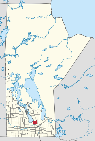
Woodlands is a rural municipality (RM) in the province of Manitoba in Western Canada. It lies in the southern part of the Interlake and is named for the community of Woodlands, which itself is named for the wooded lands of the area.
Dauphin River First Nation is an Ojibway First Nation band government in Manitoba, Canada. Its landbase is the Dauphin River First Nation Reserve 48A, located at the outlet of the Dauphin River into Lake Winnipeg. The largest city nearest this community is Winnipeg located approximately 250 km (155 mi) to the southeast.

The Interlakes, also known as the Interlakes District, is a geographic region of the Interior of British Columbia, Canada, located along and around the Interlakes Highway between 100 Mile House on BC Highway 97 and Little Fort on the North Thompson River. The area is a subregion of the Cariboo and includes the communities of Bridge Lake and Lac des Roches.
Bridge Lake is a lake in the Interlakes District of the South Cariboo region of the Interior of British Columbia, Canada. It is the source of Bridge Creek which runs in a curving course west and then northeast to Canim Lake via the town of 100 Mile House. The lake is approximately 16 km2 in area (including the area of several islands and rocks in the lake, the largest of which is named Long Island and is 1136 m in elevation. It is located 560 km north of Vancouver and around 140 km northwest of Kamloops in the Interlakes District close to the Little Fort Highway. It and its neighbours Sheridan Lake and Lac des Roches are the largest lakes along the Interlakes Highway.
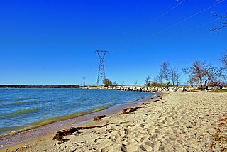
The Narrows is an unincorporated community in the Interlake region of Manitoba, Canada, situated on the northern part of Lake Manitoba within the Municipality of West Interlake.

Gimli is an unincorporated community in the Rural Municipality of Gimli on the west side of Lake Winnipeg in Manitoba, Canada.
Interlake-Eastern Regional Health Authority is the governing body responsible for healthcare delivery and regulation for the Interlake and eastern regions of Manitoba.

The Municipality of Bifrost-Riverton is a rural municipality (RM) in the Canadian province of Manitoba, and is one of the northernmost rural municipalities in the Interlake Region.
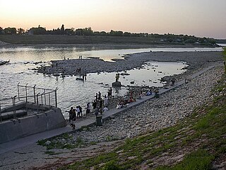
Lockport Provincial Park is a Manitoba provincial park on the east shore of the Red River in the community of Lockport, Manitoba. It is 2.26 ha in size.
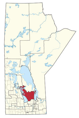
Interlake-Gimli is a provincial electoral district in the Interlake region of Manitoba.


