
Bridgeford
Location of Bridgeford in Saskatchewan
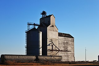
Bridgeford is an unincorporated community in Saskatchewan at the intersection of Highway 19 and Highway 367. It is south of Lake Diefenbaker, the Qu'Appelle River Dam and Douglas Provincial Park.
Bridgeford is an unincorporated community in Saskatchewan at the intersection of Highway 19 and Highway 367. It is south of Lake Diefenbaker, the Qu'Appelle River Dam and Douglas Provincial Park.
The community had a post office from 1909 to 1973. It was originally named West Bridgeford, after West Bridgford, Nottinghamshire, home town of early settlers. When the Canadian Pacific Railway built a station in the area, they shortened the name. [1]
Places adjacent to Bridgeford, Saskatchewan | |
|---|---|
Chaplin is a village in the Canadian province of Saskatchewan within the Rural Municipality of Chaplin No. 164 and Census Division No. 7. The community is situated on the Trans-Canada Highway approximately 85 km from Moose Jaw and 90 km from Swift Current. The main industries of Chaplin are Saskatchewan Minerals and farming/ranching. Chaplin consists of eight streets, two crescents, and four avenues.
Highway 367 is a provincial highway in the Canadian province of Saskatchewan. It runs from Highway 42 near Eyebrow to Highway 19 near Bridgeford. It is about 24 kilometres (15 mi) long.

The Blairmore Suburban Centre is a community service/commercial/residential community currently under development in western Saskatoon, Saskatchewan. It is part of the city's Blairmore Suburban Development Area, a large region annexed from the Rural Municipality of Corman Park No. 344 in 2005. Ultimately, the SDA will consist of seven new neighbourhoods, plus the Blairmore Suburban Centre, which is the first component of the SDA to be developed.
Coderre ) is a village in the Canadian province of Saskatchewan within the Rural Municipality of Rodgers No. 133 and Census Division No. 7. The village is located approximately 85 km southwest of the City of Moose Jaw on Highway 627.
Brownlee is a village in the Canadian province of Saskatchewan within the Rural Municipality of Eyebrow No. 193 and Census Division No. 7. The village is located approximately 58 km northwest of the City of Moose Jaw on Highway 42.

Eyebrow is a village in the Canadian province of Saskatchewan within the Rural Municipality of Eyebrow No. 193 and Census Division No. 7. The community originated at the location that is now the abandoned community of Eskbank several kilometres to the south. Eyebrow is located at the intersection of Highway 367 and Highway 42; 84 km northwest of Moose Jaw, 154 km northwest of Regina and 196 km south of Saskatoon.
Ernfold is a village in the Canadian province of Saskatchewan within the Rural Municipality of Morse No. 165 and Census Division No. 7. Initially situated alongside the original two-lane highway, the village was enclosed by the opposing lanes of the divided Trans-Canada Highway in 1973. In order to avoid complete destruction of the village the eastbound lane of the Trans-Canada Highway was rerouted approximately 3 km south of the village, leaving the village sandwiched between the Trans-Canada.

Mortlach is a village in the Canadian province of Saskatchewan within the Rural Municipality of Wheatlands No. 163 and Census Division No. 7. The village is on the Trans Canada Highway about 40 km west of the City of Moose Jaw. Thunder Creek passes the community to the north where it is joined by Sandy Creek. Mortlach became a village on April 19, 1906, and is one of two towns in Saskatchewan to have been incorporated as a town to then be reverted to village status on January 1, 1949; the other is the village of Alsask.
Parkbeg is a hamlet in Wheatlands Rural Municipality No. 163, Saskatchewan, Canada. The hamlet is located at the junction of Highway 1 and Highway 627 approximately 58 km directly west of the City of Moose Jaw on the Trans Canada Highway.
St. Boswells is a hamlet in Glen Bain Rural Municipality No. 105, Saskatchewan, Canada. The hamlet is about 8 km east of Highway 19, and about 25 km northwest of the town of Gravelbourg. Very little remains of the former village except a well known as the best water around, and sidewalks which mark the once prosperous business section of St. Boswells.
Tugaske is a village in the Canadian province of Saskatchewan within the Rural Municipality of Huron No. 223 and Census Division No. 7. It is nicknamed Gateway to Lake Diefenbaker. It is near Eyebrow Lake, a prairie lake in the Qu'Appelle Valley. It was named after an eyebrow-shaped hill also in the Qu'Appelle Valley above Eyebrow Lake. The lake, which is 9 km long and 1 km wide, is a bird sanctuary and is near Highway 627.

Pinehouse is a northern village located in the boreal forest of Saskatchewan on the western shore of Pinehouse Lake within the Canadian Shield.
Mawer is a locality in the Rural Municipality of Eyebrow No. 193, Saskatchewan, Canada. It previously held the status of village until December 31, 1967. The community is located about 5 km (3.1 mi) south of Highway 42 on Range Road 35, approximately 10 km (6.2 mi) southeast of Central Butte. It is located on the former Grand Trunk Pacific rail line.
Handsworth is a hamlet in Golden West Rural Municipality 95, Saskatchewan, Canada. The hamlet is located about 20 km east of the town of Creelman on Highway 701, along a former Canadian Pacific Railway branch line.

Lake Valley is an unincorporated community in the Rural Municipality of Eyebrow No. 193, Saskatchewan, Canada. The community is located about 10 km (6.2 mi) south of Highway 42 on Range Road 11, approximately 40 km (25 mi) northwest of the City of Moose Jaw. It is located on a former Canadian Pacific Railway line from Moose Jaw to Riverhurst.
Eskbank is an unincorporated community in the Rural Municipality of Eyebrow No. 193, Saskatchewan, Canada. The community is located about 15 km (9.3 mi) south of Highway 42 on Range Road 20, approximately 50 km (31 mi) northwest of the City of Moose Jaw. It is located on the former Grand Trunk Pacific Central Butte Subdivision from Moose Jaw to Riverhurst.
Lawson is a hamlet in Maple Bush Rural Municipality No. 224, Saskatchewan, Canada. It previously held the status of village until December 31, 1985. The hamlet is located 12 km north-west of the Town of Central Butte on highway 42 along the now defunct Canadian Pacific Railway subdivision.
Darmody is an unincorporated community in Eyebrow Rural Municipality No. 193, Saskatchewan, Canada. It previously held the status of a village until December 31, 1967. Darmody is located 87 km (54 mi) northwest of the City of Moose Jaw on highway 627.
Calderbank is a hamlet in the Canadian province of Saskatchewan located in Morse No. 165.
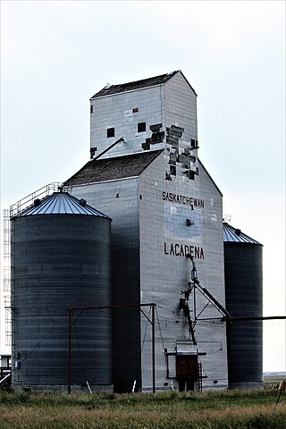
Lacadena is an unincorporated community in Lacadena Rural Municipality No. 228, Saskatchewan, Canada. The hamlet is located approximately 106 miles (171 km) northwest of Swift Current 29 miles (47 km) west of highway 4 on highway 342.
50°56′19″N106°25′19″W / 50.93861°N 106.42194°W
| | This Saskatchewan location article is a stub. You can help Wikipedia by expanding it. |