
Totnes is a market town and civil parish at the head of the estuary of the River Dart in Devon, England, within the South Devon Area of Outstanding Natural Beauty. It is about 5 miles (8.0 km) west of Paignton, about 7 miles (11 km) west-southwest of Torquay and about 20 miles (32 km) east-northeast of Plymouth. It is the administrative centre of the South Hams District Council.

The River Plym is a river in Devon, England. It runs from Dartmoor in the centre of the county southwest to meet the River Meavy, then south towards Plymouth Sound. The river is popular with canoeists, and the Plym Valley Railway runs alongside a section of the river.

South Hams is a local government district on the south coast of Devon, England. Its council is based in the town of Totnes, although the largest town is Ivybridge. The district also contains the towns of Dartmouth, Kingsbridge and Salcombe and numerous villages and surrounding rural areas.

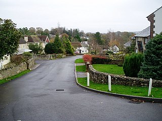
Combe is a small village in the county of Devon, England. It lies on the River Mardle about 2 miles north west of the town of Buckfastleigh.

Combe Raleigh is a village and civil parish in the county of Devon, England. The village lies about 1.5 miles north of the town of Honiton, and the parish is surrounded, clockwise from the north, by the parishes of Luppitt, Honiton, Awliscombe and Dunkeswell.

Totnes was a parliamentary constituency in Devon represented in the House of Commons of the UK Parliament.
Eype Mouth is a natural break in a line of sea cliffs on the Jurassic Coast World Heritage Site in west Dorset on the south coast of England. The small River Eype drains into the sea at this point. Eype means 'a steep place' in Old English. The village of Eype lies just upstream of the rivermouth, which is reached by a single narrow lane which runs down through Lower Eype to a shingle beach with car park.
All Saints is a civil parish in East Devon, Devon, England. It has a population of 498 according to the 2001 census. The parish includes the hamlets of All Saints, Smallridge, Churchill, Alston and Waggs Plot. This area also has one cricket pitch, a primary school, pre-school and a church.
Bridgetown may also refer to:

Broadwoodkelly is a village and civil parish in the West Devon district of Devon, England. According to the 2001 census it had a population of 218. The village is situated about 9 miles (14 km) north of Okehampton.

Buckland in the Moor is a village and civil parish in the Teignbridge district of Devon, England. According to the 2001 census it had a population of 94. The village is in Dartmoor.

Mawnan is a village and civil parish in south Cornwall, England, United Kingdom. It is in the former administrative district of Kerrier and is bounded to the south by the Helford River, to the east by the sea, and to the west by Constantine parish. The population was 1,454 in the 2001 census, rising slightly to 1,476 at the 2011 census. The church town of the parish is Mawnan Church, also known simply as Mawnan, and the only large village in the parish is Mawnan Smith, approximately three miles south of Falmouth.

Ashburton railway station is a closed railway station situated in the town of Ashburton in Devon, England. It was the terminus of a branch line from Totnes.

Frogmore is a village in the civil parish of Frogmore and Sherford in the South Hams district of the county of Devon, England.

The River Ottery is a small river in northeast Cornwall, England, United Kingdom. The river is about twenty miles (32 km) long from its source southeast of Otterham to its confluence with the River Tamar at Nether Bridge, two miles (3.2 km) northeast of Launceston.
Totnes Trinitarian Priory, also known as the Trinitarian hospital of Warland was a medieval monastic house in the town of Totnes in Devon, England. It was founded in 1271, and dissolved in 1509.
Dean Prior is a village and civil parish near the A38 road, in the South Hams district, in the county of Devon, England. It is located near the town of Buckfastleigh and north of South Brent.

Bowcombe Creek is a tidal creek in Kingsbridge, Devon, England. It is the most northerly creek of the Kingsbridge Estuary. The creek is fed by a stream to the north and is located one mile south-east of Kingsbridge.
Aller Park was a village in Devon, England, southeast of the town of Newton Abbot. The name is shared with the Aller Brook, which joins the River Teign at Newton Abbot.

Totnes Community Hospitalis a health facility on Coronation Road in Totnes, Devon, England. It is managed by Torbay and South Devon NHS Foundation Trust.

