Sopwell Priory was built c. 1140 in Hertfordshire, England by the Benedictine abbot of St Albans Abbey, Geoffrey de Gorham. It was founded as the Priory of St Mary of Sopwell and was a cell of St Albans Abbey.
Wallingford Priory was a Benedictine priory dedicated to the Holy Trinity in Wallingford in the English county of Berkshire.
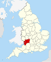
Brimpsfield Castle was a castle in the village of Brimpsfield in the county of Gloucestershire, England, between Gloucester and Cirencester.

Hurley Priory is a former Benedictine priory in the village of Hurley on the banks of the River Thames in the English county of Berkshire.

Winchester Cathedral Priory was a cathedral monastery attached to Winchester Cathedral, providing the clergy for the church. Cenwealh son of Cynegils is credited with constructing the Old Minster of Winchester in the 640s, and a new bishopric was created in the 660s with Wine as the first bishop. Although attacked by the Vikings in 860 and 879, the monastery survived and recovered.
Stratfield Saye Priory was an alien priory belonging to the Abbey of Vallemont, located at Beech Hill in the Berkshire part of the parish of Stratfield Saye.
Wing Priory also Wenge Priory was a medieval monastic house in Buckinghamshire, England.
Pilton Priory was a priory in Pilton which became a suburb of Barnstaple, Devon, England. Parts of the Priory survive today in the Church of St Mary the Virgin in Pilton.
Standon Priory was a priory in Essex, England.
Newent Priory was a priory in Gloucestershire, England.
Pamber Priory is a Church of England parish church and former priory, then known as Sherborne Priory, at Monk Sherborne in the English county of Hampshire.

Aconbury Priory was a priory in Herefordshire, England. Aconbury is a village on a road between Hereford and Ross-on-Wye. The priory was founded in the early 13th century by Margery de Lacey, the wife of William de Lacey. The existing church, still standing at Aconbury, which was first built in 1230, was attached to the conventual buildings of which little trace exists apart from the upper part of the east and north walls, which were not completely destroyed during the dissolution.
Kilpeck Priory was a priory in Kilpeck, Herefordshire, England at grid reference SO448303.
Gokewell Priory was a Cistercian Catholic priory in Broughton, Lincolnshire, England..
Lewisham Priory was a medieval monastic house in London, England.
Minster Lovell Priory was a priory in Minster Lovell, Oxfordshire, England. Its current site is lost, though it is thought to have been west of St Kenelm's parish church and Minster Lovell Hall.

Studley Priory was a small house of Benedictine nuns, ruled by a prioress. It was founded some time before 1176 in the hamlet of Studley in what is now the village of Horton-cum-Studley, 7 miles (11 km) northeast of Oxford in Oxfordshire, England, at 1 Horton Hill Road. In 1176, the priory received a grant from Bernard of St. Walery. The nuns were unhappy to be served poor beef and new beer on Thursday and Sunday nights, and no mutton. The priory was declared closed by 1536, but appears to have experienced a brief revival before its suppression in 1539. The priory lands were sold to the Croke family. The family built the house now known as Studley Priory, which still stands in its 10 acres (4.0 ha) of grounds, in 1587; a member of the Croke family was a judge in the 1649 trial of Charles I. The house and its estate was owned by the Croke family until around 1870 when it was sold to the Henderson family, who occupied it until World War II. During the war, it was a sanatorium for Royal Air Force officers.
Horsley Priory was a medieval, monastic house in Gloucestershire, England.

Bentley Priory Nature Reserve is a Site of Special Scientific Interest and Local Nature Reserve in Stanmore in the London Borough of Harrow, surrounding the stately home of Bentley Priory. It is a 55 hectare mosaic of ancient woodland, unimproved neutral grassland, scrub, wetland, streams and an artificial lake, an unusual combination of habitats in Greater London.