
The Glebe is a neighbourhood in Ottawa, Ontario, Canada. It is located just south of Ottawa's downtown area in the Capital Ward. According to the Glebe Community Association, the neighbourhood is bounded on the north by the Queensway, on the east and south by the Rideau Canal and on the west by LeBreton Street South, Carling Avenue and Dow's Lake. As of 2016, this area had a population of 13,055. This area includes the Glebe Annex, an area west of Bronson Avenue that maintains its own neighbourhood association.
Riverview is a neighbourhood in Ottawa, Ontario, Canada. It is southeast of the downtown adjacent to the Rideau River, its location on which is its namesake. The 2021 Census population of Riverview is 13,113.
Westboro is an area in the west end of Ottawa, Ontario, Canada. Located along the Ottawa River, Island Park Drive defines Westboro's eastern border, while the Ottawa River defines its northern border. Under this definition, the population of the area is 22,725.

Carling Avenue is a major east–west arterial road in the west end of Ottawa, Ontario, Canada. It runs from March Road in Kanata to Bronson Avenue in the Glebe. The road is named for John Carling, founder of Carling Brewery and Conservative MP and Senator, Postmaster General and Minister of Agriculture.

Britannia is a group of neighbourhoods in Bay Ward in the west end of Ottawa, Ontario, Canada. It is located on the Ottawa River across from Aylmer, Quebec, adjacent to its namesake, Britannia Bay, north of Richmond Road, west of the Sir John A. Macdonald Parkway and east of Boyce Avenue. The total population of this area was 6,692 as of the 2016 census. The area constituted a municipal ward from 1973 to 1994.

Lincoln Heights is a neighbourhood in the Britannia area of Bay Ward in the west end of Ottawa, Ontario, Canada. It is defined by its community association as being bounded to the south by the north side of Regina Lane, to the north by the Ottawa River, to the west by the east side of Croydon Avenue, and to the east by the Ottawa River Parkway. According to the Canada 2016 Census, the population of the neighbourhood is 1,630. The greater Lincoln Heights area can be defined as extending as far west as Greenview Avenue and as far south as Carling Avenue, which overlaps with neighbouring Britannia Village.
Fairview is a residential neighbourhood in the southeast quadrant of Calgary, Alberta. It is bounded to the north by Glenmore Trail to the east by Blackfoot Trail, to the south by Heritage Drive and to the west by Macleod Trail. Fairmount Drive bisects the neighbourhood from north to south and Chinook Centre is located northwest from the community. Fairview features homes built in the late 1950s and early 1960s on what are now considered large lots. Many are in the 1,000 sq ft range with most being bungalows. Many homes are still owned and occupied by the original owners. One of the smaller communities in Calgary with about 1,200 single family homes.

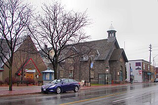
Carlington is a neighbourhood located in River Ward in the west-end of Ottawa, Ontario, Canada.

Civic Hospital is a neighbourhood in Kitchissippi Ward in central Ottawa, Canada. It is named after the Ottawa Civic Hospital, which is located in the neighbourhood.
Qualicum-Graham Park or Qualicum is a suburban neighbourhood in College Ward in the City of Ottawa, Ontario, Canada. It is located in the former City of Nepean in the west end of the city. Many of the residences in the area are executive homes situated on large lots (100x100) being built in the 1960s. Qualicum Street boasts large custom houses built by Bill Teron. The neighbourhood is bounded to the north by the Queensway, to the west by Richmond Road, to the south by Baseline Road, and to the east by Morrison Drive at the former Ottawa-Nepean border towards Redwood. Named after Qualicum Beach in British Columbia.
Courtland Park is a sub-neighbourhood of Carleton Heights in River Ward in the west end of Ottawa, Ontario, Canada. It is bounded on the north by Baseline Road, on the east by the Rideau River, on the south by Dynes Road and on the west by Fisher Avenue. Prince of Wales Drive runs thorough the neighbourhood.

Bel-Air Heights is a neighbourhood in College Ward in the west end of Ottawa, Ontario, Canada. It is bounded on the east by Agincourt Road, on the south by Baseline Road, on the west by Navaho Drive and on the north by the Central Experimental Farm Pathway. The neighbourhood is mostly a middle class housing neighbourhood.

Bel-Air Park is a neighbourhood in College Ward in the west end of Ottawa, Ontario, Canada. It is bounded on the east by the Experimental Farm Pathway, on the south by Baseline Road, on the west by Woodroffe Avenue and on the north by the Queensway.
Braemar Park is a neighbourhood in College Ward in the west end of Ottawa, Ontario, Canada. It is bounded on the north by the Queensway, east on Maitland Drive, south by the Central Experimental Pathway and west by J. H. Putman Public School.
Copeland Park is a neighbourhood located in College Ward in the west end of Ottawa, Canada. It is bounded to the west by Agincourt Road, to the south by Baseline Road, to the east by Clyde Avenue and to the north by the Central Experimental Farm Pathway.
Bayshore is a neighbourhood in Bay Ward in the west end of Ottawa, Ontario, Canada. Prior to amalgamation in 2001, the neighbourhood was in the City of Nepean. It is bounded east by row houses off Bayshore Drive, to the north Carling Avenue, to the west Holly Acres Drive and the Lakeview neighbourhood, and to the south Ontario Highway 417. The main street in Bayshore is Woodridge Crescent, while the Bayshore Station is the major bus transit station.
Queensway Terrace North (QTN) is a neighbourhood in Bay Ward in the west end of Ottawa, Ontario, Canada. Its neighbourhood association is bounded to the north by Carling Avenue, to the west by Pinecrest Road, to the south by the Queensway, and to the east by the Transitway. These boundaries include the adjacent neighbourhood of Britannia Heights.

Foster Farm, nicknamed "the Farm", is a neighbourhood in the Britannia area of Bay Ward in the west end of Ottawa, Ontario, Canada. It is roughly bounded to the north by Richmond Road, to the east by Pinecrest Road, to the west by the former Ottawa/Nepean city limits and the south by the Highway 417, the Queensway. It is bordered by Fairfield Heights, Queensway Terrace North, Redwood, Michele Heights. The total population of this area according to the 2016 Canada Census was 3,636.

Britannia United Church is a United Church of Canada congregation in Ottawa, Ontario, Canada. One of Ottawa's oldest congregations, members had been meeting in homes since 1869. The Britannia Heights Methodist Church formed in 1873. It joined the United Church when it was formed in 1925. In 1925, Britannia became officially Britannia United Church. The Britannia United Church has operated out of Pinecrest Road location since 1961.

Belltown is a neighbourhood in the Britannia area of Bay Ward, in the west end of Ottawa. It is bounded on the east by Britannia Park, on the north by the Ottawa River, on the west by Andrew Haydon Park and the south by Carling Avenue. Prior to Ottawa's amalgamation in 2001, the neighbourhood spanned the Ottawa-Nepean municipal boundary. The neighbourhood's population is 2089, with 294 people living in the Nepean portion.
