Brno-Chrlice

Last updated
Brno-Chrlice
Brno-Chrlice from west.jpg
View of Chrlice from the west
Brno-Chrlice vlajka.svg
Brno-Chrlice znak.svg
Brno MC Brno-Chrlice.png
Location of Brno-Chrlice in Brno
Coordinates: 49°12′25″N16°29′16″E / 49.20694°N 16.48778°E / 49.20694; 16.48778
Country Czech Republic
Region South Moravian
City Brno
Government
  MayorLukáš Fila
Area
  Total
9.49 km2 (3.66 sq mi)
Population
 (2023) [1]
  Total
3,691
  Density390/km2 (1,000/sq mi)
Time zone UTC+1 (CET)
  Summer (DST) UTC+2 (CEST)
Postal code
643 00
Website www.mcchrlice.brno.cz

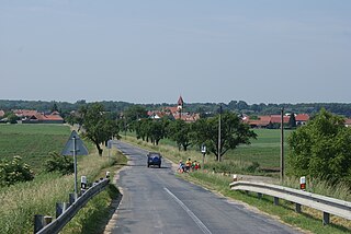
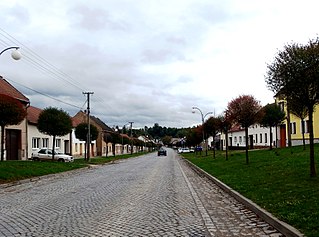
Brno-Chrlice is a city district in the south part of the city of Brno, Czech Republic. It consists of the municipal part and cadastral territory of Chrlice (German : Chirlitz), originally an independent municipality that was annexed to Brno in 1971. The current city district was established on 24 November 1990. About 3,600 people live here.

Contents

Etymology

The name Chrlice was derived from the personal name Chrla (the basis of which is either the verb chrliti – 'to throw' or the adjective chrlý – 'quick') and meant "Chrla's people". The German name (Kirlitz in the oldest documents) originated from Czech. [2]

Geography

Brno-Chrlice borders with Brno-Tuřany in the north, the municipalities of Modřice in the west, Rebešovice and Otmarov in the south, and Sokolnice in the east. It has an area of 9.49 km2. Outside the Chrlice urban area, there are extensive areas of arable land, which fill most of Chrlice.

For the purposes of the senate elections, Brno-Chrlice is included in electoral district 58 of Brno-City District.

History

The first written mention of Chrlice dates from 1320. It was already in the possession of the Archdiocese of Olomouc at that time, but the village was divided into fiefs, the holders of which changed during the following centuries. At the end of the 16th century, Chrlice became the centre of the episcopal estate. In 1787, the village of Růžový, which was an independent municipality between 1875 and 1949, was founded on the site of a parceled yard, close to Chrlice. [ citation needed ]

Chrlice (and Růžová) were annexed into Brno on 26 November 1971. Until 31 December 1975, they were an independent district of Brno with their own local national committee. The district was first called Brno XIV-Chrlice, and from 1 May 1972, only Brno-Chrlice. From 1 January 1976 to 23 November 1990, Chrlice was part of the Brno IV district. Since 23 November 1990, the current city district of Brno-Chrlice was established. [3]

Since 2005, Brno-Chrlice has its flag.

Demographics

Historical population
YearPop.±%
18691,135    
18801,328+17.0%
18901,534+15.5%
19001,608+4.8%
19101,694+5.3%
YearPop.±%
19211,814+7.1%
19302,314+27.6%
19502,382+2.9%
19612,647+11.1%
19702,565−3.1%
YearPop.±%
19803,121+21.7%
19913,110−0.4%
20013,176+2.1%
20113,722+17.2%
20213,613−2.9%
Source: Censuses [4] [5]

Transport

The D2 motorway passes through the western part of Chrlice.

Brno-Chrlice is located on the railway line LetoviceKřenovice. [6]

There is bus transport on route No. 64 on the route Chrlice to Maloměřice (Červený písek). There is also line number 78 from Židenice railway station or from the Olympia shopping mall in Modřice. Next, nightline number N95 from Kamenný vrch via the main railway station to the Chrlice loop. The regular bus line number 509 arrives in Chrlice from the direction of Měnín (some routes only go from/to Rajhradice).

Related Research Articles

<span class="mw-page-title-main">Modřice</span> Town in South Moravian, Czech Republic

Modřice is a town in Brno-Country District in the South Moravian Region of the Czech Republic. It has about 5,700 inhabitants.

<span class="mw-page-title-main">Staré Město (Uherské Hradiště District)</span> Town in Zlín, Czech Republic

Staré Město is a town in Uherské Hradiště District in the Zlín Region of the Czech Republic. It has about 6,600 inhabitants.

<span class="mw-page-title-main">Brno-City District</span> District in South Moravian, Czech Republic

Brno-City District is a district in the South Moravian Region of the Czech Republic. The district is coterminous with the city of Brno.
<span class="mw-page-title-main">Ladná</span> Municipality in South Moravian, Czech Republic

Ladná is a municipality and village in Břeclav District in the South Moravian Region of the Czech Republic. It has about 1,300 inhabitants.
<span class="mw-page-title-main">Brankovice</span> Market town in South Moravian, Czech Republic

Brankovice is a market town in Vyškov District in the South Moravian Region of the Czech Republic. It has about 900 inhabitants.

<span class="mw-page-title-main">Březina (former Blansko District)</span> Municipality in South Moravian, Czech Republic

Březina is a municipality and village in Brno-Country District in the South Moravian Region of the Czech Republic. It has about 1,100 inhabitants.

<span class="mw-page-title-main">Březina (former Tišnov District)</span> Municipality in South Moravian, Czech Republic

Březina is a municipality and village in Brno-Country District in the South Moravian Region of the Czech Republic. It has about 400 inhabitants.

<span class="mw-page-title-main">Brno-Řečkovice a Mokrá Hora</span> City District of Brno in South Moravian Region, Czech Republic

Brno-Řečkovice a Mokrá Hora is a city district of Brno, Czech Republic, located in the northern part of the city. It is made up of the cadastral territories of Řečkovice and Mokrá Hora. It has a total area of 7.57 km2. The city district was formed on November 24, 1990. Over 15,000 people live there.

<span class="mw-page-title-main">Brno-Tuřany</span> City District of Brno in South Moravian Region, Czech Republic

Brno-Tuřany is a city district in Brno, Czech Republic, located in the southeastern part of the city. It is made up of the cadastral territories of Brněnské Ivanovice, Dvorska, Holásky and Tuřany. The total area is 17.84 km². The city district was established on November 24, 1990, its office is located in Tuřany. About 5,900 inhabitants live here. It is known for the Brno-Tuřany Airport.

<span class="mw-page-title-main">Brno-Žebětín</span> City District of Brno in South Moravian Region, Czech Republic

Brno-Žebětín is a city district in Brno, Czech Republic, located on the western edge of the city. It consists of the municipal part and cadastral territory of Žebětín, originally an independent municipality that was annexed to Brno in 1971. It has an area of 13.60 km2. The city district was established on November 24, 1990. About 6,000 people live here.

<span class="mw-page-title-main">Komárov (Brno)</span> Cadastral territory of Brno in South Moravian Region, Czech Republic

Komárov is a municipal part and cadastral territory in the south part of Brno, Czech Republic. It has an area of ​​1.66 km². Originally an independent municipality, it was annexed to Brno in 1919, since November 24, 1990 it has been part of the city district of Brno-jih. About 5,000 people live here.

<span class="mw-page-title-main">Soběšice (Brno)</span> Cadastral territory of Brno in South Moravian Region, Czech Republic

Soběšice is a municipal part and cadastral territory on the northern edge of the city of Brno, Czech Republic. It has an area of 6.06 km2. Originally an independent municipality, it was annexed into Brno in 1971, and since November 24, 1990 it is a part of the city district of Brno-sever. About 2,500 people live here.

<span class="mw-page-title-main">Řečkovice</span> Cadastral territory of Brno in South Moravian Region, Czech Republic

Řečkovice is a municipal part and cadastral territory in the northern part of the city of Brno, Czech Republic. It has an area of ​​6.68 km². Originally an independent municipality, it was annexed to Brno in 1919, since November 24, 1990 it has been part of the city district of Brno-Řečkovice a Mokrá Hora, alongside Mokrá Hora. Over 14,000 people live here.

<span class="mw-page-title-main">Brno-Bosonohy</span> City District of Brno in South Moravian, Czech Republic

Brno-Bosonohy is a city district in the southwest of the city of Brno, Czech Republic. It consists of the municipal part and cadastral territory of Bosonohy and a small part of neighbouring Kohoutovice. Bosonohy was originally an independent municipality that was annexed to Brno in 1971. The city district was established on 24 November 1990. About 2,800 people live here.

<span class="mw-page-title-main">Horní Heršpice</span> Cadastral territory of Brno in South Moravian Region, Czech Republic

Horní Heršpice is a municipal part and cadastral territory in the south part of the city of Brno, Czech Republic. It has an area of 3.77 km2. Originally its own municipality, it was annexed into Brno in 1919, since November 24, 1990 it has been part of the city district of Brno-jih. About 2,100 people live here.

<span class="mw-page-title-main">Brno-Ivanovice</span> City District of Brno in South Moravian, Czech Republic

Brno-Ivanovice is a city district in the north part of the city of Brno, Czech Republic. It consists of the municipal part and cadastral territory of Ivanovice, originally an independent municipality that was annexed to Brno in 1971. The city district was established on 24 November 1990. Almost 2,000 people live here.

<span class="mw-page-title-main">Brněnské Ivanovice</span> Cadastral territory of Brno in South Moravian Region, Czech Republic

Brněnské Ivanovice is a municipal part and cadastral territory in the southeast of the city of Brno, Czech Republic. It has an area of ​​4.17 km². Originally its own municipality, it was annexed into Brno in 1919, and since November 24, 1990 it is part of the city district of Brno-Tuřany. Almost 1,500 people live here.

<span class="mw-page-title-main">Přízřenice</span> Cadastral territory of Brno in South Moravian Region, Czech Republic

Přízřenice is a municipal part and cadastral territory in the south of the city of Brno, Czech Republic. Its area is 3.82 km². Originally its own municipality, it was annexed to Brno in 1919, and since 24 November 1990 it is part of the city district of Brno-jih. It has almost 1,200 inhabitants.

<span class="mw-page-title-main">Tuřany (Brno)</span> Cadastral territory of Brno in South Moravian Region, Czech Republic

Tuřany is a municipal part and cadastral territory on the southeastern edge of the city of Brno, Czech Republic. Its area is 9.61 km². Originally its own municipality, it was annexed into Brno in 1919, and since 24 November 1990 it is part of the city district of Brno-Tuřany. It has over 2,600 inhabitants.

<span class="mw-page-title-main">Holásky</span> Cadastral territory of Brno in South Moravian Region, Czech Republic

Holásky is a municipal part and cadastral territory on the southeastern edge of the city of Brno, Czech Republic. Its area is 1.83 km2. Originally its own municipality, it was annexed into Brno in 1960, and since November 24, 1990 it has been part of the city district of Brno-Tuřany. It has about 1,100 inhabitants.

References

  1. "Participative budget in the city districts of Brno" (in Czech). Czech Statistical Office. 2023-01-01.
  2. Hosák, Ladislav; Šrámek, Rudolf (1970). Místní jména na Moravě a ve Slezsku I: A–L (in Czech). Prague: Czechoslovak Academy of Sciences. p. 325.
  3. "Historický lexikon obcí České republiky 1869–2011: Abecední přehled obcí a částí obcí" (PDF) (in Czech). Czech Statistical Office. 2015-12-21. pp. 38–39.
  4. "Historický lexikon obcí České republiky 1869–2011 – Okres Brno-město" (PDF) (in Czech). Czech Statistical Office. 2015-12-21.
  5. "Population Census 2021: Population by sex". Public Database. Czech Statistical Office. 2021-03-27.
  6. "Detail stanice Brno-Chrlice" (in Czech). České dráhy . Retrieved 2024-11-15.