Raccoon Creek is a tributary of the Ohio River in Beaver County, Pennsylvania, United States.

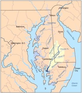
Marshyhope Creek is a 37.0-mile-long (59.5 km) tributary of the Nanticoke River on the Delmarva Peninsula. It rises in Kent County, Delaware, and runs through Caroline County, Maryland, and Dorchester County, Maryland.

The Ararat River is a tributary of the Yadkin River in southwestern Virginia and northwestern North Carolina in the United States. Via the Yadkin it is part of the watershed of the Pee Dee River, which flows to the Atlantic Ocean.

Coddle Creek is a stream/river that rises near Mooresville in Iredell County, North Carolina. It flows through most of northwestern Cabarrus County, North Carolina where it empties into Rocky River near Harrisburg, North Carolina.

Herring River is a river in Wellfleet, Massachusetts that includes a tidal estuary. As of 2014, there are plans and funding in place to restore the river, after the construction of a dike across the river in 1909 as a mosquito control project severely hampered the health of the estuary.

Contentnea Creek is a major tributary of the Neuse River in North Carolina, USA. It is part of the Neuse River Basin, and flows for 91 miles between the Buckhorn Reservoir, where it begins, and Grifton, North Carolina, where it flows into the Neuse River.

South Branch French Creek is a 24.2-mile (38.9 km) long tributary to French Creek in Erie County, Pennsylvania. It is classed as a 3rd order stream on the EPA waters geoviewer site.

Lick Creek is a tributary of Brown Creek in Anson County, North Carolina that rises southwest of Gordon Mountain and then flows north to meet Brown Creek near Mineral Springs, North Carolina. The watershed is about 67% forested, 30% agricultural and the rest is of other land uses.

Swans Branch is a tributary of Brown Creek in Anson County, North Carolina that rises in the town of Peachland, North Carolinaand then flows east to meet Brown Creek south of Polkton, North Carolina. The watershed is about 57% forested, 35% agricultural and the rest is of other land uses.

Ledbetter Branch is a tributary of Brown Creek in Anson County, North Carolina that rises north of Polkton, North Carolina and then flows south to meet Brown Creek south of Polkton, North Carolina. The watershed is about 48% forested, 34% agricultural and the rest is of other land uses.

Pinch Gut Creek is a tributary of Brown Creek in Anson County, North Carolina that rises southeast of Polkton, North Carolina and then flows south to meet Brown Creek east of Polkton. The watershed is about 70% forested, 23% agricultural and the rest is of other land uses.

Richardson Creek is a tributary of the Rocky River in south-central North Carolina that rises in Union County near Monroe and then flows northeast through Anson County to the Rocky River.

Coles Branch is a 2.7 mi (4.3 km) long tributary to Crabtree Creek in Wake County, North Carolina and is classed as a 2nd order stream on the EPA waters geoviewer site.

Turkey Creek rises in southwest Cary, North Carolina and then flows northeast to join Crabtree Creek. The watershed is about 5% forested.

Hare Snipe Creek is a tributary of Crabtree Creek that rises in the northern Raleigh, North Carolina. The creek then flows south to Lake Lynn and on to Crabtree Creek. The watershed is about 19% forested.

Mine Creek is a tributary of Crabtree Creek that rises in the northern Raleigh, North Carolina. The creek then flows southwest to Shelley Lake and then south to Crabtree Creek. The watershed is about 19% forested.

Marsh Creek is a 6.21 mi (9.99 km) long tributary to Crabtree Creek in Wake County, North Carolina and is classed as a 2nd order stream on the EPA waters geoviewer site.

Bridges Branch is a 1.26 mi (2.03 km) long tributary to Crabtree Creek in Wake County, North Carolina and is classed as a 1st order stream on the EPA waters geoviewer site.

Reedy Fork is a 43.70 mi (70.33 km) long 3rd order tributary to the Haw River, in Alamance County, North Carolina.

Lanes Creek is a 37.19 mi (59.85 km) long 4th order tributary of the Rocky River in south-central North Carolina that drains Union County, North Carolina, and Anson County, North Carolina.


