
Beaver Meadows is a borough in Carbon County, Pennsylvania, United States. It is part of Northeastern Pennsylvania. The population was 897 at the 2020 U.S. census.
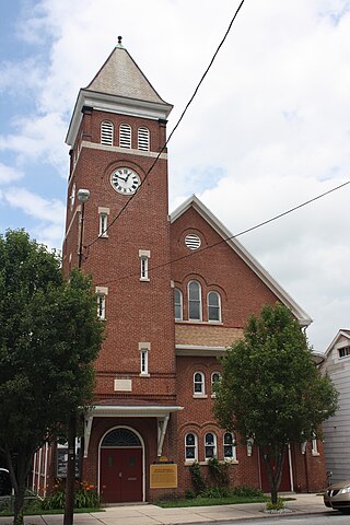
Nesquehoning is a borough in Carbon County, Pennsylvania, United States. It is part of Northeastern Pennsylvania. The population was 3,336 at the 2020 census.
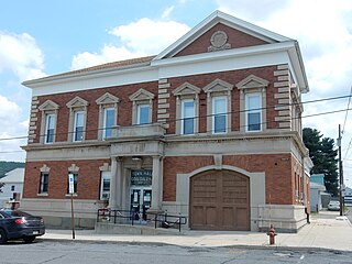
Coaldale is a borough in Schuylkill County, Pennsylvania, United States. Initially settled in 1827, it was incorporated in 1906 from part of the former Rahn Township; it is named for the coal industry—wherein, it was one of the principal early mining centers. Coaldale is in the southern Anthracite Coal region in the Panther Creek Valley, a tributary of the Little Schuylkill River, along which U.S. Route 209 was eventually built between the steep climb up Pisgah Mountain from Nesquehoning (easterly) and its outlet in Tamaqua, approximately five miles to the west.

The Flint River is a 344-mile-long (554 km) river in the U.S. state of Georgia. The river drains 8,460 square miles (21,900 km2) of western Georgia, flowing south from the upper Piedmont region south of Atlanta to the wetlands of the Gulf Coastal Plain in the southwestern corner of the state. Along with the Apalachicola and the Chattahoochee rivers, it forms part of the ACF basin. In its upper course through the red hills of the Piedmont, it is considered especially scenic, flowing unimpeded for over 200 miles (320 km). Historically, it was also called the Thronateeska River.

The Feather River is the principal tributary of the Sacramento River, in the Sacramento Valley of Northern California. The river's main stem is about 73 miles (117 km) long. Its length to its most distant headwater tributary is just over 210 miles (340 km). The main stem Feather River begins in Lake Oroville, where its four long tributary forks join—the South Fork, Middle Fork, North Fork, and West Branch Feather Rivers. These and other tributaries drain part of the northern Sierra Nevada, and the extreme southern Cascades, as well as a small portion of the Sacramento Valley. The total drainage basin is about 6,200 square miles (16,000 km2), with approximately 3,604 square miles (9,330 km2) above Lake Oroville.

Perkiomen Creek is a 37.7-mile-long (60.7 km) tributary of the Schuylkill River in Berks, Lehigh and Montgomery counties, Pennsylvania. The water course was also named Perquaminck Creek, on Thomas Holme's 1687 map.
Wallenpaupack Creek is a 30.0-mile-long (48.3 km) tributary of the Lackawaxen River in the Pocono Mountains of eastern Pennsylvania in the United States.

Nesquehoning Creek is an east flowing 14.9-mile-long (24.0 km) tributary of the Lehigh River in northeastern Pennsylvania in the United States.
Chest Creek is a tributary of the West Branch Susquehanna River in Cambria County and Clearfield County, in Pennsylvania, in the United States. It is approximately 40.4 miles (65.0 km) long and flows through Allegheny Township, East Carroll Township, Clearfield Township, Patton, Chest Township, and Elder Township in Cambria County and Westover borough, Chest Township, Newburg, Bell Township, and Mahaffey in Clearfield County. Although it is considered by the Pennsylvania Department of Environmental Protection to be impaired by situation, it is a coldwater fishery or a high-quality coldwater fishery throughout its length. The watershed of the creek has an area of 129.22 square miles (334.7 km2).
Clark Creek is a 31.4-mile-long (50.5 km) tributary of the Susquehanna River in Dauphin County, Pennsylvania, in the United States. Clark Creek was named for the Clark family who settled near its banks in the 1720s.

Boyne River is a stream in Northern Michigan, named for the River Boyne in Leinster, Ireland. Together with the north and south branches, the river system has approximately 22 miles (35 km) of mainstream and the water basin drains 40,320 acres (163.2 km2). Boyne River is Lake Charlevoix's second-largest tributary, after the Jordan River.

John Redmond Reservoir is a reservoir on the Neosho River in eastern Kansas. Built and managed by the U.S. Army Corps of Engineers, it is used for flood control, recreation, water supply, and wildlife management. It borders the Flint Hills National Wildlife Refuge to the northwest.
Hensingersville, also known as New Hensingersville, is an unincorporated community located mostly in southwestern Lower Macungie Township in Lehigh County, Pennsylvania. It also extends into Longswamp Township in Berks Township near the intersections of Pennsylvania Route 201, Pennsylvania Route 3001, Chestnut Road, and Reservoir Hill Road.

Pisgah Mountain or Pisgah Ridge is a ridgeline running 12.5 miles (20.1 km) from Tamaqua to Jim Thorpe, Pennsylvania. It is oriented north-northeast to south-southwest, and its north-side valley is followed by U.S. Route 209 from river gap to river gap. The ridge is a succession of peaks exceeding 1,440 feet (438.9 m) rising 300 to 540 feet above the boroughs of Lansford, Coaldale, and Tamaqua in the Panther Creek valley. The highest point on Pisgah Mountain is at 1,611 feet (491 m) in the borough of Summit Hill, which sits atop the ridge. Near Summit Hill was the "Sharpe Mountain" (peak) where in 1791 Phillip Ginter is documented as having discovered anthracite, leading to the formation of the Lehigh Coal Mine Company. In 1818 the Lehigh Coal Company took over the mines, and the mining camp gradually became a settlement and grew into Summit Hill.
Nesquehoning Mountain or Nesquehoning Ridge is a 15–17-mile-long (24–27 km) coal bearing ridge dividing the waters of Lehigh Valley to the north from the Schuylkill River valley and the several near parallel ridgelines of the Ridge-and-valley Appalachians barrier range all local members of which run generally WSW-ENE in the greater overall area.
East Mauch Chunk is a former independent borough in Carbon County, Pennsylvania, United States. Located along the east bank of the Lehigh River on the opposite bank from the town business district, it was part of Northeastern Pennsylvania.
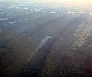
The Hauto Tunnel, dug in 1871–72, was a 1.1-mile-long (1.8 km) single-track railway tunnel crossing under the barrier ridge of Nesquehoning Mountain between Lansford, Pennsylvania, in the Panther Creek Valley and the Central Railroad of New Jersey trackage near the dam of the Hauto Reservoir impoundment about 1.3 miles (2.1 km) above Nesquehoning, Pennsylvania. The tunnel was significant for cutting nearly 15 difficult mountainous miles (24 km) off the trip to the Lehigh Canal terminal or, by rail, to other eastern coal companies, in the era when anthracite was the king of energy fuels.

Lausanne, alternately named Lausanne Landing of the 1790s–1820s was a small settlement at the mouth of Nesquehoning Creek on the Lehigh River in marshy delta-like flood plain. Some historic references will mention the presence of a 'Landing Tavern' as the entirety of the town. Lausanne township was originally organized out of dense wilderness along an ancient Amerindian Trail, the "Warriors' Path" an important regional route as it connected the Susquehanna River settlements of the lower Wyoming Valley to those around Philadelphia. During the American Revolution, this route would become the rough 'Lausanne-Nescopeck Road', and after the turn of the century with a charter (1804), be improved into a toll road, the Lehigh and Susquehanna Turnpike. The fan-shaped plain provided some of the flattest landscape terrain in the entire area, and was able to support a few small farm plots, boat building, and a lumbermill. With nascent industrialization hitting America, widespread local deforestation occurred to feed lumber mills and craft transports. Exacerbating local clearcutting was convenient river access, for the Lehigh could support river arks. The Nesquehoning Creek mouth issues behind a small river island and sits above the long curved lake-like upper pool of the Lehigh below the outlet of the gorge, and its delta's smoothly sloped sides made an attractive landing beach, giving name to the Inn. With the popularity of the route and the roughness of the country, often called "The Switzerland of America" the location was a natural rest stop for the next leg to the north involved a steep climb and was over nine miles to the area of Beaver Meadows. Hence early on it added 'Landing Tavern' to its nicknames.
At that time, all of Northampton north of the Blue Mountains was known as the Towamensing District, "Towamensing" being an Indian word for "wilderness".

Backus Creek State Game Area is a state game area within Roscommon County in the U.S. state of Michigan. It incorporates 4,379 acres (17.72 km2) of hunting, recreational, and protected wildlife and wetland areas of rural Backus Township and Higgins Township. Backus Creek State Game Area is administered by the Michigan Department of Natural Resources (MDNR).
 Picture of Reservoir On top of Dam
 Picture of Reservoir On top of Dam
 Picture of spillway
 Picture of the dam


