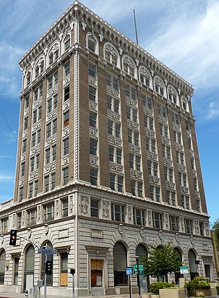
Fresno is a city in and the county seat of Fresno County, California, United States. It covers about 112 square miles (290 km2) in the center of the San Joaquin Valley, the southern portion of California's Central Valley.

South Uptown is a residential neighborhood of Minneapolis, Minnesota. In 2018, the neighborhood voted to change its name to South Uptown from its former name CARAG. Other potential names for the neighborhood included "Bryant Park" and "Bryant Square". The Minneapolis City Council has not yet approved the change.
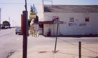
Rolinda is a small unincorporated agricultural community in Fresno County, California, United States. It is located on the Southern Pacific Railroad 10 miles (16 km) west of downtown Fresno, at an elevation of 253 feet. It is located along State Route 180. Official U.S. Geological Survey coordinates for the community are 36°44′07″N119°57′43″W. The community is in area code 559. It does not have its own ZIP code and mail uses the Fresno ZIP code of 93706.

Pinedale is a previously unincorporated community in Fresno County, California. It lies at an elevation of 348 feet. It was once a rural community located on the Southern Pacific Railroad 3.5 miles (5.6 km) north-northwest of Clovis but has since become surrounded and annexed by the city of Fresno. Millerton Lake State Recreational Area is to its NE. The ZIP Code is 93650, and the community is inside area code 559.

KFIG is an AM radio station broadcasting at 940 kHz. The station is licensed to Fresno, California and is owned by John Ostlund and Katrina Ostlund. KFIG airs a sports radio format. It carries syndicated programming from ESPN Radio, as well as some local sports shows in the afternoon and early evening. KFIG is the Fresno-area station for both San Francisco Giants and Oakland Athletics baseball games. When the teams are playing at the same time, Athletics games are instead carried on another local sports station, AM 790 KFPT, which is also an ESPN network affiliate. KFIG and KFPT have similar arrangements when they carry both San Francisco 49ers and Las Vegas Raiders football games.
Sierra Sky Park Airport is a privately owned, public-use airport located seven miles (11 km) northwest of the central business district of Fresno, a city in Fresno County, California, United States.

KJWL is a commercial FM radio station licensed to San Joaquin, California, broadcasting to the Fresno, California, radio market. It airs a classic hits radio format. KJWL is owned by John Ostlund and Fat Dawgs Broadcasting, LLC, with the license held by One Putt Broadcasting. The studios and offices are located at 1415 Fulton Street in downtown Fresno.

KALZ is a commercial radio station located in Fowler, California, broadcasting to the Fresno, California, area. KALZ airs a talk radio format. Initially, the station broadcast as "Alice 102.7" on 102.7 MHz from 1998 to early 2006. Originally, the station was known as "Smooth Jazz 96.7" (KEZL); that format was used on KJZN. Under ownership of iHeartMedia, Inc., its studios are located on Shaw Avenue in North Fresno, and the transmitter tower is in the unincorporated Fresno County community of Calwa, southeast of Fresno.
KMJ is a news/talk radio station located in Fresno, California, owned by Cumulus Media. Its studios are located at the Radio City building on Shaw Avenue in North Fresno and its transmitter is in Orange Cove, California. While 580 kHz is a Regional broadcast frequency, the station broadcasts with 50,000 watts, the highest power for an AM station permitted by the FCC, covering most of Central California. It is that region's primary entry point station in the Emergency Alert System.

Barstow is an unincorporated community in Fresno County, California. It is located 3.25 miles (5 km) west-southwest of Herndon, at an elevation of 276 feet. The main street running through Barstow is West Barstow Avenue. It covers part of zipcode 93723, along with parts of Pratton, Herndon and Biola. This zipcode includes 36 businesses, 3028 single-family occupancies and a population of 9,724. The diversity index is 85.
Floyd is an unincorporated community in Fresno County, California. It is located on the Southern Pacific Railroad 11 miles (18 km) west of downtown Fresno, at an elevation of 246 feet.

Fresno Beach is a former settlement in Fresno County, California. It was located at the terminus of a Fresno Traction Company branch line in the Scout Island area 7.5 miles (12 km) north-northwest of downtown Fresno, at an elevation of 262 feet. Fresno Beach still appeared on maps as of 1923.
Highway City is an unincorporated community in Fresno County, California. It is located 2.5 miles (4 km) southeast of Herndon, at an elevation of 299 feet.
Muscatel is an unincorporated community in Fresno County, California. It is located on the Southern Pacific Railroad 4.5 miles (7.2 km) west-northwest of downtown Fresno, at an elevation of 299 feet.
Nevills is a former settlement in Fresno County, California. It was located on the Southern Pacific Railroad 6.5 miles (10 km) west of downtown Fresno, at an elevation of 262 feet. It still appeared on maps as of 1923.
Vanguard is an unincorporated community in Fresno and Kings Counties, California. It is located 10 miles (16 km) west-southwest of Lemoore, at an elevation of 253 feet (77 m).
Andrews is a former settlement in Fresno County, California. It was located on the railroad between Fresno and Figarden. It was located 4 miles (6.4 km) southeast of Figarden; its site is within the modern city limits of Fresno.
Kingston is a former settlement, formerly in Fresno County, California. It was located 3.5 miles (5.6 km) west of Laton. Kingston, California is now in Kings County, California. Originally in Fresno County, until 1909 when Fresno County lands in the vicinity, south of the Kings River were transferred to Kings County.

Clovis Community College is a public community college located in northeastern Fresno, California near Clovis. It is in the State Center Community College District (SCCCD) along with Fresno City College and Reedley College. It has a satellite campus on Herndon Avenue in Fresno.

Helm Field also called Lemoore Auxiliary Army Airfield A-7 is a former US Amry Airfield use for training during World War 2. Helm Field was location in the town of Coalinga, California, 70 miles south of Fresno. Helm Field had two 3,000 foot runways, one oriented east/west and one oriented northwest/southeast. The Airfield was on a 773 acres site of form farm land. The US Army purchased the land on January 11, 1943 for training pilots. The Airfield was used by the Lemoore Basic Flying School, based at the Lemoore Army Air Field. Helm Field was 15 miles northwest of Lemoore Army Air Field. The Army built at Helm Field to support training stage house, control tower, motor pool building, crash truck shelter and latrines. Helm Field was used by Air Corps Basic Flying School, the AAF Basic Flying School, the AAF Pilot School, the 88th Air Base Squadron, the 3023rd Army Air Force Pilot School and the 461st Army Air Force Base Unit. The army closed Helm Field on October 15, 1844 and the Airfield was sold by the War Assets Administration. Helm Field was used as a farm labor camp in the 1950s. The east/west runway was returned to farmland. The northwest/southeast runway was still intact and was used as a civilian airfield till 1971.
