Related Research Articles

Victoria Island is a large island in the Arctic Archipelago that straddles the boundary between Nunavut and the Northwest Territories of Canada. It is the eighth largest island in the world, and at 217,291 km2 (83,897 sq mi) in area, it is Canada's second largest island. It is nearly double the size of Newfoundland (111,390 km2 [43,008 sq mi]), and is slightly larger than the island of Great Britain (209,331 km2 [80,823 sq mi]) but smaller than Honshu (225,800 km2 [87,182 sq mi]). The western third of the island lies in the Inuvik Region of the Northwest Territories; the remainder is part of Nunavut's Kitikmeot Region.

Tangra Mountains form the principal mountain range of Livingston Island in the South Shetland Islands, Antarctica. The range had been nameless until 2001, when it was named after Tangra, "the name of the ancient Bulgarian god."

Bear Glacier Provincial Park is a provincial park in British Columbia, Canada. The park is 542 ha in size and was established, effective 11 May 2000, by the Nisga'a Treaty, Appendix G-3.

The Gwa'Sala-Nakwaxda'xw Nations are a union of two Kwakwaka'wakw peoples in a band government based on northern Vancouver Island in British Columbia, Canada, whose main reserve community is near the town of Port Hardy in the Queen Charlotte Strait region of the Central Coast region of British Columbia, Canada. The band government is a member of the Kwakiutl District Council and, for treaty negotiation purposes, the Winalagalis Treaty Group which includes three other members of the Kwakiutl District Council.
The Esk'etemc First Nation, also known as the Alkali Lake Indian Band, is a First Nations government of the Secwepemc (Shuswap) people, located at Alkali Lake in the Cariboo region of the Central Interior of the Canadian province of British Columbia. It was created when the government of the then-Colony of British Columbia established an Indian reserve system in the 1860s. It is one of three Secwepemc bands that is not a member of either the Shuswap Nation Tribal Council or the Northern Shuswap Tribal Council.
The Kluskus First Nation is the band government of the Lhoosk’uz, a Dakelh people whose main reserve located on the Chilcotin Plateau 130 km west of the city of Quesnel, British Columbia, Canada. The First Nation is a member of the Carrier-Chilcotin Tribal Council, which includes both Tsilhqot'in and Carrier (Dakelh) communities.
The Tl'etinqox-t'in Government Office is a First Nations government located in the Chilcotin District in the western Central Interior region of the Canadian province of British Columbia. Governing a reserve communities near Alexis Creek known as Anaham Reserve First Nations or Anaham, it is a member of the Tsilhqot'in Tribal Council aka known as the Tsilhqot'in National Government. The main reserve is officially known as Anahim's Flat No. 1, and is more commonly as Anaham. Other reserves are Anahim's Meadow No. 2 and 2A, and Anahim Indian Reserves Nos. 3 through 18. Anaham, or Anahim and Alexis were chiefs of the Tsilhqot'in during the Chilcotin War of 1864, although they and their people did not take part in the hostilities.

The Christmas Mountains are a series of rounded peaks in northern New Brunswick, Canada, at the headwaters of North Pole Stream and the Little Southwest Miramichi River, west of Big Bald Mountain, and south of Mount Carleton. The mountains, in part, separate the Miramichi River watershed from the watersheds of the Serpentine River and the Nepisiguit River.
The Nazko First Nation is a First Nations government of the Dakelh people in the north-central Interior of British Columbia. Its reserves are located around the community of Nazko, British Columbia, which is 120 km west of Quesnel and southwest of Prince George.
The Cambria Icefield is an icefield in the Boundary Ranges of the Coast Mountains in northwestern British Columbia, Canada, located southeast of Stewart.
The Hartley Bay Indian Band, also known as the Hartley Bay First Nation, Hartley Bay Band, Gitga'at Nation and Gitga'at First Nation, is the band government of the Gitga'ata people of Hartley Bay, British Columbia, Canada.
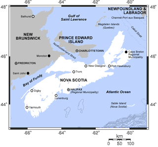
There are various Black Lakes in Nova Scotia, Canada. They vary widely in size, depth and usability. Many counties, such as Cumberland, Halifax, Inverness, and Pictou Counties have more than one Black Lake so named, while other counties mentioned in this article have only one named Black Lake.
The Lyackson First Nation is a First Nations band government located at Chemainus, British Columbia, Canada, on Vancouver Island.
Kitselas First Nation is the band government of the Kitselas subgroup of the Tsimshian. The band government is based at Gitaus in the Skeena Valley in the Skeena River valley to the northeast of the city of Terrace, British Columbia, Canada. Though there is no Tsimshian tribal council, they are a participant in the Tsimshian First Nations treaty council.

Vidbol Glacier is the 5.5 km long and 1.5 km wide glacier on Arctowski Peninsula on Danco Coast in Graham Land on the Antarctic Peninsula draining the north slopes of Pulfrich Peak. Flowing northwestwards west of Henryk Peak and east of Mount Dedo to enter Gerlache Strait at Orne Harbour.
The Leqʼ a꞉ mel First Nation, formerly known as the Lakahahmen First Nation, is a First Nations band government whose community and offices are located in the area near Deroche, British Columbia, Canada, about 12 kilometres east of the District of Mission. They are a member government of the Sto:lo Nation Chiefs Council, which is one of two tribal councils of the Sto:lo.
References
- ↑ "Brooklyn". Geographical Names Data Base . Natural Resources Canada . Retrieved 2011-03-04.
- ↑ "Brooklyn". Geographical Names Data Base . Natural Resources Canada . Retrieved 2011-03-04.
If an internal link incorrectly led you here, you may wish to change the link to point directly to the intended article.