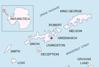
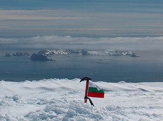
Bruix Cove is the 1.93 km wide cove indenting for 1.75 km the south coast of Moon Bay in eastern Livingston Island, the South Shetland Islands in Antarctica. Entered between Yana Point and Rila Point. Most of the cove's coastline is formed by the terminus of Iskar Glacier.
Moon Bay is a bay 7 nautical miles (13 km) wide which recedes 4 nautical miles (7 km) between Edinburgh Hill and Renier Point, on the east side of Livingston Island, in the South Shetland Islands off Antarctica. The glaciers Sopot Ice Piedmont, Iskar, Huron, Struma, Kaliakra, Panega and Debelt feed the bay.
Livingston Island is an Antarctic island in the South Shetland Islands, Western Antarctica lying between the islands of Greenwich and Snow. This island was the first land discovered south of 60° south latitude in 1819, and the name Livingston, although of unknown derivation, has been well established in international usage since the early 1820s.
The South Shetland Islands are a group of Antarctic islands with a total area of 3,687 square kilometres (1,424 sq mi). They lie about 120 kilometres (75 mi) north of the Antarctic Peninsula, and between 430 kilometres (270 mi) to 900 kilometres (560 mi) south-west from the nearest point of the South Orkney Islands. By the Antarctic Treaty of 1959, the islands' sovereignty is neither recognized nor disputed by the signatories and they are free for use by any signatory for non-military purposes.
The feature is named after Baron Alexis-Vital-Joseph (Spanish : Alejo) de Bruix (c. 1790-1825), a French military who took part in the Napoleonic Wars and the Spanish American wars of independence.
Spanish or Castilian is a Western Romance language that originated in the Castile region of Spain and today has hundreds of millions of native speakers in the Americas and Spain. It is a global language and the world's second-most spoken native language, after Mandarin Chinese.
France, officially the French Republic, is a country whose territory consists of metropolitan France in Western Europe and several overseas regions and territories. The metropolitan area of France extends from the Mediterranean Sea to the English Channel and the North Sea, and from the Rhine to the Atlantic Ocean. It is bordered by Belgium, Luxembourg and Germany to the northeast, Switzerland and Italy to the east, and Andorra and Spain to the south. The overseas territories include French Guiana in South America and several islands in the Atlantic, Pacific and Indian oceans. The country's 18 integral regions span a combined area of 643,801 square kilometres (248,573 sq mi) and a total population of 67.3 million. France, a sovereign state, is a unitary semi-presidential republic with its capital in Paris, the country's largest city and main cultural and commercial centre. Other major urban areas include Lyon, Marseille, Toulouse, Bordeaux, Lille and Nice.
The Napoleonic Wars (1803–1815) were a series of major conflicts pitting the French Empire and its allies, led by Napoleon I, against a fluctuating array of European powers formed into various coalitions, financed and usually led by the United Kingdom. The wars stemmed from the unresolved disputes associated with the French Revolution and its resultant conflict. The wars are often categorised into five conflicts, each termed after the coalition that fought Napoleon: the Third Coalition (1805), the Fourth (1806–07), the Fifth (1809), the Sixth (1813), and the Seventh (1815).
Bruix Cove is located at 62°37′40″S59°59′00″W / 62.62778°S 59.98333°W . British mapping in 1968, Chilean in 1971, Argentine in 1980, Spanish in 1991, and Bulgarian in 2005 and 2009.
The International Standard Book Number (ISBN) is a numeric commercial book identifier which is intended to be unique. Publishers purchase ISBNs from an affiliate of the International ISBN Agency.
Rugged Island is an island 3 miles (4.8 km) long and 1 mile (1.6 km) wide, lying west of Livingston Island in the South Shetland Islands. Its surface area is 10.4 square kilometres (4.0 sq mi). The island's summit San Stefano Peak rises to 256 metres (840 ft) above sea level. Rugged Island is located at 62°38′S61°15′W. Rugged Island was known to both American and British sealers as early as 1820, and the name has been well established in international usage for over 100 years.
Archar Peninsula located in the North-Western extremity of Greenwich Island, Antarctica. The three km long peninsula is bounded by Razlog Cove to the North and McFarlane Strait to the South. Its western half is snow-free in summer. The peninsula is named after the settlement of Archar in Northwestern Bulgaria, successor of the ancient town of Ratiaria.
Burgas Peninsula is a predominantly ice-covered peninsula forming the east extremity of Livingston Island in the South Shetland Islands, Antarctica extending 10 km in the east-northeast direction towards Renier Point and 4.7 km wide. It is bounded by Bruix Cove, Moon Bay and Mugla Passage to the north, and Bransfield Strait to the south-southeast. The peninsula's interior is occupied by the Delchev Ridge of Tangra Mountains.
Eliseyna Cove is a 3 km wide cove indenting for 1.4 km in the northwest coast of Varna Peninsula between Slab Point to the north and Kotis Point to the south. The cove is named after the Iskar Gorge settlement of Eliseyna in western Bulgaria.
Magura Glacier on the southeast side of Tangra Mountains on Livingston Island in the South Shetland Islands, Antarctica is located to the north of M'Kean Point, northeast of Srebarna Glacier, south of Iskar Glacier and southwest of Dobrudzha Glacier. It is bounded by Great Needle Peak to the west, Vitosha Saddle, Vihren Peak and Helmet Peak to the northwest, Plovdiv Peak and Shishman Peak to the north, and Devin Saddle and Kuber Peak to the northeast. The glacier extends 3.5 km in southwest-northeast direction and 1.9 km in northwest-southeast direction, and flows southeastward into Bransfield Strait.
Pomorie Point is a point on the coast of McFarlane Strait forming the north side of the entrance to Lister Cove, Varna Peninsula, Livingston Island in the South Shetland Islands, Antarctica.
Rila Point is a low, ice-free point on the south coast of Moon Bay, projecting 330 m west-northwestwards from Burgas Peninsula on Livingston Island in the South Shetland Islands, Antarctica, and forming the east side of the entrance to Bruix Cove. The point is named after Rila Mountain, Bulgaria.
Ruse Peak is a peak rising to over 800 m in the west part of Delchev Ridge in Tangra Mountains on Livingston Island in the South Shetland Islands, Antarctica. The peak surmounts Iskar Glacier and Bruix Cove to the north, and Dobrudzha Glacier to the south.
Shabla Knoll rises to over 400 m (1,312 ft) in Delchev Ridge, Tangra Mountains, Livingston Island in the South Shetland Islands, Antarctica surmounting Sopot Ice Piedmont to the north and Pautalia Glacier to the southwest.
Shishman Peak rises to over 800 m in the east extremity of Levski Ridge, Tangra Mountains, eastern Livingston Island in the South Shetland Islands, Antarctica. The peak overlooks Iskar Glacier and Bruix Cove to the north-northeast and Magura Glacier to the south. The peak is named after Czar Ivan Shishman of Bulgaria, 1371-1395 AD.
Shopski Cove is a 2.6 km wide cove indenting for 1.9 km the southwest coast of Greenwich Island in the South Shetland Islands, Antarctica, between Triangle Point and the westernmost extremity of the moraine spit of Provadiya Hook protecting Yankee Harbour. Shape enhanced as a result of Bravo Glacier’s retreat in the late 20th and early 21st century. The area was visited by early 19th century sealers operating from Yankee Harbour.
Varna Peninsula is a roughly rectangular predominantly ice-covered peninsula forming the northeast extremity of Livingston Island in the South Shetland Islands, Antarctica. It is bounded by Hero Bay to the northwest, by Moon Bay to the southeast, and by McFarlane Strait to the northeast.
Wulfila Glacier is located on the southern slopes of Breznik Heights, Greenwich Island in the South Shetland Islands, Antarctica, south-southwest of Solis Glacier and west of Zheravna Glacier. It is bounded by Oborishte Ridge to the northwest, Nevlya Peak to the north, Terter Peak and Razgrad Peak to the northeast, and Ephraim Bluff to the southeast. The glacier extends 3 km in northwest-southeast direction and 2 km in northeast-southwest direction, draining southwestwards into McFarlane Strait between Ephraim Bluff and the base of Provadiya Hook.
Desolation Island is one of the minor islands in the South Shetlands archipelago, Antarctica situated at the entrance to Hero Bay, Livingston Island. The island is V-shaped with its northern coast indented by Kozma Cove. Surface area 3.12 square kilometres (1.20 sq mi).
McFarlane Strait is a strait lying between Greenwich Island and Livingston Island, in the South Shetland Islands off Antarctica. It is 24 kilometres (13 nmi) long and 3 kilometres (1.6 nmi) wide. The name appears on an 1822 chart by Captain George Powell, a British sealer, and is now well established in international usage.
Renier Point is a narrow point forming the east extremity of both Burgas Peninsula and Livingston Island in the South Shetland Islands, Antarctica. The feature was known to sealers as Point Renier as early as 1821. The name ‘Pin Point’, given by Discovery Investigations personnel on the Discovery II in 1935, has been rejected in favor of the original name.
Yana Point is the point forming the west side of the entrance to Bruix Cove in eastern Livingston Island in the South Shetland Islands, Antarctica. The point separates the glacier termini of Huron Glacier to the northwest and Iskar Glacier to the southeast. The feature is named after the settlement of Yana in western Bulgaria.
Lister Cove is a 2.1 km wide cove indenting for 1.55 km the northeast coast of Varna Peninsula, Livingston Island in the South Shetland Islands, Antarctica south of Pomorie Point and north of Karavelova Point. The cove is fed by Rose Valley Glacier.
Triangle Point is the low ice-free tipped point forming the northwest side of the entrance to Shopski Cove in the south coast of Parvomay Neck linking the northwest and southeast parts of Greenwich Island in the South Shetland Islands, Antarctica. The area was frequented by early 19th century sealers operating from Yankee Harbour.
Eddystone Rocks is a group of two rocks lying to the northwest of Rugged Island off western Livingston Island in the South Shetland Islands, Antarctica.
This Livingston Island location article is a stub. You can help Wikipedia by expanding it. |