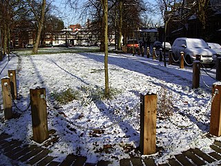
Chorlton-cum-Hardy is a suburban area of Manchester, England, three miles (4.8 km) southwest of the city centre. Chorlton ward had a population of 14,138 at the 2011 census, and Chorlton Park 15,147.

Rusholme is an area of Manchester, England, two miles south of the city centre. The population of the ward at the 2011 census was 13,643. Rusholme is bounded by Chorlton-on-Medlock to the north, Victoria Park and Longsight to the east, Fallowfield to the south and Moss Side to the west. It has a large student population, with several student halls and many students renting terraced houses, and suburban houses towards Victoria Park.
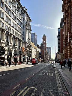
Wilmslow Road is a major road in Manchester, England, running from Parrs Wood northwards to Rusholme. There it becomes Oxford Road and the name changes again to Oxford Street when it crosses the River Medlock and reaches the city centre.

Fallowfield is a suburb of Manchester, England, with a population at the 2011 census of 15,211. Historically in Lancashire, it lies 3 miles (5 km) south of Manchester city centre and is bisected east–west by Wilmslow Road and north–south by Wilbraham Road. The former Fallowfield Loop railway line, now a cycle path, follows a route nearly parallel with the east–west main road.
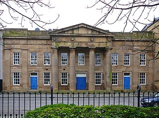
Chorlton-on-Medlock is an inner city area of Manchester, England.

Contact is an arts organisation in Manchester that focuses on youth leadership.

Hulme is an inner city area and electoral ward of Manchester, England, immediately south of Manchester city centre. It has a significant industrial heritage.

Victoria Park is a suburban area of Manchester, England. Victoria Park lies approximately two miles south of Manchester city centre, between Rusholme and Longsight.

The Church of the Holy Name of Jesus on Oxford Road, Manchester, England was designed by Joseph A. Hansom and built between 1869 and 1871. The tower, designed by Adrian Gilbert Scott, was erected in 1928 in memory of Fr Bernard Vaughan, SJ. The church has been Grade I listed on the National Heritage List for England since 1989, having previously been Grade II* listed since 1963.
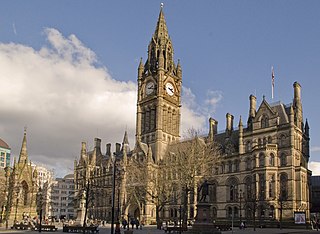
The architecture of Manchester demonstrates a rich variety of architectural styles. The city is a product of the Industrial Revolution and is known as the first modern, industrial city. Manchester is noted for its warehouses, railway viaducts, cotton mills and canals - remnants of its past when the city produced and traded goods. Manchester has minimal Georgian or medieval architecture to speak of and consequently has a vast array of 19th and early 20th-century architecture styles; examples include Palazzo, Neo-Gothic, Venetian Gothic, Edwardian baroque, Art Nouveau, Art Deco and the Neo-Classical.

The Upper Brook Street Chapel, also known as the Islamic Academy, the Unitarian Chapel and the Welsh Baptist Chapel, is a former chapel with an attached Sunday School on the east side of Upper Brook Street, Chorlton-on-Medlock, Greater Manchester, England. It is said to be the first neogothic Nonconformist chapel, having been constructed for the British Unitarians between 1837 and 1839, at the very beginning of the reign of Queen Victoria. It was designed by Sir Charles Barry, later architect of the Palace of Westminster.

Saint Chrysostom's Church is the Anglican parish church in Victoria Park, Manchester, England. The church is of the Anglo-Catholic tradition, and also has a strong tradition of being inclusive and welcoming.

The Sackville Street Building is a building on Sackville Street, Manchester, England. The University of Manchester occupies the building which, before the merger with UMIST in 2004, was UMIST's "Main Building". Construction of the building for the Manchester School of Technology began in 1895 on a site formerly occupied by Sir Joseph Whitworth's engineering works; it was opened in 1902 by the then Prime Minister, Arthur Balfour. The School of Technology became the Manchester Municipal College of Technology in 1918.

Barlow Moor is an area of Manchester, England. It was originally an area of moorland between Didsbury and Chorlton-cum-Hardy and was named after the Barlow family of Barlow Hall. Barlow Moor Road runs through the area and connects to Wilmslow Road at the southern end and Manchester Road at the northern end. Southern Cemetery and Chorlton Park are landmarks on the route. Immediately adjacent to the northwest corner of the cemetery, also on Barlow Moor Road, is the Manchester Crematorium which opened in 1892, the second in the United Kingdom. The architects were Steinthal and Solomons who chose to revive the Lombard-Romanesque style. Another notable building is the Chorlton Park Apartments, 2002.
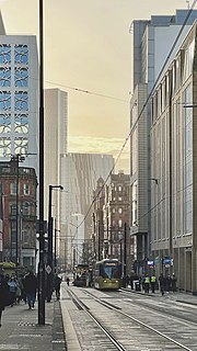
Mosley Street is a street in Manchester, England. It runs between its junction with Piccadilly Gardens and Market Street to St Peter's Square. Beyond St Peter's Square it becomes Lower Mosley Street. It is the location of several Grade II and Grade II* listed buildings.

Newland is a suburb of Kingston upon Hull, East Riding of Yorkshire, England, in the north-west of the city, a former village on the Hull to Beverley turnpike.

Grove House, in Oxford Road, Chorlton-on-Medlock, Manchester, is an early Victorian building, originally three houses, of 1838–40. It is a Grade II* listed building as of 18 December 1963.

Chorlton Poor Law Union was founded in January 1837 in response to the Poor Law Amendment Act 1834, also known as the New Poor Law. It was overseen by an elected board of 19 guardians representing the 12 parishes in the area it served: Ardwick, Burnage, Chorlton-upon-Medlock, Chorlton with Hardy, Didsbury, Gorton, Hulme, Levenshulme, Moss Side, Rusholme, Stretford, and Withington, all in present day south Manchester, England.

Chorlton New Mills is a former large cotton spinning complex in Cambridge Street, Chorlton-on-Medlock, Manchester, England which has since been converted to apartments.
St Saviour's Church on the corner of Plymouth Grove and Upper Brook Street, Chorlton on Medlock, Manchester, was an Anglican parish church. Construction began in 1835, with the estimated £6000 cost being met by public subscription. It was consecrated on 11 November 1836. The primary benefactor for the construction was Scholes Birch, whose son, Edward, became the first rector. The foundation stone was laid on 2 July 1835.


