| Brushy Creek | |
|---|---|
 | |
| Location | |
| Country | United States |
| Physical characteristics | |
| Source | |
| • location | Texas |
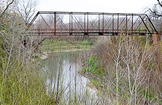
Brushy Creek is a tributary of the San Gabriel River in Texas that flows east for 69 miles. [1]
| Brushy Creek | |
|---|---|
| | |
| Location | |
| Country | United States |
| Physical characteristics | |
| Source | |
| • location | Texas |
Brushy Creek is a tributary of the San Gabriel River in Texas that flows east for 69 miles. [1]
South Brushy Creek forks off from Brushy Creek and runs south of Cedar Park, Texas. North Fork Brushy Creek and South Fork Brushy Creek branch off from Brushy Creek north of Leander, Texas. The "round rock" of Round Rock, Texas sits in Brushy Creek. Brushy Creek ultimately merges into the San Gabriel River.
There are long term plans to create a trail that will go from Leander to Hutto, Texas, via Cedar Park and Round Rock, following the route of Brushy Creek. The following segments have currently been created:

Williamson County is a county in the U.S. state of Texas. As of the 2020 census, its population was 609,017. Its county seat is Georgetown. The county is named for Robert McAlpin Williamson, a community leader and a veteran of the Battle of San Jacinto.

Travis County is located in Central Texas. As of the 2020 census, the population was 1,290,188. It is the fifth-most populous county in Texas. Its county seat and most populous city is Austin, the capital of Texas. The county was established in 1840 and is named in honor of William Barret Travis, the commander of the Republic of Texas forces at the Battle of the Alamo. Travis County is part of the Austin–Round Rock–Georgetown Metropolitan Statistical Area. It is located along the Balcones Fault, the boundary between the Edwards Plateau to the west and the Blackland Prairie to the east.
Brushy Creek is a census-designated place (CDP) in Williamson County, Texas, United States. The population was 22,519 at the 2020 census.

Cedar Park is a city and a suburb of Austin in the state of Texas, approximately 16 miles (26 km) northwest of the center of Austin. According to the 2020 U.S. census, the city's population was 77,595, and in 2022 was estimated to be 77,642.

Leander is a city in Williamson County and Travis County, Texas, United States. The population was 59,202 at the 2020 census and 74,375 at the 2022 census estimate. A suburb just north of Austin, and part of the Greater Austin metropolitan area, it was the fastest-growing city in the United States between 2018 and 2019.
Round Rock is a city in the U.S. state of Texas, in Williamson County, which is a part of the Greater Austin metropolitan area. Its population is 119,468 according to the 2020 census.

The American Discovery Trail is a system of recreational trails and roads that collectively form a coast-to-coast hiking and biking trail across the mid-tier of the United States. Horses can also be ridden on most of this trail. The coastal trailheads are the Delmarva Peninsula on the Atlantic Ocean and the northern California coast on the Pacific Ocean. The trail has northern and southern alternates for part of its distance, passing through Chicago and St. Louis respectively. The total length of the trail, including both the north and south routes, is 6,800 miles (10,900 km). The northern route covers 4,834 miles (7,780 km) with the southern route covering 5,057 miles (8,138 km). It is the only non-motorized coast-to-coast trail.
Round Rock Independent School District (RRISD) is a school district headquartered in the city of Round Rock, Texas, United States. As of 2022, the school district serves over 48,000 students, prekindergarten through grade 12.

Leander Independent School District is a school district based in Leander, Texas (USA) and covering a total of 200 square miles (520 km2) in Leander, Cedar Park, Georgetown, Jonestown, Round Rock in Williamson County and northwest Austin in Travis County. In 2015, the school district was rated "Met Standards" by the Texas Education Agency.

Frozen Head State Park and Natural Area is a state park in Morgan County, Tennessee, in the southeastern United States. The park, situated in the Crab Orchard Mountains between the city of Wartburg and the community of Petros, contains some of the highest mountains in Tennessee west of the Blue Ridge Mountains.
The Little River is a river in Central Texas in the Brazos River watershed. It is formed by the confluence of the Leon River and the Lampasas River near Little River, Texas in Bell County. It flows generally southeast for 75 miles (121 km) until it empties into the Brazos River about 5 miles (8.0 km) southwest of Hearne, at a site called Port Sullivan in Milam County. The Little River has a third tributary, the San Gabriel River, which joins the Little about 8 miles (13 km) north of Rockdale and five miles southwest of Cameron. Cameron, the county seat of Milam County and the only city of any significant size on the Little River, was established in 1846.
McNeil High School is a public secondary school in an unincorporated area in both Travis and Williamson counties, near Austin, Texas, United States. Serving freshmen, sophomores, juniors, and seniors. The school is part of the Round Rock Independent School District (RRISD), with admission primarily based on the locations of students' homes in the district. Four middle schools feed into McNeil: Cedar Valley, Chisholm Trail, Pearson Ranch and Deerpark. The school colors are navy blue, forest green, and white, and the mascot is the Maverick.

The Austin–Round Rock–San Marcos metropolitan statistical area, or Greater Austin, is a five-county metropolitan area in the U.S. state of Texas, as defined by the Office of Management and Budget. The metropolitan area is situated in Central Texas on the western edge of the American South and on the eastern edge of the American Southwest, and borders Greater San Antonio to the south.

The Crooked River is a tributary, 125 miles (201 km) long, of the Deschutes River in the U.S. state of Oregon. The river begins at the confluence of the South Fork Crooked River and Beaver Creek. Of the two tributaries, the South Fork Crooked River is the larger and is sometimes considered part of the Crooked River proper. A variant name of the South Fork Crooked River is simply "Crooked River". The Deschutes River flows north into the Columbia River.
Canyon Creek is a residential neighborhood located in far northwest Austin, Texas. The neighborhood is located in ZIP Code 78726 and is bordered by Ranch to Market Road 2222 (RM 2222) on the south, Ranch to Market Road 620 (RM 620) on the west, Anderson Mill Road on the north, and a major headwater tributary of Bull Creek to the east as well as the Balcones Canyonlands National Wildlife Refuge. The major bisecting road is Boulder Lane, a loop which crosses RM 620 at the north and south entrances. The neighborhood is approximately 5 miles (8.0 km) from Lake Travis and Lake Austin.

Bull Creek is a tributary of the Colorado River originating in the Texas Hill Country. The creek passes through some of the more scenic areas in the Austin region and forms a greenbelt that is the habitat for many indigenous species of flora and fauna. It runs beneath steep slopes and benches surfaced with shallow clay loams that support ashe juniper, escarpment live oak, mesquite, and grasses.
Nameless is a populated place in Travis County, Texas, United States, with a small portion extending into Williamson County. The community is also referred to as Cross Creek and Fairview. Nameless is approximately 21 miles northwest of downtown Austin, and is a part of the Austin-Round Rock metropolitan area. It contains the Cherry Hollow Subdivision and a large portion of Nameless Road, which extends into both Jonestown and Leander.

The South Fork Kings River is a 44.1-mile (71.0 km) tributary of the Kings River in the Sierra Nevada of Fresno County, California. The river forms part of Kings Canyon, the namesake of Kings Canyon National Park and one of the deepest canyons in North America with a maximum relief of 8,200 feet (2,500 m) from rim to river.
30°43′25″N97°02′50″W / 30.7236°N 97.0471°W
| | This article related to a river in Texas is a stub. You can help Wikipedia by expanding it. |