Until 1974, Montgomeryshire was an administrative county in mid Wales, later classed as one of the thirteen historic counties of Wales. It was named after its county town, Montgomery, which in turn was named after one of William the Conqueror's main counsellors, Roger de Montgomerie, who was the 1st Earl of Shrewsbury.

Llanidloes is a town and community on the A470 and B4518 roads in Powys, within the historic county boundaries of Montgomeryshire, Wales. The population in 2011 was 2,929, of whom 15% could speak Welsh. It is the third largest settlement in Montgomeryshire, after Newtown and Welshpool.

The Clywedog Reservoir is a reservoir near Llanidloes, Wales on the head-waters of the River Severn. The construction of the reservoir was enabled by an Act of Parliament which asserted that "At certain times the flow of water in the river is inadequate ... unless that flow were regulated so as to ensure that at those times water in addition to the natural flow will flow down the river."

The Great Laxey Mine Railway was originally constructed to serve the Isle of Man's Great Laxey Mine, a lead mine located in Laxey. The 19 in gauge railway runs from the old mine entrance to the washing floors along a right of way that passes through the Isle of Man's only remaining railway tunnel under the 3 ft gauge Victorian Manx Electric Railway and the main A2 Douglas to Ramsey coast road.

Hafren Forest lies north-west of Llanidloes, an ancient market town in Mid Wales.
Staylittle, sometimes referred to colloquially as Y Stay or Y Stae, is a small village set in the shallow upland basin of the Afon Clywedog on the B4518 road, equidistant from Llanidloes and Llanbrynmair in the historic county of Montgomeryshire, Wales, although now administered as part of the unitary authority of Powys.

Towan is found in many placenames in Cornwall. However, The Towans usually refers to the three-mile (5 km) stretch of coastal dunes which extends north-east from the estuary of the River Hayle to Gwithian beach with a midpoint near Upton. The South West Coast Path crosses the towans.

The Clywedog Trail is a 9-mile (14 km) footpath close to Wrexham in Wales. Starting at the Minera Lead Mines (53.0512°N 3.0811°W) and running to King's Mills (53.0358°N 2.9750°W), it follows the course of the River Clywedog. It is a haven for walking, relaxation and enjoying the peace of the wildlife. The Clywedog region played a role in the Industrial Revolution; ironmaking began in 1670, smelting iron ore with coke began in 1721 and John Wilkinson set up shop in 1761. For many years the area was one of the most important iron manufacturing centres in the world.

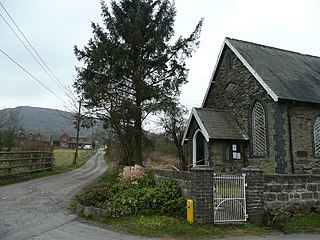
Dylife is a former mining settlement in Powys, Wales, located at the head of Afon Twymyn in the Cambrian Mountains, one mile west of the road between Llanidloes and Llanbrynmair (B4518). It is in the historic county of Montgomeryshire. The nearby lead mines intermittently sustained mining communities from Roman times until the early 20th century. During the late 19th century, as mining declined after the 1860s so did Dylife's population. The remaining buildings are two former chapels converted into homes and the Star Inn.

Cwmystwyth mines are located in Cwmystwyth, Ceredigion, Wales and exploited a part of the Central Wales Orefield.

White Grit is a small, scattered village beneath Corndon Hill in Powys, Wales, directly on the border with Shropshire. The nearby village of Priest Weston, despite being in England, actually lies to the west of White Grit. To the east is the A488 road. The nearest town is Bishop's Castle.

Cwmsymlog is a short valley, sheltering a hamlet of the same name, in Ceredigion, in the west of Wales. Once an important mining area, but the mining slowly declined and finally came to an end in 1901. Now it is peaceful, open countryside with a few mining remains, scattered houses and farmland. It is also the name of a Site of Special Scientific Interest at that location.

The B4518 road is a road in Powys, central Wales, with a total length of 30.5 miles (49.1 km). It begins at 52°18′5″N3°30′41″W in Rhayader near the junction of the A470 road and the A44 road and leads eventually to the A470 again at Llanbrynmair at 52°36′42″N3°37′38″W. En route going north from Rhayader it passes through the following settlements: St Harmon, Pant-y-Dwr, Tylwch, Llanidloes, Staylittle, Pont Crugnant, Pennant, Bont Dolgadfan, Llan and Plas Esgair. It passes through the Clywedog Valley and Clywedog Reservoir, built in 1964.

Great Western Mine, also known as Hetty Pit, was a coal mine, at Hopkinstown, near Pontypridd, Glamorgan in South Wales.

Klondyke Mill was an ore processing mill on the edge of the Gwydir Forest, near Trefriw, north Wales.

Snailbeach Countryside Site is an industrial archeology site in Shropshire. It is located three 3 miles (4.8 km) south of the village of Pontesbury and around 12 miles (19 km) from the county town of Shrewsbury. At peak of production during the 19th century, it was reputed to be extracting the largest volume of lead per acre in Europe.

Greenside Mine was a successful lead mine in the Lake District of England. Between 1825 and 1961 the mine produced 156,000 long tons of lead and 1,600,000 ounces of silver, from around 2 million tons of ore. During the 1940s it was the largest producer of lead ore in the UK. Unusually for a 19th-century metalliferous mine in Britain there are very full records of its activities, dating back to 1825.
Sundown Tin and Copper Mine is a heritage-listed mine at Little Sundown Creek, Stanthorpe, Southern Downs Region, Queensland, Australia. It was built from c. 1897 to 1920s. It was added to the Queensland Heritage Register on 28 July 2000.
Einasleigh Copper Mine and Smelter is a heritage-listed mine at Daintree Road, Einasleigh, Shire of Etheridge, Queensland, Australia. It was built from 1867 to 1922. It is also known as Lynd Copper Mine and New Einasleigh Copper Mine. It was added to the Queensland Heritage Register on 11 December 2006.


