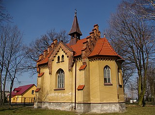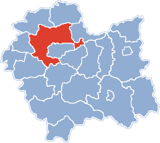
Chełm is a village in the administrative district of Gmina Bochnia, within Bochnia County, Lesser Poland Voivodeship, in southern Poland. It lies approximately 9 kilometres (6 mi) west of Bochnia and 30 km (19 mi) east of the regional capital Kraków.

Wola Wieruszycka is a village in the administrative district of Gmina Łapanów, within Bochnia County, Lesser Poland Voivodeship, in southern Poland. It lies approximately 3 kilometres (2 mi) north-east of Łapanów, 14 km (9 mi) south-west of Bochnia, and 34 km (21 mi) south-east of the regional capital Kraków.

Chorowice is a village in the administrative district of Gmina Mogilany, within Kraków County, Lesser Poland Voivodeship, in southern Poland. It lies approximately 12 km (7 mi) south-west of the regional capital Kraków.

Libertów is a village in the administrative district of Gmina Mogilany, within Kraków County, Lesser Poland Voivodeship, in southern Poland. It lies approximately 12 km (7 mi) south of the regional capital Kraków.

Borek Szlachecki is a village in the administrative district of Gmina Skawina, within Kraków County, Lesser Poland Voivodeship, in southern Poland. It lies approximately 5 kilometres (3 mi) south-west of Skawina and 16 km (10 mi) south-west of the regional capital Kraków.

Wielkie Drogi is a village in the administrative district of Gmina Skawina, within Kraków County, Lesser Poland Voivodeship, in southern Poland. It lies approximately 9 kilometres (6 mi) west of Skawina and 20 km (12 mi) south-west of the regional capital Kraków.

Ochojno is a village in the administrative district of Gmina Świątniki Górne, within Kraków County, Lesser Poland Voivodeship, in southern Poland. It lies approximately 4 kilometres (2 mi) north of Świątniki Górne and 11 km (7 mi) south of the regional capital Kraków.

Wrząsowice is a village in the administrative district of Gmina Świątniki Górne, within Kraków County, Lesser Poland Voivodeship, in southern Poland. It lies approximately 3 kilometres (2 mi) north-east of Świątniki Górne and 13 km (8 mi) south of the regional capital Kraków.

Bęczarka is a village in the administrative district of Gmina Myślenice, within Myślenice County, Lesser Poland Voivodeship, in southern Poland. It lies approximately 8 kilometres (5 mi) north-west of Myślenice and 21 km (13 mi) south of the regional capital Kraków.

Biertowice is a village in the administrative district of Gmina Sułkowice, within Myślenice County, Lesser Poland Voivodeship, in southern Poland. It lies approximately 6 kilometres (4 mi) north of Sułkowice, 12 km (7 mi) north-west of Myślenice, and 23 km (14 mi) south-west of the regional capital Kraków.

Wróblówka is a village in the administrative district of Gmina Czarny Dunajec, within Nowy Targ County, Lesser Poland Voivodeship, in southern Poland, close to the border with Slovakia. It lies approximately 10 kilometres (6 mi) west of Nowy Targ and 67 km (42 mi) south of the regional capital Kraków.

Uniszowa is a village in the administrative district of Gmina Ryglice, within Tarnów County, Lesser Poland Voivodeship, in southern Poland. It lies approximately 2 kilometres (1 mi) west of Ryglice, 19 km (12 mi) south-east of Tarnów, and 87 km (54 mi) east of the regional capital Kraków.

Łukanowice is a village in the administrative district of Gmina Wojnicz, within Tarnów County, Lesser Poland Voivodeship, in southern Poland. It lies approximately 4 kilometres (2 mi) east of Wojnicz, 12 km (7 mi) south-west of Tarnów, and 69 km (43 mi) east of the regional capital Kraków.

Chocznia is a village in the administrative district of Gmina Wadowice, within Wadowice County, Lesser Poland Voivodeship, in southern Poland. It lies approximately 4 kilometres (2 mi) west of Wadowice and 41 km (25 mi) south-west of the regional capital Kraków.

Gorzeń Dolny is a village in the administrative district of Gmina Wadowice, within Wadowice County, Lesser Poland Voivodeship, in southern Poland. It lies approximately 2 kilometres (1 mi) west of Wadowice and 39 km (24 mi) south-west of the regional capital Kraków.

Chrząstowice is a village in the administrative district of Gmina Brzeźnica, within Wadowice County, Lesser Poland Voivodeship, in southern Poland. It lies approximately 3 kilometres (2 mi) west of Brzeźnica, 12 km (7 mi) north-east of Wadowice, and 27 km (17 mi) south-west of the regional capital Kraków.

Zarzyce Wielkie is a village in the administrative district of Gmina Kalwaria Zebrzydowska, within Wadowice County, Lesser Poland Voivodeship, in southern Poland. It lies approximately 5 kilometres (3 mi) north-east of Kalwaria Zebrzydowska, 17 km (11 mi) east of Wadowice, and 25 km (16 mi) south-west of the regional capital Kraków.

Bachowice is a village in the administrative district of Gmina Spytkowice, within Wadowice County, Lesser Poland Voivodeship, in southern Poland. It lies approximately 10 kilometres (6 mi) north of Wadowice and 34 km (21 mi) west of the regional capital Kraków.

Zawadka is a village in the administrative district of Gmina Tokarnia, within Myślenice County, Lesser Poland Voivodeship, in southern Poland. It lies approximately 10 kilometres (6 mi) south of Myślenice and 35 km (22 mi) south of the regional capital Kraków.

Pisarzowice is a village in the administrative district of Gmina Wilamowice, within Bielsko County, Silesian Voivodeship, in southern Poland. It lies approximately 4 kilometres (2 mi) south of Wilamowice, 8 km (5 mi) north-east of Bielsko-Biała, and 42 km (26 mi) south of the regional capital Katowice. The village has a population of 4,673.


