Related Research Articles
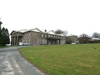
Buckland Filleigh is a village, civil parish and former manor in the Torridge district of North Devon, England, situated about 8 miles south of the town of Great Torrington. According to the 2001 census, the parish had a population of 170. It is surrounded clockwise from the north by the parishes of Peters Marland, Petrockstowe, Highampton, Sheepwash and Shebbear.

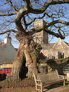
Buckland in the Moor is a village and civil parish in the Teignbridge district of Devon, England. According to the 2001 census it had a population of 94. The village is in Dartmoor.

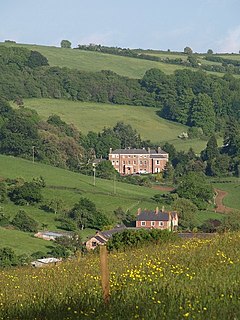
Buckland Monachorum is a village and civil parish in the West Devon district of Devon, England, situated on the River Tavy, about 10 miles north of Plymouth.

Buckland-Tout-Saints is a village and civil parish in the South Hams district of Devon, England. In the 2001 census it had a population of 178, up from a population of only 37 in 1901. The parish is surrounded clockwise from the north by the parishes of Woodleigh, East Allington, Frogmore and Sherford, Kingsbridge, Churchstow, and a short boundary with Loddiswell.

Milber is a housing estate at grid reference SX8770 considered part of the town of Newton Abbot in south Devon. It is on the opposite side of the A380 road from the town centre. Milber contains mainly houses, but also a trading estate and some shops. The estate is part of the electoral ward termed Buckland and Milber. The population at the 2011 census was 7,089. Its unusual 20th-century church of St Luke was built as a result of a dream experienced by William Keble Martin in 1931. It is partly circular in form with three naves and was completed in 1942. Some of the roads in Milber are named after trees - Hazel Close, Beechwood Avenue and Chestnut Drive being examples of this. The narrow, half mile-long, strip of Ben Stedham's Wood separates Milber from the suburbs of Aller and Newtake: the Iron Age hill fort of Milber Down is at the top of this wood.
Cormorant Channel Marine Provincial Park is a provincial park in British Columbia, Canada, located in the Pearse Islands, a small archipelago to the east of Cormorant Island and the Village of Alert Bay at the western end of Johnstone Strait.
Jackson Narrows Marine Provincial Park is a provincial park in British Columbia, Canada, located on the west side of Mathieson Channel to the north of the community of Bella Bella.
Buckland Athletic Football Club is a football club based in Newton Abbot, Devon, England. They are currently members of the Western League Premier Division and play at Homers Heath.
Dartmouth Association Football Club is a football club based in Dartmouth, Devon, England. They are currently members of the South West Peninsula League Premier Division East and play at Long Cross.
Turin is a hamlet in Alberta, Canada within the Lethbridge County. It is located approximately 56 kilometres (35 mi) northeast of Lethbridge on Highway 25 and along a Canadian Pacific Railway line.

East Allington is a village and civil parish in the South Hams district of Devon, England, three miles (5 km) south of Halwell and just off the A381 road. It lies about three miles (5 km) from Kingsbridge and about ten miles (16 km) from Totnes. The coast at Slapton Sands is about five miles (8 km) to the south-east. Also in the parish is the hamlet of The Mounts, about one mile (1.6 km) away.
Meavy is a small village, civil parish and former manor in the English county of Devon. Meavy forms part of the district of West Devon. It lies a mile or so east of Yelverton. The River Meavy runs near the village. For administrative purposes the parish is grouped with the parishes of Sheepstor and Walkhampton to form Burrator Parish Council, and for electoral purposes it is grouped with the same two parishes to form Burrator Ward.

Crapstone is a village in the county of Devon. The village is located on the edge of Dartmoor, in the parish of Buckland Monachorum and is approximately 1 mile (1.6 km) from the village of Yelverton, 9 miles (14 km) from the city of Plymouth and 5 miles (8 km) from Tavistock.
West Fork is an unincorporated community in Union Township, Crawford County, Indiana.
Crown Center is an unincorporated community in Adams Township, Morgan County, in the U.S. state of Indiana.

Rhesus Glacier is a 7 km long and 2.5 km wide glacier draining the east slopes of the Trojan Range on Anvers Island in the Palmer Archipelago, Antarctica southeast of Paris Peak. Situated east of Iliad Glacier, south of Lipen Glacier and north of Thamyris Glacier. Flowing northeastwards into Fournier Bay south of Thompson Peninsula and north of Predel Point.

Frogmore and Sherford is a civil parish in Devon, England. Within it are the villages of Frogmore and Sherford. The parish was created in 1986 from Sherford and parts of South Pool and Charleton.
Cross Roads is an unincorporated community in Laughery Township, Ripley County, in the U.S. state of Indiana.
Haccombe with Combe is a civil parish in the Teignbridge local government district of Devon, England. The parish lies immediately to the east of the town of Newton Abbot, and south of the estuary of the River Teign. Across the estuary are the parishes of Kingsteignton and Bishopsteignton. The parish is bordered on the east by Stokeinteignhead and on the south by Coffinswell. Most of the southern boundary of the parish follows the minor ridge road that runs between the suburbs of Milber in Newton Abbot and Barton in Torquay and it bisects the Iron Age hill fort of Milber Down.
Prospect Grove is an unincorporated community in Scotland County, in the U.S. state of Missouri.
References
- ↑ Harris, Helen (2004). A Handbook of Devon Parishes. Tiverton: Halsgrove. p. 170. ISBN 1-84114-314-6.
| | This Devon location article is a stub. You can help Wikipedia by expanding it. |