
Hamlin Beach State Park is a 1,287-acre (5.21 km2) state park located on the shore of Lake Ontario in the Town of Hamlin in Monroe County, New York, United States. The Lake Ontario State Parkway passes through the park.

Reservoir is a suburb in Melbourne, Victoria, Australia, 12 km (7.5 mi) north of Melbourne's Central Business District, located within the City of Darebin local government area. Reservoir recorded a population of 51,096 at the 2021 census.
Eno River State Park is a 4,319-acre (17.48 km2) North Carolina state park in Durham and Orange Counties, North Carolina. Together with the adjoining West Point on the Eno city park, the two parks preserve over 14 miles (22.5 km) of the Eno River and surrounding lands.

A partial cloverleaf interchange or parclo is a modification of a cloverleaf interchange.
The Toronto Suburban Railway was a Canadian electric railway operator with local routes in west Toronto, and a radial (interurban) route to Guelph.

The Pennine Bridleway is a National Trail in Northern England.

Lake Murray is a reservoir in San Diego, California, operated by the City of San Diego's Public Utilities Department. When full, the reservoir covers 171.1 acres (69.2 ha), has a maximum water depth of 95 feet (29 m), and a shoreline of 3.2 miles (5.1 km). The asphalt-paved service road lining roughly two-thirds of the lake's perimeter is a popular recreation site for the Navajo community as well as residents of the northernmost neighborhoods in La Mesa. It lies south of Cowles Mountain and a small golf course. It also functions as an important aeronautical reporting point for aircraft inbound to land at Montgomery-Gibbs Executive Airport.
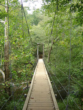
The Manasquan Reservoir is a source of water for municipalities and utilities, as well as a 1,204-acre (4.87 km2) park, located in Howell Township, in Monmouth County, New Jersey, United States. The reservoir doubles as a park that is part of the Monmouth County Park System. The park has trails, a visitor's center, a nature/environmental center, a boat launching area and several dikes for fishing, among its facilities. The reservoir itself, which is dammed from the Manasquan River, is operated by the New Jersey Water Supply Authority, which is a part of the much larger Raritan Basin Watershed. The nature trails circling around the reservoir are what makes this county park as one of the most popular hiking destinations in Central New Jersey, as the park receives over one million visitors a year. It is reachable by car and there are five parking lots, including one for vehicles hauling trailers. The park's trails are open to walkers, runners, hikers, bicyclists and equestrians.
The Hamilton–Brantford–Cambridge Trails are a network of multiuse interurban recreational rail trails connecting several municipalities in southern Ontario, Canada. The trails are part of the Southern Ontario Loop of the Trans Canada Trail. From end to end, the trail is 80 kilometres (50 mi) long, running from Cambridge south through Paris to Brantford and then East to central Hamilton.
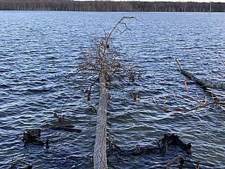
Splitrock Reservoir is 1,500 acres (610 ha) of wilderness, surrounding a 650 acre reservoir, located on the borders of Rockaway Township and Kinnelon, in Morris County, New Jersey, United States. Splitrock, along with the nearby Boonton Reservoir, provides water for Jersey City, New Jersey. The reservoir is surrounded by woods and can be reached by traveling a mile on a dirt road known as Split Rock Road. The reservoir is three miles from end to end, with many large islands. There is a man-made dam on the southwest end of the reservoir. The reservoir and surrounding natural area were opened to the public on November 21, 2003.

The Los Vaqueros Reservoir and watershed is located in the northern Diablo Range, within northeastern Contra Costa County, northern California. It was completed by the Contra Costa Water District (CCWD) in 1998 to improve the quality of drinking water for its 550,000 customers in Central and Eastern Contra Costa County. The reservoir is accessible via Vasco Road, a road which connects Brentwood and Livermore.

Wicomico Demonstration Forest is primarily forested land. This area is used by the Maryland Forest Service to demonstrate various timber management techniques and practices.

Dundas Valley Conservation Area is located on the Niagara Escarpment in Dundas, Ontario, a constituent community of Hamilton, Ontario, and is owned and operated by the Hamilton Conservation Authority. Its 40-kilometre trail system provides a connection to the Bruce Trail. The area contains a trailhead of the Hamilton-Brantford-Cambridge Trails, Canada's first fully developed interurban multi-use trail system, which is a part of the Trans Canada Trail.

The Great Lakes Circle Tour is a designated scenic road system connecting all of the Great Lakes and the St. Lawrence River. It consists of routes for circumnavigating the lakes, either individually or collectively. It was designated by the Great Lakes Commission in 1988.

Located in the southeastern section of Manchester, Connecticut, the Case Mountain Recreational Area encompasses 640 acres (2.6 km2) of combined open space and watershed land stretching from the Glastonbury border north to Case Pond. Some trails lead south across the Glastonbury border to a larger area of land owned by the Town of Manchester to maintain the Buckingham Reservoir and provide drinking water to Manchester. The land around the reservoir is open to recreation. While there is a hill named Case Mountain in this area, locals refer to this entire trail system and forest in Manchester and Glastonbury simply as “Case Mountain.”

This is a list of trails and greenways in Detroit.

The Mount Tammany Fire Road is an unpaved 4.5-mile (7.2 km) road on the eastern ridgeline of Kittatinny Mountain from Upper Yards Creek Reservoir to Mount Tammany, the 1,527-foot (465 m) prominence on the New Jersey side of the Delaware Water Gap. The fire road, located within Worthington State Forest, is maintained as a firebreak and access road for wildfire suppression efforts by the New Jersey Forest Fire Service. There are three helispots along the fire road used by the Forest Fire Service.

The Morrison Trail is a hiking trail system in Allegheny National Forest in northwestern Pennsylvania, consisting of 12 linear miles of trails. The system includes an entrance trail from Pennsylvania Route 59 that leads to a long loop trail, which in turn includes a cross-connector trail, enabling several different loops of various lengths.
