
The mountain pygmy possum ; also simply known as the burramys, is a small, mouse-sized nocturnal marsupial of Australia found in dense alpine rock screes and boulder fields, mainly southern Victoria and around Mount Kosciuszko in Kosciuszko National Park in New South Wales at elevations from 1,300 to 2,230 metres. At almost 14 cm (5.5 in), its prehensile tail is longer than its 11 cm (4.3 in) combined head and body length. Its diet consists of insects, fleshy fruits, nuts, nectar and seeds. Its body is covered in a thick coat of fine grey fur except for its stomach, which is cream coloured; its tail is hairless. On the underside of the female's body is a pouch containing four teats. This possum is the only extant species in the genus Burramys. It is also the only Australian mammal restricted to alpine habitat.
Mount Pisgah is the name of several mountains and places:
Bugger or buggar can at times be considered as a mild swear word. In the United Kingdom the term has been used commonly to imply dissatisfaction, refer to someone or something whose behaviour is in some way inconvenient or perhaps as an expression of surprise. In the United States, particularly in the Midwest and South, it is an inoffensive slang term meaning "small animal".

The Australian Alps are a mountain range in southeast Australia. It comprises an interim Australian bioregion, and is the highest mountain range in Australia. The range straddles the borders of eastern Victoria, southeastern New South Wales, and the Australian Capital Territory. It contains Australia's only peaks exceeding 2,000 m (6,600 ft) in elevation, and is the only bioregion on the Australian mainland in which deep snow falls annually. The range comprises an area of 1,232,981 ha.

Mount Baw Baw is a mountain summit on the Baw-Baw Plateau of the Great Dividing Range, located in Victoria, Australia. The name is from the Woiwurrung language spoken by Eastern Kulin people. It is of uncertain meaning, but possibly signifies, echo, or ghost.
One Tree Hill may refer to:

Mount Keira is a suburb and mountain in the Illawarra region of New South Wales, Australia.
Ararat or in Western Armenian Ararad may refer to:
Mount Albert may refer to:

The City of Blue Mountains is a local government area of New South Wales, Australia, governed by the Blue Mountains City Council. The city is located in the Blue Mountains, on the Great Dividing Range at the far western fringe of the Greater Sydney area.

Mount Victoria is a small township in the Blue Mountains of New South Wales, Australia. Mount Victoria is geographically the western most village and suburb of Greater Sydney on the great western highway in the City of Blue Mountains, located about 120 kilometres (75 mi) west-northwest by road from the Sydney central business district and at an altitude of about 1,052 metres (3,451 ft) AHD . The settlement had a population of 823 people at the 2011 Census.

The King River, a perennial river of the North-East Murray catchment of the Murray-Darling basin, is located in the Alpine and Hume regions of Victoria, Australia. It flows from the northwestern slopes of the Alpine National Park in the Australian Alps, through the King Valley, and joining with the Ovens River at the rural city of Wangaratta.
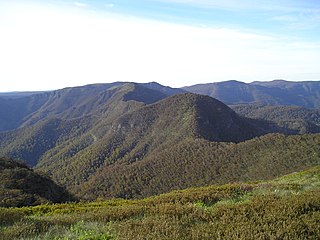
Mount Buggery is a mountain located in the Alpine Shire within the Alpine National Park in the alpine region of Victoria, Australia. The mountain is located on the end of a ridgeline known as the Crosscut Saw between Mount Speculation and Mount Howitt, both located 4 kilometres (2.5 mi) to the south of Mount Buggery.
Mount Leura is a 313-metre scoria cone surrounding a dry crater 100 m deep and is the central and most obvious component of a larger volcanic complex southeast of the town of Camperdown located in western Victoria, Australia, 194 kilometres (121 mi) south west of the state capital, Melbourne. The inactive volcano is thought to have last erupted between 5,000 and 20,000 years ago. The name means "big nose" in local aboriginal dialect.
Mount Toolebewong is a bounded rural locality in Victoria, Australia 65 kilometres north-east of Melbourne, located within the Shire of Yarra Ranges local government area. Mount Toolebewong recorded a population of 119 at the 2021 census.
Mount Warrnambool is a single large scoria cone volcano that is 216 metres (709 ft) high. It is 16 kilometres (10 mi) southwest of Terang, Victoria, Australia. It is visible from the Princes Highway on the way to Warrnambool.
Mount Buggery is a mountain located in the Wangaratta Rural City local government area, near Abbeyard above the Buffalo River in the alpine region of Victoria, Australia.
This page is based on this
Wikipedia article Text is available under the
CC BY-SA 4.0 license; additional terms may apply.
Images, videos and audio are available under their respective licenses.