
Hoima District is a district in Western Uganda. Like most other Ugandan districts, it is named after its main municipal centre, Hoima.

Masindi is a town in the Western Region of Uganda. It is on the road between Kampala and the Murchison Falls National Park. It is the site of the headquarters of the Masindi District.
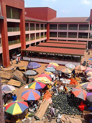
Hoima is the second capital of Uganda. It is the main municipal, administrative, and commercial center of Hoima District. It is also the location of the palace of the Omukama of Bunyoro.

Kibaale is a town in the Western Region of Uganda. It is the main municipal, administrative, and commercial center of Kibaale District, and the district headquarters are located there.

Kakiri is a town located in Wakiso District in the Central Region of Uganda. Kakiri is the site of the headquarters of the first division of the Uganda People's Defence Force (UPDF). It is also the hometown of Gilbert Bukenya, who represents the town and the surrounding constituency of Busiro North in the parliament of Uganda and is a former vice president of Uganda.

Buliisa District is a district in Western Uganda. As with most Ugandan districts, Buliisa District is named after its "main town" Buliisa, where the district headquarters are located. Bugungu has 6 sub counties: Kigwera, Ngwedo, Buliisa, Butiaba, Kihungya, and Biiso. It also contain 3 town councils: Buliisa, Butiaba and Biiso.
Kagadi is a town in the Western Region of Uganda. It is the commercial and administrative headquarters of Kagadi District.

Masindi Port is a town in the Western Region of Uganda. The name also applied to the sub-county, where the own sits and forms the sub-county headquarters.
Butiaba, is a town in the Western Region of Uganda. It is a fishing town and landing site on the shores of Lake Albert, in Uganda.

Kiryandongo District is a district in Western Uganda. Like many other Ugandan districts, it is named after its 'chief town', Kiryandongo, where the district headquarters are located.
Namayingo is a town in Namayingo District in the Eastern Region of Uganda. It is the site of the district headquarters.
Sanga, is an urban center in the Kiruhura District, Ankole sub-region, in the Western Region of Uganda.
Hoima–Butiaba–Wanseko Road is a road in the Western Region of Uganda, connecting the city of Hoima and the towns of Butiaba, Buliisa, and Wanseko on the shores of Lake Albert. This is one of Uganda's critical oil roads because it facilitates oil exploration in the Albertine Graben, as well as tourism, due to its proximity to Kabalega National Park.
Wanseko, is a settlement in Western Uganda.
The Kyenjojo–Kabwoya Road, in the Western Region of Uganda, connects the town of Kyenjojo in the Kyenjojo District with Kabwoya in the Hoima District. The road is part of the 238 kilometres (148 mi) Kyenjojo–Hoima–Masindi–Kigumba road corridor.
Kabalega International Airport, also Hoima International Airport, is an airport under construction in Hoima District, Uganda. It is part of the infrastructure under construction as Uganda prepares to develop its nascent petroleum industry. When completed, it would be Uganda's second international airport, besides Entebbe International Airport. The new airport is expected to facilitate mobilization of equipment for construction of the Uganda Oil Refinery and assist in the development of agriculture and tourism in Uganda's Western Region.
Namayumba is a settlement in the Wakiso District in the Buganda Region of Uganda. The name also refers to "Namayumba sub-county", the location of Namayumba settlement.
Kasenyi is a village in Ngedwo sub county, Buliisa District, in the Western Region of Uganda. It is the location of a "central processing facility" (CPF) of Uganda's oil fields in the Albertine Graben.

Kikuube District is a district in the Western Region of Uganda. It is named after its main municipal centre, Kikuube.
Kikuube is a town in the Western Region of Uganda. It is the main municipal, administrative, and commercial center of Kikuube District and the site of the district headquarters.

