The City of Whittlesea is a local government area located in the outer northern suburbs of Melbourne, the state capital of Victoria, Australia. The city covers an area of 490 square kilometres (189.2 sq mi), and in June 2018, it had a population of 223,322.

Attwood is a suburb in Melbourne, Victoria, Australia, 17 km (11 mi) north-west of Melbourne's Central Business District, located within the City of Hume local government area. Attwood recorded a population of 3,309 at the 2021 census.

Bulla is a locality and township in Melbourne, Victoria, Australia, 23 kilometres (14 mi) north-west of Melbourne's Central Business District, located within the City of Hume local government area. Bulla recorded a population of 668 at the 2021 census.

Greenvale is a suburb in Melbourne, Victoria, Australia, 20 km (12 mi) north of Melbourne's Central Business District, located within the City of Hume local government area. Greenvale recorded a population of 21,274 at the 2021 census.
Oaklands Junction is a bounded locality in Melbourne, Victoria, Australia, 25 km (16 mi) north-west of Melbourne's Central Business District, located within the City of Hume local government area. Oaklands Junction recorded a population of 439 at the 2021 census.

Gundagai is a town in New South Wales, Australia. Although a small town, Gundagai is a popular topic for writers and has become a representative icon of a typical Australian country town. Located along the Murrumbidgee River and Muniong, Honeysuckle, Kimo, Mooney Mooney, Murrumbidgee and Tumut mountain ranges, Gundagai is 390 kilometres (240 mi) south-west of Sydney. Until 2016, Gundagai was the administrative centre of Gundagai Shire local government area. In the 2021 census, the population of Gundagai was 2,057.
Ebenezer Syme was a Scottish-Australian journalist, proprietor and manager of The Age.

Abbotsford Bridge is a steel Allan truss-type road bridge that carries the Silver City Highway across the Murray River, between Curlwaa in New South Wales, and Yelta in Victoria, Australia. It is the only remaining steel truss bridge with a lift span that crosses the Murray. Opened in 1928, the bridge was built by the NSW Department of Public Works and was designed by Percy Allan. It was the second last vertical-lift bridge to be built over the river, the last being the Nyah Bridge, which opened in 1941.
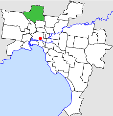
The City of Broadmeadows was a local government area about 20 kilometres (12 mi) north of Melbourne, the state capital of Victoria, Australia. The city covered an area of 63.65 square kilometres (24.58 sq mi), and existed from 1857 until 1994.
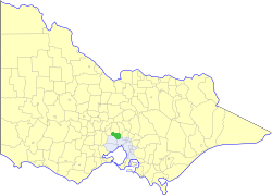
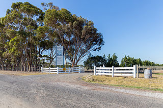
The Shire of Bulla was a local government area about 40 kilometres (25 mi) northwest of Melbourne, the state capital of Victoria, Australia. The shire covered an area of 422.17 square kilometres (163.0 sq mi), and existed from 1862 until 1994.

The Church Street Bridge is an historic road arch bridge over the Yarra River and the Monash Freeway in Melbourne, Victoria, Australia. It links Church Street in Richmond on the north bank with Chapel Street in South Yarra on the south.

The Deep Creek is a watercourse of the Port Phillip catchment, located in the outer north western suburbs of Melbourne, in the Australian state of Victoria.

The Jackson Creek is a watercourse within the Port Phillip catchment, located in the outer northern suburbs of Melbourne, in the Australian state of Victoria.

Clackline Bridge is a road bridge in Clackline, Western Australia, 77 kilometres (48 mi) east of Perth in the Shire of Northam, that carried the Great Eastern Highway until 2008. It is the only bridge in Western Australia to have spanned both a waterway and railway, the Clackline Brook and the former Eastern Railway alignment. The mainly timber bridge has a unique curved and sloped design, due to the difficult topography and the route of the former railway. The bridge was designed in 1934 to replace two dangerous rail crossings and a rudimentary water crossing. Construction began in January 1935, and was completed relatively quickly, with the opening ceremony held in August 1935. The bridge has undergone various improvement and maintenance works since then, including widening by three metres (10 ft) in 1959–60, but remained a safety hazard, with increasing severity and numbers of accidents through the 1970s and 1980s. Planning for a highway bypass of Clackline and the Clackline Bridge began in the 1990s, and it was constructed between January 2007 and February 2008. The local community had been concerned that the historic bridge would be lost, but it remains in use as part of the local road network, and has been listed on both the Northam Municipal Heritage Inventory and the Heritage Council of Western Australia's Register of Heritage Places.
Eveline Syme was an Australian artist associated with the Grosvenor School of Modern Art, and an advocate for women's post-secondary education.

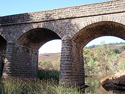
The Shelford Bridge is an important early wrought iron box girder road bridge built in 1873-4 over the River Leigh and designed by Charles Anthony Corbett Wilson (1827–1923) on the main road from Melbourne to Portland in Victoria, Australia.
McMillans Bridge, is a riveted wrought iron open web truss bridge, located over the Woady Yaloak River on the Rokewood-Skipton Road between Rokewood and Werneth on a historical route between Geelong and the 1850s goldfields at Ararat and Streatham.

Pitfield Bridge, is a riveted wrought iron, Warren truss road bridge, located over the Woady Yaloak Creek on the Rokewood-Skipton Road near Pitfield in Victoria, Australia. The bridge was originally constructed in the late 1850s, by the Woady Yallock Roads Board, and modified later in the century by construction of a large riveted wrought iron truss span.

Marion County Bridge 0501F, also known as Indiana State Bridge 534-C-3439 on SR 100, is a historic truss bridge located on the Michigan Road at Indianapolis, Marion County, Indiana. It was built in 1941–1942, as a bridge along the State Road 100 project. It consists of two identical Warren pony truss sections at each end with two Parker through truss spans at the center. The pony truss sections are each 96 feet long and the through truss spans are 174 feet long.

The Hay Bridge is a road bridge that carries the Cobb Highway across the Murrumbidgee River at Hay, New South Wales, Australia. The current bridge is the second bridge located in Hay that crosses the Murrumbidgee; the first bridge was in operation from 1873 until 1973; the second and current bridge has operated since 1973.