A stalactite is a mineral formation that hangs from the ceiling of caves, hot springs, or man-made structures such as bridges and mines. Any material that is soluble and that can be deposited as a colloid, or is in suspension, or is capable of being melted, may form a stalactite. Stalactites may be composed of lava, minerals, mud, peat, pitch, sand, sinter, and amberat. A stalactite is not necessarily a speleothem, though speleothems are the most common form of stalactite because of the abundance of limestone caves.

A speleothem is a geological formation made by mineral deposits that accumulate over time in natural caves. Speleothems most commonly form in calcareous caves due to carbonate dissolution reactions. They can take a variety of forms, depending on their depositional history and environment. Their chemical composition, gradual growth, and preservation in caves make them useful paleoclimatic proxies.

Speedwell Cavern is one of the four show caves in Castleton, Derbyshire, England.
The Parque da Cascata is the popular name of Parque Florestal Municipal de Sete Lagoas located at Serra Santa Helena, just 3 km (2 mi) from downtown Sete Lagoas, Minas Gerais, Brazil. It was created by decree on 27 September 1977.

Phong Nha-Kẻ Bàng is a national park and UNESCO World Heritage Site in the Bố Trạch and Minh Hóa districts of central Quảng Bình Province in the North Central Coast region of Vietnam, about 500 km south of Hanoi. The park borders the Hin Namno National Park in Khammouane Province, Laos to the west and 42 km east of the East sea from its borderline point. Phong Nha-Kẻ Bàng National Park is in a limestone zone of 2,000 km2 in Vietnamese territory and borders another limestone zone of 2,000 km2 of Hin Namno in Laotian territory. The core zone of this national park covers 857.54 km2 and a buffer zone of 1,954 km2.

Cave of the Winds is a cave in the Pikes Peak region of Colorado. It is located just west of Colorado Springs on U.S. Highway 24, near the Manitou Cliff Dwellings. Tours of the complex of caves are given daily.

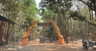
Kanger Valley National Park is a national park in the Bastar region of Chhattisgarh state in India. It came into existence in July 1982 and covers an area of approximately 200 square kilometres (77 sq mi). The park extends from the Teerathagarh waterfalls in the west to the Kolab river in the east, spanning an average length of 33.5 km (20.8 mi) and an average width of 6 km (3.7 mi) from north to south. It derives its name from the Kanger river, which flows centrally through it. Situated at a distance of 30 km (19 mi) southeast of Jagdalpur city, it is one of India's densest national parks and is known for its biodiversity, landscape, waterfalls, and subterranean geomorphologic limestone caves. It is also the home to the Bastar hill myna, the state bird of Chhattisgarh.

The Borra Caves(Borrā Guhalu) are located on the East Coast of India, in the Ananthagiri hills of the Araku Valley of the Alluri Sitharama Raju district in Andhra Pradesh. The caves, one of the largest in the country, at an elevation of about 705 m (2,313 ft), distinctly exhibit a variety of speleothems ranging in size and irregularly shaped stalactites and stalagmites. The caves are basically karstic limestone structures extending to a depth of 80 m (260 ft), and are considered the deepest caves in India. The native name for the caves is Borrā Guhalu where Borra means abdomen in and Guhalu means caves in Telugu language.

Alistrati is a small town in Serres, situated at the borders of the regional unit of Drama and regional unit of Serres, in the Macedonia region of Greece. It has approximately 2,300 inhabitants, a town hall and a visitable cave. It is 20 km away from Drama and 45 km away from Serres. It is a listed traditional settlement and archaeologists had found something there. Since 2010 Alistrati is part of the municipality New Zichni, of which it is a municipal unit. The municipal unit has an area of 129.878 km2. Alistrati was built like an amphitheatrical inside a fascinating mountain groups on hills of the mountain range Menikio on an altitude of 325m. In Alistrati there exists rising and sloping streets. Sea-winds blowing from Thassos and Staymonikon Bay influence Alistrati day by day. Alistrati, a traditional community one of the biggest of the area Zichni-Fillida. It's been up-graded to municipality of Alistrati with the "Kapodistrias" law and included the villages :Agioxori, Skopia, Mandili, Lefkothea and R.S of Aggista.

The Benxi Water Caves is a partially submerged cavern system containing a forest of stalactites and stalagmites, located 26 kilometres (16 mi) east of Benxi, Liaoning Province, People's Republic of China. It was made a national park on January 10, 1994, and is open to the public all year round. It was designated an "AAAAA"-class tourist attraction by CNTA in 2015.

Abukuma-do is a limestone cave located in Fukushima Prefecture, Japan. The cave was discovered on August 15, 1969, northeast of the city of Tamura and was originally named Kamayama Shonyu-do (釜山鍾乳洞). It was designated a natural heritage of the town on February 7, 1971, and renamed Abukuma-do on June 1, 1973. Visitors can traverse a 600-metre-long path inside the cave as well as a 120-metre-long exploration course to view the stalactites and stalagmites. Each stalactite has taken more than eighty million years to form. Beyond the public areas lie about 2,500 metres of cave that are not open to the public. Nearby Abukuma Cave is the smaller Irimizu Shonyu-do, discovered in 1927. Irimizu Limestone Cave was designated a National Natural Treasure on December 28, 1934. The temperature inside Abukuma-do is approximately 15 °C and the humidity is above 90%.

The Castellana Caves are a karst cave system located in the municipality of Castellana Grotte, in the Metropolitan City of Bari, Apulia, southern Italy.

Gruta de Maquiné (MG-0243), also Lapa Nova de Maquiné, is the oldest and one of the most commercially visited caves in Brazil. It is located about 5 km (3.1 mi) from Cordisburgo and 143 km (88.9 mi) northwest of Belo Horizonte, in the State of Minas Gerais. The cave has seven huge chambers explored, amounting to 650 m (2,130 ft) (linear) and unevenness of the ground of only 18 m (59 ft). Safety measures like lighting, walkways and handrails allow a multitude of visitors to enjoy safely the wonders of the grotto where the whole journey is accompanied by an experienced local guide.

Mirusha Park is a regional park located in the central part of Kosovo on the eastern side of the Dukagjin Plain.

Taman Hutan Raya Ir. H. Juanda, locally shortened to "Tahura" is a conservation area and botanical garden in Bandung, Indonesia.

Gunung Sewu Geopark or Sewu Mountains is a series of mountains stretching along the southern coast of Gunung Kidul Regency and Wonogiri Regency of Central Java, to Pacitan Regency of East Java in the island of Java, Indonesia. This is a national Geopark, which is also a member of Global Geopark Network (GGN), recognized by UNESCO in 2015.

Solkota Cave Natural Monument is a karst cave 2.3 km to the north of village Kumistavi, known for nearby Prometheus Cave Natural Monument, in Tskaltubo Municipality in Imereti region of Georgia. Cave is located on the left bank of river Semi, 379 meters above sea level.

Navenakhevi Cave Natural Monument is a karst cave near village Navenakhevi in Terjola Municipality in Imereti region of Western Georgia, 235 m above sea level. In 2017 cave was refurbished to be used as a tourist attraction.
Iazoni Cave Natural Monument also known as Tskaltsitela Cave is a karst cave located across the river Tskaltsitela near village Godogni, Terjola Municipality, just outside Kutaisi in Imereti region of Georgia, 135 metres above sea level. Cave is on the right bank of Tskaltsitela river, the tributary of the Rioni, near Godogni village bridge.

Toba Waterfall and Arsen Okrojanashvili Cave Natural Monument is the highest in Georgia cascading waterfall of 234 m height and a karst cave complex located 5.6 km to the west from village First Balda in Martvili Municipality, Samegrelo-Zemo Svaneti region of Georgia. It is located at 707 metres above sea level on the left bank of Toba river, left-bank tributary of Abasha river and can be reached by marked hiking trail.


