The Great Barrier Reef is the world's largest coral reef system, composed of over 2,900 individual reefs and 900 islands stretching for over 2,300 kilometres (1,400 mi) over an area of approximately 344,400 square kilometres (133,000 sq mi). The reef is located in the Coral Sea, off the coast of Queensland, Australia, separated from the coast by a channel 160 kilometres (100 mi) wide in places and over 61 metres (200 ft) deep. The Great Barrier Reef can be seen from outer space and is the world's biggest single structure made by living organisms. This reef structure is composed of and built by billions of tiny organisms, known as coral polyps. It supports a wide diversity of life and was selected as a World Heritage Site in 1981. CNN labelled it one of the Seven Natural Wonders of the World in 1997. Australian World Heritage places included it in its list in 2007. The Queensland National Trust named it a state icon of Queensland in 2006.

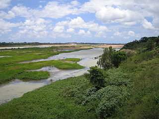
The Burdekin River is a river in North and Far North Queensland, Australia. The river rises on the northern slopes of Boulder Mountain at Valley of Lagoons, part of the western slope of the Seaview Range, and flows into the Coral Sea at Upstart Bay over 200 kilometres (124 mi) to the southeast of the source, with a catchment area of approximately 130,000 square kilometres (50,000 sq mi). The Burdekin River is Australia's largest river by (peak) discharge volume.

Greening Australia is an Australian environmental organisation, founded in 1982, the International Year of the Tree, to protect, restore and conserve Australia's native vegetation. Greening Australia was formed by the United Nations Association of Australia and the Nursery Industry Association of Australia.

Rain gardens, also called bioretention facilities, are one of a variety of practices designed to increase rain runoff reabsorption by the soil. They can also be used to treat polluted stormwater runoff. Rain gardens are designed landscape sites that reduce the flow rate, total quantity, and pollutant load of runoff from impervious urban areas like roofs, driveways, walkways, parking lots, and compacted lawn areas. Rain gardens rely on plants and natural or engineered soil medium to retain stormwater and increase the lag time of infiltration, while remediating and filtering pollutants carried by urban runoff. Rain gardens provide a method to reuse and optimize any rain that falls, reducing or avoiding the need for additional irrigation. A benefit of planting rain gardens is the consequential decrease in ambient air and water temperature, a mitigation that is especially effective in urban areas containing an abundance of impervious surfaces that absorb heat in a phenomenon known as the heat-island effect.

The Ministry of Environment is the South Korea branch of government charged with environmental protection. In addition to enforcing regulations and sponsoring ecological research, the Ministry manages the national parks of South Korea. Its headquarters is in Sejong City.
NQ Dry Tropics is the natural resource management body for the Burdekin Dry Tropics region. Based in Townsville, it is an independent, community based, not-for-profit organisation that has been delivering on-ground Natural Resource Management (NRM) activities since 2005 to enhance the sustainability of the region's natural resources including water, soil and biodiversity.

The Burdekin Falls Dam, also known as the Burdekin Dam, is a concrete gravity dam with an uncontrolled spillway across the Burdekin River in the Whitsunday Region, Queensland, Australia. Built for the purpose of irrigation, the reservoir is called Lake Dalrymple, and is on the boundary of the Whitsunday Region and the Charters Towers Region. Burdekin Falls Dam is managed by SunWater. Water from the reservoir is also used to replenish downstream aquifers.

The Water Framework Directive (WFD)2000/60/EC is an EU directive to establish a framework for the protection of all water bodies (including marine waters up to one nautical mile from shore) by 2015. The WFD establishes a programme and timetable for Member States to set up River Basin Management Plans by 2009.

Water efficiency is the practice of reducing water consumption by measuring the amount of water required for a particular purpose and is proportionate to the amount of essential water used. Water efficiency differs from water conservation in that it focuses on reducing waste, not restricting use. Solutions for water efficiency not only focus on reducing the amount of potable water used but also on reducing the use of non-potable water where appropriate. It also emphasizes the influence consumers can have on water efficiency by making small behavioral changes to reduce water wastage, and by choosing more water-efficient products.

Nutrient pollution, a form of water pollution, refers to contamination by excessive inputs of nutrients. It is a primary cause of eutrophication of surface waters, in which excess nutrients, usually nitrogen or phosphorus, stimulate algal growth. Sources of nutrient pollution include surface runoff from farm fields and pastures, discharges from septic tanks and feedlots, and emissions from combustion. Raw sewage is a large contributor to cultural eutrophication since sewage is high in nutrients. Releasing raw sewage into a large water body is referred to as sewage dumping, and still occurs all over the world. Excess reactive nitrogen compounds in the environment are associated with many large-scale environmental concerns. These include eutrophication of surface waters, harmful algal blooms, hypoxia, acid rain, nitrogen saturation in forests, and climate change.

The Urban Waste Water Treatment Directive 1991 European Union directive concerning urban waste water "collection, treatment and discharge of urban waste water and the treatment and discharge of waste water from certain industrial sectors". It aims "to protect the environment from adverse effects of waste water discharges from cities and "certain industrial sectors". Council Directive 91/271/EEC on Urban Wastewater Treatment was adopted on 21 May 1991, amended by the Commission Directive 98/15/EC.
Green Fins is an approach to sustainable marine tourism activities operating in Southeast Asia, Caribbean and the Indian Ocean that works with business operators, communities and governments. It helps to implement environmental standards for the diving and snorkelling industry through a code of conduct. The overall aim of the initiative is to mitigate damaging impacts to the marine environment from the marine tourism sector and improve sustainability. The code of conduct is a set of 15 points designed to tackle the most common and detrimental effects of scuba diving and snorkelling activities on the habitat in which they operate.

Nonpoint source (NPS) water pollution regulations are environmental regulations that restrict or limit water pollution from diffuse or nonpoint effluent sources such as polluted runoff from agricultural areas in a river catchments or wind-borne debris blowing out to sea. In the United States, governments have taken a number of legal and regulatory approaches to controlling NPS effluent. Nonpoint water pollution sources include, for example, leakage from underground storage tanks, storm water runoff, atmospheric deposition of contaminants, and golf course, agricultural, and forestry runoff.

Point source water pollution comes from discrete conveyances and alters the chemical, biological, and physical characteristics of water. In the United States, it is largely regulated by the Clean Water Act (CWA). Among other things, the Act requires dischargers to obtain a National Pollutant Discharge Elimination System (NPDES) permit to legally discharge pollutants into a water body. However, point source pollution remains an issue in some water bodies, due to some limitations of the Act. Consequently, other regulatory approaches have emerged, such as water quality trading and voluntary community-level efforts.

Water-sensitive urban design (WSUD) is a land planning and engineering design approach which integrates the urban water cycle, including stormwater, groundwater, and wastewater management and water supply, into urban design to minimise environmental degradation and improve aesthetic and recreational appeal. WSUD is a term used in the Middle East and Australia and is similar to low-impact development (LID), a term used in the United States; and Sustainable Drainage System (SuDS), a term used in the United Kingdom.
The North Carolina Coastal Federation is a nonprofit organization that works with coastal residents and visitors to protect and restore the beautiful and productive N.C. coast. The four main areas in which the federation operates include: coastal advocacy; environmental education; habitat and water quality restoration and preservation; and support in the improvement and enforcement of environmental laws. The federation headquarters are located in Newport (Ocean), North Carolina, with regional offices in Wanchese and Wrightsville Beach, North Carolina. The federation is currently a member of Restore America's Estuaries (RAE).

A Living shoreline is a relatively new approach for addressing shoreline erosion and protecting marsh areas. Unlike traditional structures such as bulkheads or seawalls that worsen erosion, living shorelines incorporate as many natural elements as possible which create more effective buffers in absorbing wave energy and protecting against shoreline erosion. The process of creating a living shoreline is referred to as soft engineering, which utilizes techniques that incorporate ecological principles in shoreline stabilization. The natural materials used in the construction of living shorelines create and maintain valuable habitats. Structural and organic materials commonly used in the construction of living shorelines include sand, wetland plants, sand fill, oyster reefs, submerged aquatic vegetation, stones and coir fiber logs.

Hussainsagar Lake and Catchment Area Improvement Project is a project led by Hyderabad Metropolitan Development Authority to improve the quality of Hussain Sagar Lake (pictured) in Hyderabad, India.

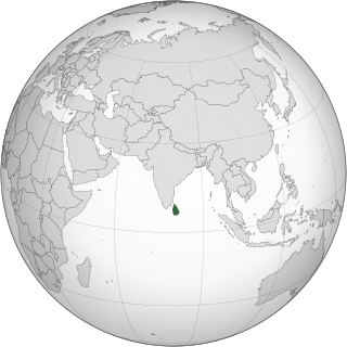
Environmental issues in Sri Lanka include large-scale logging of forests and degradation of mangroves, coral reefs and soil. Air pollution and water pollution are challenges for Sri Lanka since both cause negative health impacts. Overfishing and insufficient waste management, especially in rural areas, leads to environmental pollution. Sri Lanka is also vulnerable to climate change impacts such as extreme weather events and sea level rise.

The Queensland State Soils Collection is a Queensland Government scientific collection based in Queensland, Australia. The collection is a component of the Queensland Government's response to the need to understand the properties of soil across the state.


