Related Research Articles

New South Wales is a state on the east coast of Australia. It borders Queensland to the north, Victoria to the south, and South Australia to the west. Its coast borders the Coral and Tasman Seas to the east. The Australian Capital Territory is an enclave within the state. New South Wales' state capital is Sydney, which is also Australia's most populous city. In June 2020, the population of New South Wales was over 8.1 million, making it Australia's most populous state. Just under two-thirds of the state's population, 5.3 million, live in the Greater Sydney area. The demonym for inhabitants of New South Wales is New South Welshmen; some have protested this term, but there is no commonly accepted alternative.

The geography of France consists of a terrain that is mostly flat plains or gently rolling hills in the north and west and mountainous in the south and the east. Metropolitan France has a total size of 551,695 km2 (213,011 sq mi). It is the third largest country in Europe after Russia and Ukraine.

Woollahra is a suburb in the Eastern Suburbs of Sydney, in the state of New South Wales, Australia. Woollahra is located 5 kilometres east of the Sydney central business district, in the local government area of the Municipality of Woollahra. The Municipality of Woollahra takes its name from the suburb but its administrative centre is located in Double Bay. Woollahra is famous for its quiet, tree-lined residential streets and village-style shopping centre.

Mongarlowe is a village in the Southern Tablelands of New South Wales, Australia in Queanbeyan-Palerang Regional Council. In former times, it was also known, in various contexts, as Little River, Monga, and Sergeants Point.

The border between the Australian state of South Australia and what is today the State of Victoria was established in 1836 by imperial letters patent "as the 141st degree meridian of longitude east of Greenwich". In 1836 the land in what is now called Victoria was part of the colony of New South Wales, the original Victorian border was drawn between the colonies of South Australia and New South Wales. Due to human error by numerous explorers and surveyors, it took more than 75 years and a protracted legal dispute before the precise placement of the border was settled, resulting in the forfeiture of more than 1,300 km2 (500 sq mi) of territory from South Australia to Victoria.

The Port Phillip District was a historical administrative division of the Colony of New South Wales, which existed from September 1836 until 1 July 1851, when it was separated from New South Wales and became the Colony of Victoria.

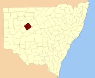
For lands administrative purposes, New South Wales is divided into 141 counties, which are further divided into parishes. The counties were first set down in the Colony of New South Wales, which later became the Australian state of New South Wales.

Henry Dangar was a surveyor and explorer of Australia in the early period of British colonisation. He became a successful pastoralist and businessman, and also served as a magistrate and politician. He was born on 18 November 1796 at St Neot, Cornwall, United Kingdom, and was the first of six brothers to emigrate as free settlers to New South Wales. From 1845 to 1851 Dangar was a Member of the New South Wales Legislative Council.
Coldstream River, a watercourse of the Clarence River catchment, is located in the Northern Rivers district of New South Wales, Australia.
Krui River, a perennial river of the Hunter River catchment, is located in the Upper Hunter region of New South Wales, Australia.
Danglemah is a bounded rural locality in the New England region of Australia.
The Border Police of New South Wales was a frontier policing body introduced by the New South Wales colonial government with the passing of the Crown Lands Unauthorised Occupation Act 1839.
Albert Parish located at 32°00'54.0"S 141°08'29.0"E is a remote rural locality, and cadastral Parish of Yancowinna County, far western New South Wales. The parish is on the Barrier Highway midway between Broken Hill, New South Wales and Cockburn on the South Australian border.
Donalroe Parish in Cobar Shire is a civil parish of Rankin County,; a Cadastral division of New South Wales.
Yantabulla, New South Wales is a ghost town in far north west New South Wales, Australia. It is on the border of New South Wales and Queensland.

Queensland is the north-eastern state of Australia and has land borders with three other Australian states and territories: New South Wales, South Australia and Northern Territory. To the north of Queensland is the Torres Strait separating the Australian mainland from Papua New Guinea. To the east of Queensland is the Coral Sea, part of the Pacific Ocean. There are many islands off the Queensland coast which form part of the state of Queensland.
Wallarunga is a rural locality and ghost town located at -32.031799316 and 141.317901611 about 10 Kilometers south west of Broken Hill, New South Wales.
Purnamoota is a rural locality, cattle station and ghost town of the Unincorporated Far West and a civil parish of Yancowinna County, and is located about 23 kilometers north of Broken Hill, New South Wales, Australia.
Yancowinna County is a rural locality in Unincorporated Far West and a civil parish of Yancowinna County in far western New South Wales.

Numeralla is a village in Snowy Monaro Region of New South Wales, Australia. In 2016, the population of the village and its surrounding area was 258. The village was known as Umaralla until 1972.
References
- ↑ Map of the County of Yancowinna, Western Division N.S.W., Land District of Willyama / compiled, drawn & printed at the Department of Lands, Sydney, N.S.W.
- ↑ David R Horton (creator), © Aboriginal Studies Press, AIATSIS, and Auslig/Sinclair, Knight, Merz, 1996.
- ↑ "History." Broken Hill: Accessible Outback. 2007, Edition 15, p4.