Burnside Island

Last updated

Burnside Island
Australia Western Australia location map.svg
Red pog.svg
Burnside Island
Geography
Coordinates 22°06′21″S114°30′31″E / 22.105833333333333°S 114.50861111111111°E / -22.105833333333333; 114.50861111111111
Area59 ha (150 acres) [1]
Administration

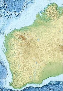
Burnside Island lies on the eastern side of Exmouth Gulf on the coast of Western Australia.

The southern tip of Burnside Island is located 1 km due east of the northern end of Simpson Island. The low, straight, narrow 2 km long island faces west-northwest into the gulf. It consists of the narrow high tide beach (WA 1637) backed by low scarped calcarenite bluffs, and a low grassy ridge widening to 200 m towards the northern end of the island. A 2 km wide mangrove-lined tidal creek backs the island. One kilometre to the north is Wilderness Island which is a more irregular, low 200 ha island consisting of a more exposed west-facing side. [1] Burnside Island is a popular bird watching and fishing location.

Burnside Island was named while the Royal Australian Navy was surveying the area in 1954. [2]

See also

Related Research Articles

<span class="mw-page-title-main">Cocklebiddy, Western Australia</span> Roadhouse community in Western Australia

Cocklebiddy is a small roadhouse community located on the Eyre Highway in Western Australia. It is the third stop after Norseman on the journey east across the Nullarbor Plain. The area is noted for its caves and lakes.

St Alouarn Islands are a group of islands and rocks south-east of Cape Leeuwin in Western Australia, approximately 11 km south of Augusta in Flinders Bay.

<span class="mw-page-title-main">Wannanup</span> Suburb of Mandurah, Western Australia

Wannanup is a residential suburb in Western Australia, located 12 kilometres (7 mi) southwest of Mandurah and 87 kilometres (54 mi) south-southwest of the state capital, Perth. It is surrounded on three sides by water – the Indian Ocean to the west, the Harvey Estuary to the east and the Dawesville Channel to the south – and is home to the Port Bouvard development. It is one of four suburbs which lie on an island created by the building of the Dawesville Channel.

<span class="mw-page-title-main">Toolinna Cove</span> Small bay on south coast of Wesdtern Australia

Toolinna Cove is a cove on the south coast of Western Australia. It is a sea-cove along the Baxter Cliffs at the western end of the Great Australian Bight, in Nuytsland Nature Reserve. It is the only place between Point Culver and Twilight Cove where a boat can be landed.

<span class="mw-page-title-main">King Sound</span> Gulf in Kimberley region of Western Australia

King Sound is a large gulf in northern Western Australia. It expands from the mouth of the Fitzroy River, one of Australia's largest watercourses, and opens to the Indian Ocean. It is about 120 kilometres (75 mi) long, and averages about 50 kilometres (31 mi) in width. The port town of Derby lies near the mouth of the Fitzroy River on the eastern shore of King Sound. King Sound has the highest tides in Australia, and amongst the highest in the world, reaching a maximum tidal range of 11.8 metres (39 ft) at Derby. The tidal range and water dynamic were researched in 1997–1998.

Western Australia has the longest coastline of any state or territory in Australia, at 10,194 km or 12,889 km. It is a significant portion of the coastline of Australia, which is 35,877 km.

Oakajee Port is a proposed deep water port to be built in the Mid West region of Western Australia, 24 kilometres (15 mi) north of Geraldton, to service the region's growing iron ore industry.

Prince Frederick Harbour lies at the southern end of the York Sound, in the Kimberley region of Western Australia, opening into the Indian Ocean.

<span class="mw-page-title-main">Seal Island (St Alouarn Islands)</span> Island near Augusta, Western Australia in the South West region

Seal Island is located near Augusta, Western Australia in the South West region.

<span class="mw-page-title-main">Becher Point</span>

Becher Point is the southernmost point of Warnbro Sound in Port Kennedy in Western Australia. It was the site of multiple ship beachings. It is a reference point for the adjacent Ramsar Becher Point Wetlands that lie inland from the point. It offers significant conservation value. It has been identified as a site for assessing Holocene environment on the coastline. As a place name, Port Kennedy is the name of a locality that is found where Becher point is, however Port Kennedy is not a notable coastal feature.

Cape Dussejour is located at the western side of the entrance to the Cambridge Gulf in the Kimberley region of Western Australia.

Cape Clairault is located south of Yallingup in the coastal region between Cape Naturaliste and Cape Leeuwin.

Boongaree Island is located off the Kimberley coast of Western Australia.

<span class="mw-page-title-main">Pondalowie Bay</span> Bay in Spencer Gulf

Pondalowie Bay is a bay in the Australian state of South Australia located on the west coast of the south-west tip of Yorke Peninsula in Spencer Gulf about 12 kilometres west of Marion Bay. The coastline of Pondalowie Bay is both within the gazetted locality of Inneston and the Innes National Park.

<span class="mw-page-title-main">Favorite Island</span> Island of Western Australia

Favorite Island is an island near Jurien Bay in Western Australia.

Germein Bay is a bay in the Australian state of South Australia located at the northern end Spencer Gulf on the gulf's east coast to the immediate north of the city of Port Pirie. Its extent includes the port known as ‘Port Pirie’ and the former port of Port Germein. Since 2012, the majority of the bay has been within the protected area known as the Upper Spencer Gulf Marine Park.

Twilight Cove is situated at the end of the Baxter Cliffs on the south coast of Western Australia on the Great Australian Bight coastline. It has had other names, including Malbinya.

Wilson Bluff is a coastal cliff on the Australian continental coastline, extending from east of Eucla in Western Australia to south of Border Village in South Australia. It was first recorded in 1885 as Wilson Point, but was Wilson Bluff in volume one of the Australian Pilot 1914–1918 edition. It is reported as being named after "Professor Wilson of Victoria" by E. A. Delisser, a surveyor employed by DeGraves and Co., a pastoral company.

<span class="mw-page-title-main">Baxter Cliffs</span> Coastal cliffs in Western Australia

The Baxter Cliffs is a long stretch of coastal cliff on the south coast of Western Australia.

<span class="mw-page-title-main">Whitlock Island (Carnarvon)</span> Island of Western Australia

Whitlock Island is an island near Carnarvon in Western Australia. It was named after Frank Whitlock who was a mayor of Carnarvon between 1908 and 1915.

References

  1. 1 2 Andrew D. Short (2005). Beaches of the Western Australian Coast - Eucla to Roebuck Bay: A Guide to Their Nature, Characteristics, Surf and Safety. Sydney University Press. ISBN   978-0-9586504-3-4.
  2. page 39 Murray, Ian; Hercock, Marion; Murray, Ian; Hercock, Marion (2008), Where on the coast is that?, Hesperian Press, ISBN   978-0-85905-452-2