
Sunbury County is located in central New Brunswick, Canada. A large military base is located in the western part of the county south of the town of Oromocto. The county also hosts forestry and mixed farming. Burton is the county shire town.

The Welland Canal is a ship canal in Ontario, Canada, and part of the St. Lawrence Seaway and Great Lakes Waterway. The canal traverses the Niagara Peninsula between Port Weller on Lake Ontario, and Port Colborne on Lake Erie, and was erected because the Niagara River—the only natural waterway connecting the lakes—was unnavigable due to Niagara Falls. The Welland Canal enables ships to ascend and descend the Niagara Escarpment, and has followed four different routes since it opened.

The St. Croix River is a river in northeastern North America, 71 miles (114 km) in length, that forms part of the Canada–United States border between Maine (U.S.) and New Brunswick (Canada). The river rises in the Chiputneticook Lakes and flows south and southeast, between Calais and St. Stephen. It discharges into Passamaquoddy Bay, in the Bay of Fundy.
This is a list of the extreme points of Europe: the geographical points that are higher or farther north, south, east or west than any other location in Europe. Some of these positions are open to debate, as the definition of Europe is diverse.

The Reversing Falls are a series of rapids on the Saint John River located in Saint John, New Brunswick, Canada, where the river runs through a narrow gorge before emptying into the Bay of Fundy.

Potton is a township municipality of about 2,500 people in the Memphrémagog Regional County Municipality. It is located on the western shore of Lake Memphremagog in the Estrie region of Quebec, and is one of the municipalities in Brome County. Potton is located about 125 kilometres (78 mi) southeast of Montreal, 30 kilometres (19 mi) to the southwest of the city of Magog, and next to the United States border, north of North Troy, Vermont.
5th Canadian Division Support Base Gagetown, formerly known as and commonly referred to as CFB Gagetown, is a large Canadian Forces Base covering an area over 1,100 km2 (420 sq mi), located in southwestern New Brunswick. It is the biggest facility in Eastern Canada, and Canada's second-largest facility.

The Canso Canal is a short canal located in Nova Scotia, Canada.
LeBreton Flats, known colloquially as The Flats, is a neighbourhood in Somerset Ward in central Ottawa, Ontario, Canada. It lies to the west of Centretown neighbourhood, and to the north of Centretown West. The Ottawa River forms the western and northern limit, with the western side being a wider area of the river known as Nepean Bay.
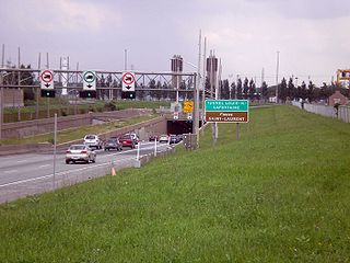
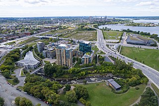
The Louis-Hippolyte Lafontaine Bridge–Tunnel is a highway bridge–tunnel running over and beneath the Saint Lawrence River. It connects the Montreal borough of Mercier–Hochelaga-Maisonneuve with the south shore of the river at Longueuil, Quebec.
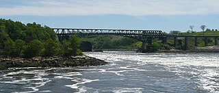
The Reversing Falls Railway Bridge is the name given to two different steel truss bridges crossing the Saint John River at the same location in Saint John, New Brunswick, Canada.

The Saint John Harbour Bridge is three-span crossing of Saint John Harbour at the mouth of the Saint John River in Saint John, New Brunswick, Canada. It opened in 1968.
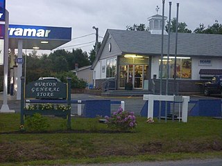
Burton is a Canadian rural community in Sunbury County, New Brunswick.
The Jemseg River is a short river in the Canadian province of New Brunswick which drains Grand Lake into the Saint John River.
The Nerepis River is a river approximately 25 miles (40 km) long in New Brunswick, Canada. A popular river for canoeists and anglers, it is a tributary of the Saint John River. The river has been subjected to significant environmental stress over many years.

The Metamora was a wooden tug commissioned in 1864 and used predominantly for ferrying passengers and goods in the Georgian Bay area of Ontario. It ran onto a shallow shoal near Turning Island in Georgian Bay on July 30, 1907, caught fire and sank in six feet of water.
Route 690 is a 45.6-kilometre (28.3 mi) long mostly north–south secondary highway in the southwestern portion of New Brunswick, Canada. Most of the route is in Canning Parish.
Route 760 is a 37.4-kilometre (23.2 mi) long mostly west–east secondary highway in the southwestern portion of New Brunswick, situated in Canada.

L'Avenue is a mixed-use skyscraper complex in Montreal, Quebec, Canada. It is located across from the Bell Centre in downtown Montreal, on Avenue des Canadiens-de-Montréal between de la Montagne Street and Drummond Street.

Ferry Bridge is a Victorian pedestrian bridge over the River Trent in Staffordshire, England. The bridge and its extension, the Stapenhill Viaduct, link Burton upon Trent town centre to the suburb of Stapenhill half a mile away on the other side of the river.