Route
101
Route 101 operates every 20 – 30 minutes from Talbot Street in Dublin City Centre to Drogheda Bus Station. It runs along the Swords Quality Bus Corridor, via Gardiner Street, Dorset Street, Drumcondra Road Lower, Drumcondra Road Upper, Swords Road, Dublin Airport, Dublin Road (Swords), Swords Bypass, Lissenhall, Blakes Cross, Balrothery, Dublin Street (Balbriggan), Bridge Street (Balbriggan), Drogheda Street (Balbriggan), Gormanston Cross, Julianstown and Dublin Road (Drogheda), utilising the R132 road for a large portion of its journey. [3]
101X & 100X
Route 101X is a peak time express service from Wilton Terrace in Dublin city centre to Termon Abbey, north of Drogheda. Services operate via Baggot Street Lower, Pembroke Street, Leeson Street, Dawson Street, Suffolk Street, Westmoreland Street, Eden Quay, North Wall Quay, Dublin Port Tunnel, M1 motorway, Balrothery, then follow the same route as the 101 as far as Drogheda Bus Station and continues out to Termon Abbey. [4]
Route 100X is an hourly express service from Wilton Terrace in Dublin city centre to Long Walk in Dundalk. It follows the same route as the 101X as far as the Dublin Port Tunnel, then operates via M1 motorway, Dublin Airport, M1 motorway, Drogheda Bus Station, M1 motorway, Dundalk I.T. and Long Walk, Dundalk. Some services also serve Dunleer and Castlebellingham. [5]
Most of the transport system in Ireland is in public hands, either side of the Irish border. The Irish road network has evolved separately in the two jurisdictions into which Ireland is divided, while the Irish rail network was mostly created prior to the partition of Ireland.

Swords in County Dublin, the county town of the local government area of Fingal, is a large suburban town on the east coast of Ireland, situated ten kilometres north of Dublin city centre. It is the eighth largest urban area in Ireland, with a population of 40,776 as of the 2022 census. The town was reputedly founded c. AD 560. Located on the Ward River, Swords features Swords Castle, a restored medieval castle, a holy well from which it takes its name, a round tower and a Norman tower. Facilities in the area include the Pavilions shopping centre, one of the largest in the Dublin region, a range of civic offices, some light industries, the main storage facility and archive of the National Museum of Ireland and several parks. Dublin Airport is located nearby.

The M1 motorway is a motorway in Ireland. It forms the large majority of the N1 national primary road connecting Dublin towards Belfast along the east of the island of Ireland. The route heads north via Swords, Drogheda and Dundalk to the Northern Irish border just south of Newry in County Armagh, where it joins the A1 road and further on, the M1 motorway in Northern Ireland. It also forms a significant part of the road connection between Dublin and the Northern Irish cities of Newry, and Lisburn. The route is part of European route E01.

Balbriggan is a coastal town in Fingal, in the northern part of the traditional County Dublin, Ireland. It is approximately 34 km north of the city of Dublin, for which it is a commuter town. The 2022 census population was 24,322 for Balbriggan and its environs, the 17th largest urban area in Ireland. The town formerly had an active textile industry, and was the site of a major episode in the Irish War of Independence.

Bus Éireann is a state-owned bus and coach operator providing services throughout Ireland, with the exception of Dublin, where bus services are provided by sister company Dublin Bus. It is a subsidiary of Córas Iompair Éireann (CIÉ). The company's primary hub is Busáras, located in Store Street, Dublin. In 2022 it operated 229 Public Service Obligation Routes, 14 expressway routes and 8940 school transport routes.

National Development Plan is the title given by the Irish Government to a scheme of organised large-scale expenditure on (mainly) national infrastructure. The first five-year plan ran from 1988 to 1993, the second was a six-year plan from 1994 to 1999 and the third ran as a seven-year plan from 2000 to 2006. A fourth National Development Plan ran from 2007 to 2011. The main elements of the third plan were the development of a national motorway network between the major cities in Ireland. The upgrading of the rail network was a secondary scheme.

Connolly station or Dublin Connolly is the busiest railway station in Dublin and Ireland, and is a focal point in the Irish route network. On the North side of the River Liffey, it provides InterCity, Enterprise and commuter services to the north, north-west, south-east and south-west. The north–south Dublin Area Rapid Transit (DART) and Luas red line light rail services also pass through the station. The station offices are the headquarters of Irish Rail, Iarnród Éireann. Opened in 1844 as Dublin Station, the ornate facade has a distinctive Italianate tower at its centre.

Dunleer is a town and townland in County Louth, Ireland. Dunleer is situated midway between Dundalk and Drogheda and is located on the junction of the R132, R169 and R170 regional roads that intersect the town. As of the 2022 census, the town had a population of 2,143.

A regional road in the Republic of Ireland is a class of road not forming a major route, but nevertheless forming a link in the national route network. There are over 11,600 kilometres of regional roads. Regional roads are numbered with three-digit route numbers, prefixed by "R". The equivalent road category in Northern Ireland are B roads.
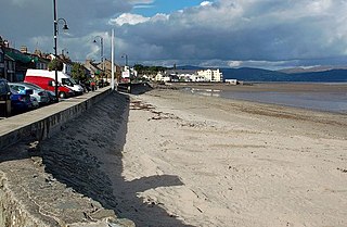
Blackrock is a seaside village just to the south of Dundalk, County Louth, Ireland. The village is in the townland of Haggardstown, in the Barony of Upper Dundalk, and part of the Dundalk metropolitan area. The population of the village is approximately 3,000.

The Belfast–Dublin Line is the busiest railway route on the island of Ireland, connecting Dublin Connolly station in the Republic of Ireland and Belfast Grand Central station in Northern Ireland. It is the only railway line that crosses the Republic of Ireland–United Kingdom border.
The R132 road is one of Ireland's newest regional roads, having been classified following the opening M1 motorway which by-passes most of the old N1 route. The R132 is 98.9 kilometres (61.5 mi) long.

Many companies operate public transport services in Dublin, most of which are state-owned or semi-state-owned.
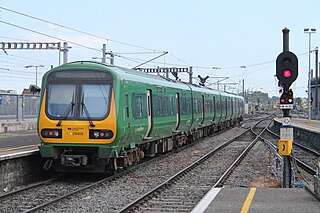
The Dublin Suburban Rail network, branded as Commuter, is a railway network that serves the city of Dublin, Ireland, most of the Greater Dublin Area and outlying towns. The system is made up of five lines:

Gormanston is a village in County Meath, Ireland. It is near the mouth of the River Delvin and the northern border of County Dublin.
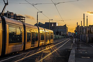
This article deals with transport in the Greater Dublin Area centred on the city of Dublin in Ireland.
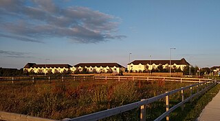
Holywell is a neighbourhood near Swords, Dublin, Ireland. Developed and marketed in phases and under various names, Feltrim Hall, Gorse Hill, Abbey Stone, Holywell and The Meadows, all the street names in the community include the common name Holywell e.g. Holywell Drive. It is the eastern part of the urban area of Kinsealy–Drinan, separated from the western part by the M1 motorway.

Applewood is a neighbourhood in the suburban town of Swords, near Dublin, Ireland. It was built around the year 2002 by property developer Gerry Gannon. It has been designed "village-style" with shops in the centre and housing estates surrounding this. In 2006, it won the Best Urban Village award at the National Tidy Towns competition.

Rathbeale is a neighbourhood in the town of Swords in Ireland. It developed in west Swords along the Rathbeale Road (R125), which runs from Swords to the townland of Rathbeal. It has been designed around the Rathbeale Road, which has shops, including two supermarkets, with housing estates on either side of the road.

Brackenstown is a neighbourhood in the north Dublin suburb of Swords in Ireland. It developed in west Swords on the north side of the Ward River. It developed along the Brackenstown Road, which runs from Swords to the townland of Knocksedan. Brackenstown was initially part of the Finglas-Swords social housing expansion, where the estates of St.Cronans, Glasmore, and Brackenstown Village were constructed. It was estimated that over 5,000 people benefited from this, primarily being relocated from Gardiner Street. Following its construction, Brackenstown's address was Finglas, Dublin 11. This was due to a social divide between the native people of Swords Village, not wanting the association with the rise in antisocial behaviour in Brackenstown. Gangland feuds once ruled the area upon its construction and its ties to Finglas Village were stronger than to Swords. Following the Celtic tiger, and the large expansion of Swords. Brackenstown became surrounded by a new sprawling Dublin suburb, and modernly is a small area located in the major Dublin city suburb of Swords. Brackenstown has shops, including a supermarket and a pub, and is adjacent to the Ward River Valley Park. Brackenstown is also a parish in the Fingal North deanery of the Roman Catholic Archdiocese of Dublin.


