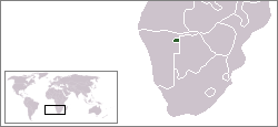
South West Africa was a territory under South African administration from 1915 to 1966, and under South African occupation from 1966 to 1990. Renamed Namibia by the United Nations in 1968, it became independent under this name on 21 March 1990.

A Bantustan was a territory that the National Party administration of South Africa set aside for black inhabitants of South Africa and South West Africa, as a part of its policy of apartheid.

The Gods Must Be Crazy is a 1980 comedy film written, produced, edited and directed by Jamie Uys. An international co-production of South Africa and Botswana, it is the first film in The Gods Must Be Crazy series. Set in Southern Africa, the film stars Namibian San farmer Nǃxau ǂToma as Xi, a hunter-gatherer of the Kalahari Desert whose tribe discovers a glass Coca-Cola bottle dropped from an aeroplane, and believe it to be a gift from their gods. When Xi sets out to return the bottle to the gods, his journey becomes intertwined with that of a biologist, a newly hired village school teacher, and a band of guerrilla terrorists.

Nǃxau ǂToma was a Namibian bush farmer and actor who starred in the 1980 film The Gods Must Be Crazy and its sequels, in which he played the Kalahari Bushman Xixo. The Namibian called him "Namibia's most famous actor".

The San peoples, or Bushmen, are the members of any of the indigenous hunter-gatherer cultures of southern Africa, and the oldest surviving cultures of the region. They are thought to have diverged from other humans 100,000 to 200,000 years ago. Their recent ancestral territories span Botswana, Namibia, Angola, Zambia, Zimbabwe, Lesotho, and South Africa.
Kaokoland was an administrative unit and a Bantustan in northern South West Africa. Established in 1980 during the apartheid era, it was intended to be a self-governing homeland of the Ovahimba, but an actual government was never established, and the territory was administered by the leaders of Hereroland. Like other homelands in South West Africa, the Kaokoland Bantustan was abolished in May 1989, at the beginning of the transition of Namibia towards independence.
Hereroland was a Bantustan and later a non-geographic ethnic-based second-tier authority, the Representative Authority of the Hereros, in South West Africa, intended by the apartheid-era government to be a self-governing homeland for the Herero people.
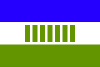
Ovamboland, also referred to as Owamboland, was a Bantustan and later a non-geographic ethnic-based second-tier authority, the Representative Authority of the Ovambos, in South West Africa.

Damaraland was a name given to the north-central part of South West Africa, which later became Namibia, inhabited by the Damaras. It was bordered roughly by Ovamboland in the north, the Namib Desert in the west, the Kalahari Desert in the east, and the Windhoek region in the south.
Tswanaland was a Bantustan and then later a non-geographic ethnic-based second-tier authority, the Representative Authority of the Tswanas, in South West Africa, in the far central eastern area of the territory around the village of Aminuis. It was intended by the apartheid government to be a self-governing homeland for the Tswana people.

Kavangoland was a Bantustan and then later a non-geographic ethnic-based second-tier authority, the Representative Authority of the Kavangos, in South West Africa, intended by the apartheid government to be a self-governing homeland for the Kavango people.

Namaland was a Bantustan and then later a non-geographic ethnic-based second-tier authority, the Representative Authority of the Namas, the in South West Africa, intended by the apartheid government to be a self-governing homeland for the Nama people. Namaland comprised an area of 2,156 km2 (832 sq mi) and was to accommodate the estimated 34,806 southern Namas of the South West African territory.

East Caprivi or Itenge was a Bantustan and later a non-geographic ethnic-based second-tier authority, the Representative Authority of the Caprivis in South West Africa, intended by the apartheid government to be a self-governing homeland for the Masubiya people.

Apartheid was a system of institutionalised racial segregation that existed in South Africa and South West Africa from 1948 to the early 1990s. It was characterised by an authoritarian political culture based on baasskap, which ensured that South Africa was dominated politically, socially, and economically by the nation's minority white population. Under this minoritarian system, white citizens held the highest status, followed by Indians, Coloureds and black Africans, in that order. The economic legacy and social effects of apartheid continue to the present day, particularly inequality.
ǃKungKUUNG (ǃXun), also known as Ju, is a dialect continuum spoken in Namibia, Botswana, and Angola by the ǃKung people, constituting two or three languages. Together with the ǂʼAmkoe language, ǃKung forms the Kxʼa language family. ǃKung constituted one of the branches of the putative Khoisan language family, and was called Northern Khoisan in that scenario, but the unity of Khoisan has never been demonstrated and is now regarded as spurious. Nonetheless, the anthropological term "Khoisan" has been retained as an umbrella term for click languages in general.
The system of racial segregation and oppression in South Africa known as apartheid was implemented and enforced by many acts and other laws. This legislation served to institutionalize racial discrimination and the dominance by white people over people of other races. While the bulk of this legislation was enacted after the election of the National Party government in 1948, it was preceded by discriminatory legislation enacted under earlier British and Afrikaner governments. Apartheid is distinguished from segregation in other countries by the systematic way in which it was formalized in law.

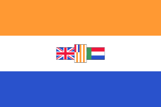
Namibia–South Africa relations refers to the current and historical relationship between Namibia and South Africa. South Africa captured the area now known as Namibia from Germany during World War I and governed it, by the name 'South West Africa', until 1990, when the country gained independence under the name 'Namibia'. During those 75 years, thousands of South Africans settled in the territory and South Africa treated the area as effectively a fifth province of both the Union and the Republic, imposing apartheid laws in South West Africa as it did in South Africa.

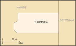
Tsumkwe Constituency is an electoral constituency in the Otjozondjupa Region of Namibia. It had 8,823 inhabitants in 2004 and 7,075 registered voters in 2020. About 2,400 San people live in this constituency. The constituency consists of the settlement of Tsumkwe and the surrounding rural area.
Platfontein is a community located in an arid region of the Northern Cape Province, 15 kilometers outside the city of Kimberley. The community consists of two San tribes, the !Xun and the Khwe. “The San of Platfontein” is a collective name used for both the !Xun and Khwe.
TheLegal Assistance Centre is a human rights organization in Windhoek, the capital of Namibia. The organization was established in 1988 during the apartheid era to litigate on behalf of people who were oppressed by the government and continues to operate today.