
East Riddlesden Hall is a 17th-century manor house in Keighley, West Yorkshire, England, now owned by the National Trust. The hall was built in 1642 by a wealthy Halifax clothier, James Murgatroyd. The hall is a Grade I listed building. There is a medieval tithebarn in the grounds.
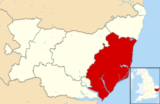
Suffolk Coastal was a local government district in Suffolk, England. Its council was based in Melton, having moved from neighbouring Woodbridge in 2017. Other towns include Felixstowe, Framlingham, Leiston, Aldeburgh, and Saxmundham.
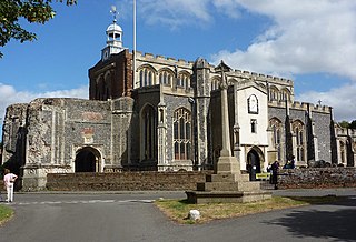
East Bergholt is a village in the Babergh District of Suffolk, England, just north of the Essex border.
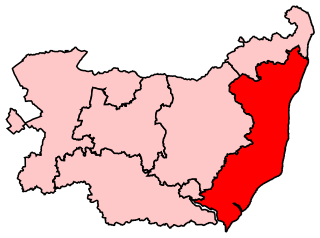
Suffolk Coastal is a constituency represented in the House of Commons of the UK Parliament since 2010 by Therese Coffey, a Conservative.

Helmingham Hall is a moated manor house in Helmingham, Suffolk, England. It was begun by John Tollemache in 1480 and has been owned by the Tollemache family ever since. The house is built around a courtyard in typical late medieval/Tudor style. The house is listed Grade I on the National Heritage List for England, and its park and formal gardens are also Grade I listed on the Register of Historic Parks and Gardens.

The House in the Clouds is a water tower at Thorpeness, Suffolk, England. It was built in 1923 to receive water pumped from Thorpeness Windmill and was designed to improve the looks of the water tower, disguising its tank with the appearance of a weatherboarded building more in keeping with Thorpeness's mock-Tudor and Jacobean style, except seeming to float above the trees. The original capacity of the water tank was 50,000 imperial gallons (230,000 l) but during the Second World War, the House in the Clouds was hit by gunfire from anti-aircraft guns based at Thorpeness. The water tank was repaired using its own steel, which resulted in a reduced capacity of 30,000 imperial gallons (140,000 l). In 1977 the water tower was made redundant by a mains water supply to the village, and additional living space was created. In 1979 the main water tank was removed to fully convert the building into a house. The building currently has five bedrooms and three bathrooms; it contains a total of 85 steps from top to bottom and is around 70 ft high.
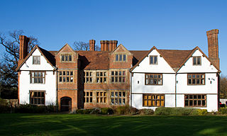
Sheldon Hall is an early 16th-century Grade II* listed manor house located on Gressel Lane in the Tile Cross/Kitts Green area of Birmingham, England, consisting of a main block of two stories and attics built of red and black bricks with stone dressings. The city boundary runs along the eastern side of the property. The building is now used as a restaurant.

Glemham Hall is an Elizabethan stately home, set in around 300 acres (120 ha) of park land on the outskirts of the village of Little Glemham in Suffolk, England. It is a Grade I listed building, properly called Little Glemham Hall.

Falkenham is a village and a civil parish in the Suffolk Coastal District, in the English county of Suffolk, near the village of Kirton and the towns of Ipswich and Felixstowe. The population of the civil parish as of the 2011 census was 170.
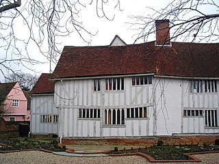
Lavenham Priory is a 13th-century Grade I listed building in Lavenham, Suffolk, England.
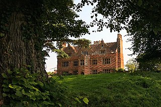
Newe House is a Grade II* listed Jacobean dower house in the village of Pakenham, Suffolk.
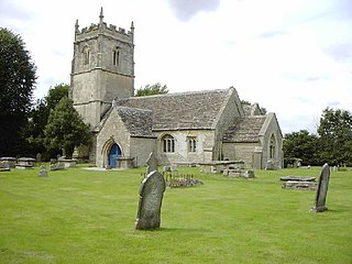
Hankerton is a village and civil parish in Wiltshire, England, 3 miles (4.8 km) northeast of Malmesbury. The parish includes the hamlets of Cloatley, Cloatley End and Bullock's Horn.

The A1094 is an A road in the English county of Suffolk. It is around 7 miles (11 km) in length. The road runs from a junction off the A12 trunk road at Friday Street in Benhall to Aldeburgh on the North Sea coast. The road is single carriageway throughout.
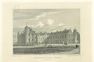
Rushbrooke Hall was a British stately home in Rushbrooke, Suffolk. For several hundred years it was the family seat of the Jermyn family. It was demolished in 1961.

Lubbesthorpe is a hamlet and parish in the district of Blaby within Enderby on the outskirts of Leicester, on the west side of the M1 motorway and the River Soar.

Neutral Farm Pit, Butley is a 1.1 hectare geological Site of Special Scientific Interest in Butley, east of Woodbridge in Suffolk. It is a Geological Conservation Review site, and is in the Suffolk Coast and Heaths Area of Outstanding Natural Beauty.

Red House Farm Pit is a 0.5 hectare geological Site of Special Scientific Interest east of Wickham Market in Suffolk. It is a Geological Conservation Review site, and in the Suffolk Coast and Heaths Area of Outstanding Natural Beauty.
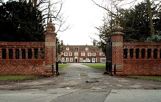
Brandeston Hall is a grade II* listed house in Old Maids Lane, Brandeston, Suffolk, England.
Farnham Manor is a grade II listed house in Farnham, Suffolk, England. It is timber-framed and dates from at least 1602 based on a year marked on plasterwork in the house.


