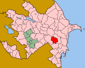
Saatly is an administrative district (rayon) in Azerbaijan. It was established in 1943 and has a current population of 87,000. The district's headquarters are in the city of Saatlı.

Abbasbeyli is a village in the Saatly Rayon of Azerbaijan.
Minbaşılı is a village in the Jabrayil Rayon of Azerbaijan.
Bozayran is a village in the Jalilabad Rayon of Azerbaijan.
Imishli is the capital of the Imishli Rayon of Azerbaijan.
Agamamedli is a village in the Saatly Rayon of Azerbaijan.
Saatlı is a city in and the capital of the Saatly Rayon of Azerbaijan.
Minbashyly is a village in the Saatly Rayon of Azerbaijan.
Bəşirbəyli is a village in the Salyan Rayon of Azerbaijan. The village forms part of the municipality of Pambıqkənd.
Beriyakend is a village in the Saatly Rayon of Azerbaijan.
Molday is a village in the Saatly Rayon of Azerbaijan.
Balakend is a village in the Saatly Rayon of Azerbaijan.
Agaragimli is a village in the Saatly Rayon of Azerbaijan.
Vasilyevka is a village in the Khachmaz Rayon of Azerbaijan.
Şükürlü is a village and municipality in the Jalilabad Rayon of Azerbaijan. It has a population of 385.
Genişkənd is a village and municipality in the Saatly Rayon of Azerbaijan. It has a population of 557.
Hacıqasımlı is a village and municipality in the Saatly Rayon of Azerbaijan. It has a population of 772.
Yeni Novruzlu is a village and municipality in the Saatly Rayon of Azerbaijan. It has a population of 881.
Çolpı is a village and municipality in the Saatly Rayon of Azerbaijan. The village was raised to municipality status in 2004.
Soltanabad is a village and municipality in the Saatly Rayon of Azerbaijan. The village was raised to municipality status in 2004.


