The Single European Sky (SES) is a European Commission initiative that seeks to reform the European air traffic management system through a series of actions carried out in four different levels with the aim of satisfying the needs of the European airspace in terms of capacity, safety, efficiency and environmental impact.

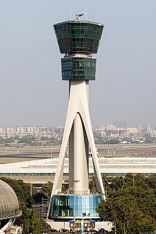
Air traffic control (ATC) is a service provided by ground-based air traffic controllers who direct aircraft on the ground and through a given section of controlled airspace, and can provide advisory services to aircraft in non-controlled airspace. The primary purpose of ATC worldwide is to prevent collisions, organize and expedite the flow of air traffic, and provide information and other support for pilots.
NATS Holdings, formerly National Air Traffic Services and commonly referred to as NATS, provides en-route air traffic control services to flights within the UK flight information regions and the Shanwick Oceanic Control Area. It also provides air traffic control services to 14 UK airports.

ENAIRE is the air navigation manager in Spain, certified for the provision of en route, approach and aerodrome control services. As a public corporate entity attached to the Spanish Ministry of Public Works, it is responsible for air traffic control, aeronautical information and the communication, navigation and surveillance networks - these are all necessary so that air companies and their aircraft can fly safely and in an organised format within Spanish airspace.

The European Organisation for the Safety of Air Navigation, commonly known as Eurocontrol, is an international organisation working to achieve safe and seamless air traffic management across Europe. Founded in 1960, Eurocontrol currently has 41 member states and is headquartered in Brussels, Belgium. It has several local sites as well, including an Innovation Hub in Brétigny-sur-Orge, France, the Aviation Learning Centre (ALC) in Luxembourg, and the Maastricht Upper Area Control Centre (MUAC) in Maastricht, the Netherlands. The organisation employs approximately two thousand people, and operates with an annual budget in excess of half a billion Euro.

The Airports Authority of India, or AAI, is a Statutory body under the ownership of the Ministry of Civil Aviation, Government of India. It is responsible for creating, upgrading, maintaining, and managing civil aviation infrastructure in India. It provides Communication Navigation Surveillance/Air Traffic Management (CNS/ATM) services over the Indian airspace and adjoining oceanic areas. AAI currently manages a total of 137 airports, including 34 international airports, 10 Customs Airports, 81 domestic airports, and 23 Civil enclaves at Defence airfields. AAI also has ground installations at all airports and 25 other locations to ensure the safety of aircraft operations. AAI covers all major air routes over the Indian landmass via 29 Radar installations at 11 locations along with 700 VOR/DVOR installations co-located with Distance Measuring Equipment (DME). 52 runways are provided with Instrument landing system (ILS) installations with Night Landing Facilities at most of these airports and an Automatic Message Switching System at 15 Airports.
The Future Air Navigation System (FANS) is an avionics system which provides direct data link communication between the pilot and the air traffic controller. The communications include air traffic control clearances, pilot requests and position reporting. In the FANS-B equipped Airbus A320 family aircraft, an Air Traffic Services Unit (ATSU) and a VHF Data Link radio (VDR3) in the avionics rack and two data link control and display units (DCDUs) in the cockpit enable the flight crew to read and answer the controller–pilot data link communications (CPDLC) messages received from the ground.
System Wide Information Management (SWIM) is a global Air Traffic Management (ATM) industry initiative to harmonize the exchange of Aeronautical, Weather and Flight information for all Airspace Users and Stakeholders. SWIM is an integral part of the International Civil Aviation Organization (ICAO) Global Air Navigation Plan (GANP). The GANP defines 4 Performance Improvement Areas (PIA), SWIM resides in PIA 2: Globally interoperable systems and data, where its implementation is further defined in Aviation System Block Upgrades (ASBU) B1-SWIM and B2-SWIM. ASBU B1-SWIM defines SWIM as a “a net-centric operation where the air traffic management (ATM) network is considered as a series of nodes, including the aircraft, providing or using information.” it goes on to say “The sharing of information of the required quality and timeliness in a secure environment is an essential enabler to the ATM target concept.”
Controller–pilot data link communications (CPDLC), also referred to as controller pilot data link (CPDL), is a method by which air traffic controllers can communicate with pilots over a datalink system.
The Aeronautical Information Exchange Model (AIXM) is designed to enable the management and distribution of Aeronautical Information Services (AIS) data in digital format. AIXM is based on Geography Markup Language (GML) and is one of the GML Application Schemas which is applicable for the Aeronautical domain. It was developed by the US Federal Aviation Administration (FAA), the US National Geospatial Intelligence Agency (NGA) and the European Organisation for the Safety of Air Navigation (EUROCONTROL).The current version is AIXM 5.1.1.
Single European Sky ATM Research (SESAR) is a collaborative project to completely overhaul European airspace and its air traffic management (ATM). The actual program is managed by the SESAR Joint Undertaking as a public–private partnership (PPP).

Anchorage Air Route Traffic Control Center (PAZA/ZAN) is located just outside the main gate of Joint Base Elmendorf-Richardson at 700 North Boniface Parkway in Anchorage, Alaska, United States. The Anchorage ARTCC is one of 22 Air Route Traffic Control Centers in the United States.

PHOENIX is a multipurpose Radar Data Processing System(RDPS) / Surveillance Data Processing System (SDPS) - a.k.a. tracker - used for many ATC applications in the Deutsche Flugsicherung (DFS), and is continuously extended and maintained ever since. PHOENIX is also foreseen as a fundamental component for all future ATM systems in the DFS into the 2020s and part of the DFS initiative for “ATS componentware” in the European SESAR programme.

ARTAS is a system designed by Eurocontrol to operationally support Aerial surveillance and Air traffic control by establishing an accurate Air Situation Picture of all traffic over a pre-defined geographical area and then distributing the relevant surveillance information to a community of user systems.

ADMAR, an initialism for the German titleAbgesetzte Darstellung von MADAP Radar data, was the predecessor product of CIMACT.
GIADS - German Improved Air Defence System - is the standard Air Command and Control System of the German Air Force Tactical Command and Control Service.
Frequentis is an Austrian high-tech company that develops communication and information systems in fields such as air traffic management and public safety & transport.
BULATSA is the Bulgarian Air Traffic Services Authority, a branch of the Bulgarian Civil Aviation Administration responsible for air traffic management within Bulgaria's airspace.
Communication, navigation and surveillance (CNS) are the main functions that form the infrastructure for air traffic management, and ensure that air traffic is safe and efficient.
Unmanned aircraft system traffic management (UTM) is an air traffic management ecosystem under development for autonomously controlled operations of unmanned aerial systems (UAS) by the FAA, NASA, other federal partner agencies, and industry. They are collaboratively exploring concepts of operation, data exchange requirements, and a supporting framework to enable multiple UAS operations beyond visual line-of-sight at altitudes under 400 ft above ground level in airspace where FAA air traffic services are not provided.


