
The Arctic Archipelago, also known as the Canadian Arctic Archipelago, is a group of islands north of the Canadian mainland.
Gardner Inlet is a large, ice-filled inlet at the southwest side of Bowman Peninsula, on the east coast of Palmer Land, Antarctica. It was discovered by the Ronne Antarctic Research Expedition, 1947–48, under Finn Ronne, who named it for Irvine Clifton Gardner, a physicist at the National Bureau of Standards, and member of the American Antarctic Association, Inc., the organization set up to make plans and preparations for the expedition. His work in the field of optics as applied to aerial photography has been an important contribution to this technique in polar exploration.

Cutsdean is a small village in the Cotswolds, located close to the Gloucestershire town of Cheltenham. The River Windrush runs through the village. The history of the village traces back to the Anglo-Saxon period. It was a possession of the Worcester Priory, and was part of Worcestershire until 1931, when the boundaries were rationalized and it was moved to Gloucestershire.

Gorqu is a village in the Tibet Autonomous Region of China.

Ampanefena is a town and commune in northern Madagascar. It belongs to the district of Vohemar, which is a part of Sava Region. The population of the commune was estimated to be approximately 19,000 in 2001 commune census.

The Duke of Gloucester Islands is a subgroup of the Tuamotu group in French Polynesia. They are located southeast of Tahiti and south of the main Tuamotu atoll cluster and are rather isolated.

Daule, also known as Villa Daule, is a canton located in the Guayas province in Ecuador. Created in 1820, it is one of the most important parts of Guayas thanks to its rice production and other products such as corn and eggs.
Esbensen Bay is a small bay 1 nautical mile (2 km) southwest of Nattriss Head, along the southeast end of South Georgia. It was charted by the Second German Antarctic Expedition, 1911–12, under Filchner, and was named for Captain Viktor Esbensen, manager of the Compañía Argentina de Pesca whaling station at Grytviken, the first land-based whaling station in Antarctica.

Ponte Serrada is a municipality in the state of Santa Catarina in the South region of Brazil.
Vanchiyankulam Mavilankeni is a small town in Sri Lanka. It is located within Northern Province.
Gősfa is a village in Zala County, Hungary.
Los Ralos (Tucumán) is a settlement in Tucumán Province in northern Argentina.
Allikmaa is a village in Lääne-Nigula Parish, Lääne County, in western Estonia.

The Alley Glacier is a glacier in Antarctica that drains the north slopes of Britannia Range in the vicinity of Ward Tower and flows north to Darwin Glacier. It is separated from Gaussiran Glacier by a series of large rock buttresses, including Robertson Buttress.

Breitfuss Glacier is a glacier 10 nautical miles (19 km) long, which flows southeast from Avery Plateau into Mill Inlet to the west of Cape Chavanne, on the east coast of Graham Land. It was charted by the Falkland Islands Dependencies Survey (FIDS) and photographed from the air by the Ronne Antarctic Research Expedition in 1947. It was named by the FIDS for Leonid Breitfuss, a German polar explorer, historian, and author of many polar bibliographies.
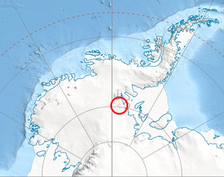
Plummer Glacier is a short glacier descending east through the Enterprise Hills to the north of Lippert Peak and the Douglas Peaks, in the Heritage Range in Antarctica. Mapped by United States Geological Survey (USGS) from surveys and U.S. Navy air photos, 1961-66. Named by Advisory Committee on Antarctic Names (US-ACAN) for Charles C. Plummer, United States Antarctic Research Program (USARP) glaciologist at Palmer Station in 1965.
Mount Frazier is the northernmost peak of the Rockefeller Mountains, standing 1 nautical mile (2 km) north of Mount Jackling on Edward VII Peninsula in Marie Byrd Land, Antarctica. It was discovered on January 27, 1929, by the Byrd Antarctic Expedition. It was named for Russell G. Frazier, medical officer at the West Base of the United States Antarctic Service (1939–41), and observer with the Rockefeller Mountains Geological Party, which visited this area in December 1940.
Green Glacier is a glacier on the east side of Graham Land, Antarctica, 15 nautical miles (28 km) long and 4 nautical miles (7 km) wide, flowing from the plateau northeast between Dugerjav Peak and Rugate Ridge, and then east into Vaughan Inlet next north of Pirne Peak and south of the terminus of Hektoria Glacier.
Hoinkes Peak is a sharp rock peak, 1,840 metres (6,040 ft) high, standing at the head of Henderson Glacier, where it forms part of the west wall of the glacier, in the Heritage Range, Antarctica. It was mapped by the United States Geological Survey from surveys and U.S. Navy air photos from 1961–66, and was named by the Advisory Committee on Antarctic Names for Herfried C. Hoinkes, a meteorologist at Little America V Station in 1957.
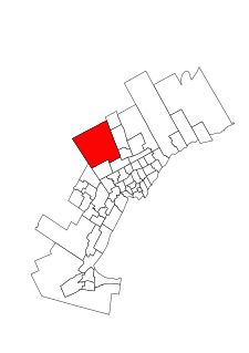
King—Vaughan is a provincial electoral district in Ontario, Canada. It elects one member to the Legislative Assembly of Ontario. This riding was created in 2015.


