
South Africa occupies the southern tip of Africa, its coastline stretching more than 2,500 kilometres from the desert border with Namibia on the Atlantic (western) coast southwards around the tip of Africa and then northeast to the border with Mozambique on the Indian Ocean. The low-lying coastal zone is narrow for much of that distance, soon giving way to a mountainous escarpment that separates the coast from the high inland plateau. In some places, notably the province of KwaZulu-Natal in the east, a greater distance separates the coast from the escarpment. Although most of the country is classified as semi-arid, it has considerable variation in climate as well as topography.

Melanorosaurus is a genus of basal sauropodomorph dinosaur that lived during the Late Triassic period. A herbivore from South Africa, it had a large body and sturdy limbs, suggesting it moved about on all fours. Its limb bones were massive and weighty, like sauropod limb bones.

The Argentine Northwest is a geographic and historical region of Argentina composed of the provinces of Catamarca, Jujuy, La Rioja, Salta, Santiago del Estero and Tucumán.

The Great Escarpment is a major topographical feature in Africa that consists of steep slopes from the high central Southern African plateau downward in the direction of the oceans that surround Southern Africa on three sides. While it lies predominantly within the borders of South Africa, in the east it extends northwards to form the border between Mozambique and Zimbabwe, continuing on beyond the Zambezi River valley to form the Muchinga Escarpment in eastern Zambia. In the west, it continues northwards into Namibia and Angola.

John Hutchinson, OBE, FRS was a renowned English botanist, taxonomist and author.

The Elliot Formation is a geological formation and forms part of the Stormberg Group, the uppermost geological group that comprises the greater Karoo Supergroup. Outcrops of the Elliot Formation have been found in the northern Eastern Cape, southern Free State, and in the eastern KwaZulu-Natal provinces of South Africa. Outcrops and exposures are also found in several localities in Lesotho such as Qacha’s Neck, Hill Top, Quthing, and near the capital, Maseru. The Elliot Formation is further divided into the lower (LEF) and upper (UEF) Elliot formations to differentiate significant sedimentological differences between these layers. The LEF is dominantly Late Triassic (Norian-Rhaetian) in age while the UEF is mainly Early Jurassic (Hettangian) and is tentatively regarded to preserve a continental record of the Triassic-Jurassic boundary in southern Africa. This geological formation is named after the town of Elliot in the Eastern Cape, and its stratotype locality is located on the Barkly Pass, 9 km north of the town.
Mpofu Nature Reserve is a nature reserve in the Amatole district of the Eastern Cape Province, South Africa that is managed by Eastern Cape Parks.
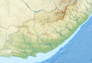
Barkly Pass is situated in the high mountains of the Eastern Cape, South Africa, on the Regional R58 tarred road between Elliot and Barkly East.
Katberg Pass is a mountain pass situated in the Eastern Cape province of South Africa, on the R351 between Seymour and Whittlesea. The pass climbs almost 700 meters in altitude to summit at 1622m ASL. The average gradient is 1:15 with some sections as steep as 1:3.
Kwaaiman Pass,, is situated in the Eastern Cape province of South Africa, on the road between Cala, Eastern Cape and Tsomo.
Satansnek Pass, or just Satansnek, is situated in the Eastern Cape, province of South Africa, on the road between Mthatha and Cala, Eastern Cape.

The Stormberg Group is one of the four geological groups that comprises the Karoo Supergroup in South Africa. It is the uppermost geological group representing the final phase of preserved sedimentation of the Karoo Basin. The Stormberg Group rocks are considered to range between Lower Triassic (Olenekian) to Lower Jurassic (Pliensbachian) in age. These estimates are based on means of geological dating including stratigraphic position, lithostratigraphic and biostratigraphic correlations, and palynological analyses.

Wolseley is a small town in the upper Breede River Valley region of the Western Cape province of South Africa. In the 2001 Census it had a population of 12,130 people. It is located 90 kilometres (60 mi) northeast of Cape Town, in the Land van Waveren valley between the Waterval Mountains to the west and the Witzenberg Mountains to the east.

Cala is a town in Sakhisizwe Local Municipality, part of the Chris Hani District Municipality in the Eastern Cape province of South Africa.
Provincial routes are the second category of road in the South African route-numbering scheme. They are designated with the letter "R" followed by a number from 21 to 82 formerly with the letter "P" followed by a number from 66 They serve as feeders to the national routes and as trunk roads in areas where there is no national route.

Kosovo Pomoravlje or Anamorava, is a valley in Kosovo, in the southern part of the District of Gjilan surrounding the Binač Morava River. It stretches eastward to the Preševo Valley in southern Serbia. The mountains in this region, rising to an altitude of 1,000–1,200 metres (3,300–3,900 ft), border the Skopska Crna Gora region in neighboring Macedonia north of Skopje. Gjilan, Kosovska Kamenica, Novo Brdo and Vitina are municipalities located in the region. The region gave its name to Kosovo Pomoravlje District. It is known for recording the lowest temperature in Kosovo: −32.5 °C (−26.5 °F), on 25 January 1963.
The R410 is a Regional Route in South Africa. Its western terminus is the R392 near Queenstown. It heads east-north-east to Lady Frere. Thereafter, it meets the southern terminus of the R396. Continuing east-north-east it passes through Cala and the Cala Pass to end at a junction with the R58.
Pakhuis Pass is a mountain pass on the R364 in the northern Cederberg in South Africa. The pass connects Clanwilliam to Calvinia. A turnoff from the pass heads southeast to the Biedouw Valley and Wupperthal. The pass is 25 km long, reaches an altitude of 905 m at a gradient of 1:9.


